El Dorado to Diamond City on The Scenic 7 Byway

This route was brought to you by:
RouteXpert René Plücken (MRA Master)
Last edit: 12-02-2021
 Route Summary
  Share this route


Animation

Verdict


Duration
7h 10m

Mode of travel
Car or motorcycle

Distance
503.39 km

Countries

 RouteXpert Review
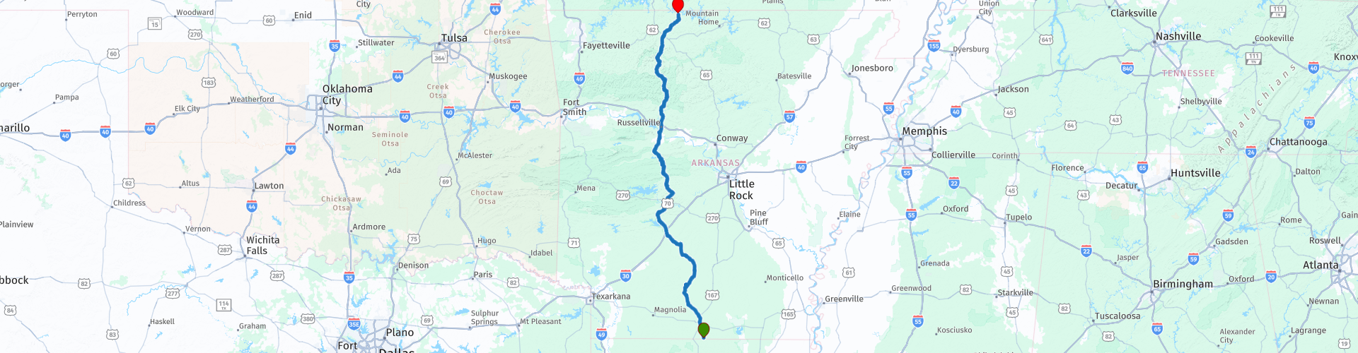
 This route runs from south to north through the state of Arkansas.
The start is near El Dorado just outside of Lockhart on the state line with Louisiana and the end point is in Diamond City near the state line with Missouri. This ride is also called the Scenic 7 Byway.
Approximately 60 miles from the highway that runs through the Ozark and Ouachita National Forests has been designated by the US Forest Service as part of the National Forest Scenic Byways system. While traveling through the Ouachita and Ozark Mountains on the Scenic 7 Byway you can enjoy striking mountain scenery and beautiful fall colors.
There are numerous recreational areas that offer opportunities for camping, hiking, mountain biking, canoeing and horse riding along or within a few kilometers of the highway.
Along the way you will pass several beautiful bridges, some of which I have marked with yellow route points.
This route is a total of 312 miles and you can do a lot on the way and it is therefore advisable to spend the night on the way, the first option is in Hot Springs (RP11), here are several hotels. In Hot Springs you can enjoy and relax from the many hot springs in the Hot Springs National Park (RP12), also called "The American Spa" because of its 47 thermal springs. The second is The Cliff House Inn (RP22) in the Ozark Mountains near the, this is a hotel restaurant built on a cliff with spectacular views.
This route has beautiful roads with many curves through the mountains and nature reserves of Arkansas and is enjoyable on the motorcycle and in the car.
This route gets 4 stars.


 Usage
Usage Want to download this route?
You can download the route for free without MyRoute-app account. To do so, open the route and click 'save as'. Want to edit this route?
No problem, start by opening the route. Follow the tutorial and create your personal MyRoute-app account. After registration, your trial starts automatically.  Disclaimer
Use of this GPS route is at your own expense and risk. The route has been carefully composed and checked by a MyRoute-app accredited RouteXpert for use on TomTom, Garmin and MyRoute-app Navigation.
Changes may nevertheless have occurred due to changed circumstances, road diversions or seasonal closures. We therefore recommend checking each route before use.
Preferably use the route track in your navigation system. More information about the use of MyRoute-app can be found on the website under 'Community' or 'Academy'.