TTT 2012 01 Eifel Prum D3

This route was brought to you by:
RouteXpert Hans van de Ven (Mr.MRA)
Last edit: 10-08-2019
 Route Summary
 The 173 ANWB Promoter TankTasTocht (TTT) were scanned by Henry ten Dam and signed by Leon Stolk in Mapsource and later placed as a Track in a .gpx file. These have been made available through the MrGPS website with the approval of the ANWB Promoter so that everyone can enjoy it. The 1st TTT is from 1992, so the route may differ slightly from the original.
I have checked all route points and, where necessary, placed them neatly on the road. I have also, if necessary, set the starting point and end point of the route a little further apart to prevent navigation to the end point directly and added the POI files of the starting point and end point just like a possible stopping point.
Finally, I made the route the same for TomTom, Garmin and MyRoute-app Navigation users.
Thanks to Henry, Leon, MrGPS and Promoter.
 Share this route


Animation

Verdict


Duration
6h 13m

Mode of travel
Car or motorcycle

Distance
304.77 km

Countries


 RouteXpert Review
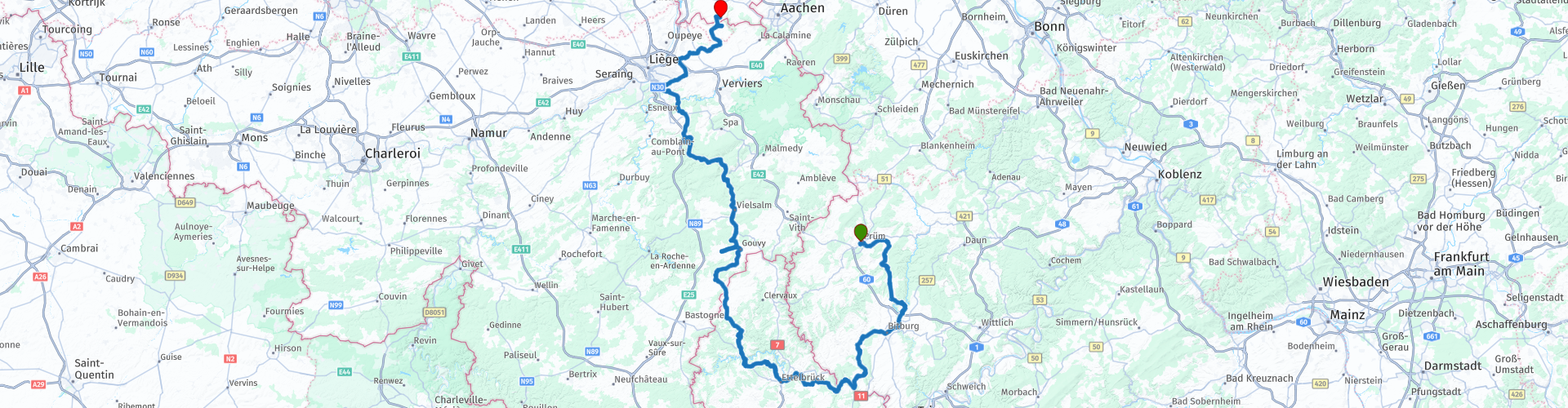
 The route first goes south to the border town of Bollendorf, where the 1st stop is also planned, then you enter Luxembourg to eat kebab at Hanni, where the 2nd stop is planned. After lunch it continues to Belgium where you stop to refuel in Vielsalm. Then another stop in Sprimont before you arrive at the end point of this TTT in Slenaken and you can finish the 3-day TTT through the Eifel while enjoying a snack and a drink at 't-Brugske.
Because I have driven large parts of this route myself, this route gets 4 stars.
Route details:
The route has been made the same for TomTom, Garmin and MyRoute-app Navigation users.
rp 1 - Starting point at Stangl Wirtin in Prum.
rp 9 - Coffee stop at Hotel Hauer in Bollendorf
rp 20 - Lunch stop at Hanni in Wiltz
rp 28 - Tank stop at Total in Vielsalm
rp 32 - Coffee spot at La Perreon in Sprimont
rp 43 - End point at 't Brugske in Slenaken


 Links
Links  Usage
Usage Want to download this route?
You can download the route for free without MyRoute-app account. To do so, open the route and click 'save as'. Want to edit this route?
No problem, start by opening the route. Follow the tutorial and create your personal MyRoute-app account. After registration, your trial starts automatically.  Disclaimer
Use of this GPS route is at your own expense and risk. The route has been carefully composed and checked by a MyRoute-app accredited RouteXpert for use on TomTom, Garmin and MyRoute-app Navigation.
Changes may nevertheless have occurred due to changed circumstances, road diversions or seasonal closures. We therefore recommend checking each route before use.
Preferably use the route track in your navigation system. More information about the use of MyRoute-app can be found on the website under 'Community' or 'Academy'.