
Port Huron to Niagara Falls

This route was brought to you by:
RouteXpert Nick Carthew - (MRA Master)
Last edit: 24-05-2021
 Route Summary
 This route enters Canada over the Bluewater Bridge, the toll for this is $3 US or $4 Can. The route is all about riding through well kept farmland and using lakeside roads. The scenery is superb and the riding is easy.
The road following the St Clair River and Lakeshore road along with the beautiful scenery and world class attraction of Niagara Falls makes this a 4**** star route.
 Share this route


Animation

Verdict


Duration
10h 35m

Mode of travel
Car or motorcycle

Distance
420.71 km

Countries


 RouteXpert Review
 This route starts by crossing the Bluewater Bridge from the US into Canada over the St Clair River. It then follows the St Clair for about 30 miles (50 km) passing heavy industry and green spaces and always offering great views back across to the US.
Wallaceburg arrives after an hour and it's time for your first Canadian coffee.
Wallaceburg was originally a small settlement, it was recognized for its significant contribution to the lumber and boat building industries and strategic location along the banks of the scenic Sydenham River. In more recent years, 1895-1999, the town was known for its glass making industry. For that reason, Wallaceburg is locally known as the "glass town of Canada."
Wallaceburg is also the home of WAMBO (Wallaceburg Antique Motor and Boat Outing), an annual antique car, boat, bus, and fire truck show that began in 1988.
30 minutes away on an arrow straight road comes the city of Chatham-Kent. This has a special meaning for me as I was born in Chatham in the county of Kent, England.
The former city of Chatham began as a naval dockyard in the 1790s, as it straddles the Thames River. The town was named after the Earl of Chatham, William Pitt (the Elder). It was built as a naval dockyard, a characteristic shared by Chatham, Kent, England. In 1998 the County of Kent and the city of Chatham were amalgamated by the Province of Ontario to form the Municipality of Chatham–Kent. Here in Canada the Thames River flows through the middle of the city from all the way from London, another similarity that I find amusing. The route follows the Thames River for 50 miles (80 km) rarely glimpsing sight of it as it meanders through the well kept farmland.
Port Stanley is where you will meet the fourth of the Great Lakes of this tour - Lake Erie.
Lake Erie is the fourth largest lake (by surface area) of the five Great Lakes in North America, and the eleventh largest globally if measured in terms of surface area. At the time of European contact, there were several groups of Native American cultures living around the shores of the eastern end of the lake. The Erie tribe (from whom the lake takes its name) lived along the southern edge, while the Neutrals (also known as Attawandaron) lived along the northern shore. Lake Erie was the last of the Great Lakes to be explored by Europeans, since the Iroquois who occupied the Niagara River area were in conflict with the French, and they did not allow explorers or traders to pass through. The site of Port Stanley was part of an important early route from Lake Erie to other inland waterways for a succession of explorers and travellers of the 17th and 18th centuries. It was an important landing point and camping spot.
From here the route stays close to Lake Erie when it can and the next stop is a good place to have some lunch - Port Dover.
Since 1981, Port Dover has held a motorcycle rally that equals the one held at Sturgis in the US.
The Friday the 13th Motorcycle Rally is a motorcycle rally held every time that there is a Friday the 13th in the month, the event has been described as "the biggest single-day motorcycle event in the world". Although hundreds of attendees arrive during winter months, attendance is at its highest when the date falls on a summer day. In August 2010, the rally drew more than 150,000 attendees. The crowds of people spending money in the local shops ensures that as a motorcyclist you'll be warmly welcomed.
Leaving Port Dover behind You'll pass the huge steel mill site occupied by US Steel and then the Nanticoke Thermal Generating Station, a 44 MW solar power station which started operation in April 2019. Previously from 1972 to 2013, it was the largest coal-fired power plant in North America. The route now joins the fantastic Lakeshore road and as the name suggests, it follows very closely to the lake's edge. There are some great photo opportunities all along the shore.
You'll leave the lake and head in a northeasterly direction through more well kept farmland for about one hour and onto the routes destination of Niagara Falls. I would suggest 2 nights in Niagara Falls to allow you to see all of the falls from the many different vantage points and to explore the city itself.


 Links
Links  Usage
Usage Want to download this route?
You can download the route for free without MyRoute-app account. To do so, open the route and click 'save as'. Want to edit this route?
No problem, start by opening the route. Follow the tutorial and create your personal MyRoute-app account. After registration, your trial starts automatically.  Disclaimer
Use of this GPS route is at your own expense and risk. The route has been carefully composed and checked by a MyRoute-app accredited RouteXpert for use on TomTom, Garmin and MyRoute-app Navigation.
Changes may nevertheless have occurred due to changed circumstances, road diversions or seasonal closures. We therefore recommend checking each route before use.
Preferably use the route track in your navigation system. More information about the use of MyRoute-app can be found on the website under 'Community' or 'Academy'.
Michigan
About this region
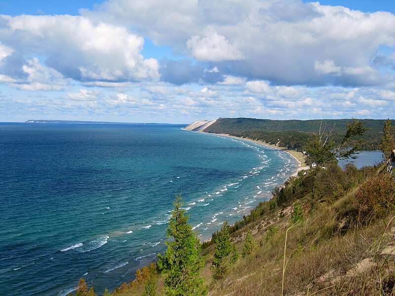
Michigan is a state in the Great Lakes region of the upper Midwestern United States. Its name derives from a gallicized variant of the original Ojibwe word ᒥᓯᑲᒥ (mishigami), meaning 'large water' or 'large lake'. With a population of nearly 10.1 million and a total area of nearly 97,000 sq mi (250,000 km2), Michigan is the 10th-largest state by population, the 11th-largest by area, and the largest east of the Mississippi River. Its capital is Lansing, and its largest city is Detroit. Metro Detroit is among the nation's most populous and largest metropolitan economies.
Michigan is the only state to consist of two peninsulas. The Lower Peninsula is shaped like a mitten. The Upper Peninsula (often called "the U.P.") is separated from the Lower Peninsula by the Straits of Mackinac, a five-mile (8 km) channel that joins Lake Huron to Lake Michigan. The Mackinac Bridge connects the peninsulas. Michigan has the longest freshwater coastline of any political subdivision in the world, being bordered by four of the five Great Lakes, plus Lake St. Clair. It also has 64,980 inland lakes and ponds.The area was first occupied by a succession of Native American tribes over thousands of years. Inhabited by natives, Métis, and French explorers in the 17th century, it was claimed as part of the New France colony. After France's defeat in the French and Indian War in 1762, the region came under British rule. Britain ceded the territory to the newly independent United States after Britain's defeat in the American Revolutionary War. The area was part of the larger Northwest Territory until 1800, when western Michigan became part of the Indiana Territory. Michigan Territory was formed in 1805, but some of the northern border with Canada was not agreed upon until after the War of 1812. Michigan was admitted into the Union in 1837 as the 26th state, a free one. It soon became an important center of industry and trade in the Great Lakes region and a popular émigré destination in the late 19th and early 20th centuries; immigration from many European countries to Michigan was also the busiest at that time, especially for those who emigrated from Finland, Macedonia and the Netherlands.Although Michigan developed a diverse economy, it is widely known as the center of the U.S. automotive industry, which developed as a major economic force in the early 20th century. It is home to the country's three major automobile companies (whose headquarters are all in Metro Detroit). While sparsely populated, the Upper Peninsula is important for tourism due to its abundance of natural resources, while the Lower Peninsula is a center of manufacturing, forestry, agriculture, services, and high-tech industry.
Read more on Wikipedia
Michigan is the only state to consist of two peninsulas. The Lower Peninsula is shaped like a mitten. The Upper Peninsula (often called "the U.P.") is separated from the Lower Peninsula by the Straits of Mackinac, a five-mile (8 km) channel that joins Lake Huron to Lake Michigan. The Mackinac Bridge connects the peninsulas. Michigan has the longest freshwater coastline of any political subdivision in the world, being bordered by four of the five Great Lakes, plus Lake St. Clair. It also has 64,980 inland lakes and ponds.The area was first occupied by a succession of Native American tribes over thousands of years. Inhabited by natives, Métis, and French explorers in the 17th century, it was claimed as part of the New France colony. After France's defeat in the French and Indian War in 1762, the region came under British rule. Britain ceded the territory to the newly independent United States after Britain's defeat in the American Revolutionary War. The area was part of the larger Northwest Territory until 1800, when western Michigan became part of the Indiana Territory. Michigan Territory was formed in 1805, but some of the northern border with Canada was not agreed upon until after the War of 1812. Michigan was admitted into the Union in 1837 as the 26th state, a free one. It soon became an important center of industry and trade in the Great Lakes region and a popular émigré destination in the late 19th and early 20th centuries; immigration from many European countries to Michigan was also the busiest at that time, especially for those who emigrated from Finland, Macedonia and the Netherlands.Although Michigan developed a diverse economy, it is widely known as the center of the U.S. automotive industry, which developed as a major economic force in the early 20th century. It is home to the country's three major automobile companies (whose headquarters are all in Metro Detroit). While sparsely populated, the Upper Peninsula is important for tourism due to its abundance of natural resources, while the Lower Peninsula is a center of manufacturing, forestry, agriculture, services, and high-tech industry.
View region
 Statistics
  9
9Amount of RX reviews (Michigan)
 11251
11251Amount of visitors (Michigan)
 154
154Amount of downloads (Michigan)
 Route Collections in this region
 The ultimate Great Lakes Tour
This is a tour from Chicago to Staten Island, New York visiting the 5 Great Lakes of North America.
Starting from EagleRider Motorcycle rental at Illinois Harley-Davidson in Chicago and ending at EagleRider Motorcycle rental in Staten Island.
The Ultimate Great Lakes tour is a route through the United States and Canada to scenic destinations along Lakes Michigan, Superior, Huron, Erie and Ontario.
What are the Great Lakes? The Great Lakes are a series of five interconnected freshwater lakes located on the border of the United States and Canada. They are the largest group of freshwater lakes in the world by area and have sea-like characteristics such as rolling waves, strong currents, miles of sandy and rocky beaches, and distant horizons. This tour of 8 routes includes places to stop for coffee, lunch and overnight hotels. It also visits well known historic and scenic sites along the way mostly avoiding major highways. I have suggested 2 nights at Lake Superior and 2 nights at Niagara Falls, making this a 10 day tour, but of course, that is up to you. The scenery and landscapes are breathtaking and each day is different to the next. Please enjoy.
View Route Collection
Trans Canada Highway
The Trans-Canada Highway (TCH) or Trans-Canadian Highway is a system of highways that cover all 10 provinces of Canada.
The Federal and Provincial Highways System that now forms the TCH were authorized by the Trans-Canada Highway Act of 1948 and opened in 1962. It was completed in 1971. The total length of the TCH is 7821 km.
Contrary to the American Interstate Highway System, the TCH does not consist of an unambiguous network of motorways, but forms a network of restricted access highways and other main routes that are more akin to the Dutch provincial roads. The route is indicated by a green shield with a white maple leaf.
The numbering of the roads that are part of the TCH is the domain of the provinces. Only the western provinces have aligned their numbering and the TCH has the designation Highway 1 there.
The main route of the TCH starts in Victoria in British Columbia and runs via Calgary and Regina to Winnipeg. From Winnipeg the route leads to Kenora in Ontario, after which several branches pass through Ontario to Ottawa.
Further east, the route passes through the province of Quebec via Montreal and Quebec, among others, to Moncton, New Brunswick. Then the TCH continues east through Nova Scotia, where a branch (via the Confederation Bridge) leads to Prince Edward Island. Another section runs down to the sea in the port city of Sydney, where a ferry service leaves for Channel-Port aux Basques on the island of Newfoundland. From there the route continues for more than 900 km to the provincial capital of St. John's, in the extreme southeast of the island.
We not only drive the TCH, but will take the rural roads as much as possible, because only Highway driving is too boring and Canada has many beautiful roads through its beautiful landscape. You drive through all provinces and through very varied and scenic landscapes, from the Rockies in the West, the Central Prairies to the Eastern Maritimes and the Northern Forest.
The riding season is generally April through October with longer seasons on the west coast and southern Ontario. Provide good all season clothing or bring rain gear, depending on the province and the season the weather can change and you may be surprised by a rain or even a snow or hail shower, so be prepared.
In Canada the metric system is used, so speeds are indicated in Km / h. A helmet requirement (DOT approved) applies throughout Canada.
You will see many wildlife throughout Canada. This varies from province to province, such as deer, buffalos, moose, caribou, wolves, pumas, bears, mountain goats, sheep, lynx, coyotes, foxes, raccoons, badgers, various rodents and all kinds of birds. Even if it is very tempting to stop for a photo, don't do it, it can be very dangerous.
The routes described in this review sometimes deviate from the Trans Canada Highway, bringing the total length to 9,300 kilometers. The routes are made so that you drive through the beautiful parts of Canada with truly beautiful panoramas and beautiful sights to visit, this differs from museums, parks to historical points. The routes are not too long so there is time to stop for photos and sights along the way. You can also choose to arrange and combine the stages differently or to add other routes to shorten or extend your journey. The routes are marked with a rating in stars, some routes are less challenging or interesting but are necessary to drive to the next point, which is why they often have a lower rating.
In the route description you will find more details about the routes and the points of interest along the way. These points and also hotels, restaurants, petrol stations etc. are indicated with a POI and sometimes also with a Route point. In the description you will also find links to interesting sites and to the routes that connect to that day.
The described routes are;
Day 01 TCH Victory to Nanaimo
Day 02 TCH Nanaimo to Hope
Day 03 TCH Hope to Kamloops
Day 04 TCH Kamloops to Revelstoke
Day 05 TCH Revelstoke to Lake Louise
Day 06 TCH Lake Louise to Calgary
Day 07 TCH Calgary to Medicine Hat
Day 08 TCH Medicine Hat to Moose Jaw
Day 09 TCH Moose Jaw to Regina
Day 10 TCH Regina to Brandon
Day 11 TCH Brandon to Winnipeg
Day 12 TCH Winnipeg to Kenora
Day 13 TCH Kenora to Ignace
Day 14 TCH Ignace to Thunder Bay
Day 15 TCH Thunder Bay to Marathon
Day 16 Thunder Bay to Wawa
Day 17 TCH Wawa to Sault Ste Marie
Day 18 TCH Sault Ste Marie to Espanola
Day 19 TCH Espanola to Mattawa
Day 20 TCH Mattawa to Ottawa
Day 21 TCH Ottawa to Montreal
Day 22 TCH Montreal to Quebec
Day 23 TCH Quebec to Riviere du Loup
Day 24 TCH Riviere du Loup to Grand Falls
Day 25 TCH Grand Falls to Fredericton
Day 26 TCH Fredericton to Moncton
Day 27 TCH Moncton to Charlottetown
Day 28 TCH Charlottetown to Truro
Day 29 TCH Truro to North Sydney
Day 30 TCH North Sydney to Corner Brook
Day 31 TCH Corner Brook to Grand Falls
Day 32 TCH Grand Falls to Clarenville
Day 33 TCH Clarenville to St John.
Have fun reading the reviews and planning your next road trip.
If you have driven this trip, I am very curious about your feedback!
View Route Collection