R41 NT Kaltukatjara to Yulara

This route was brought to you by:
RouteXpert Hans van de Ven (Mr.MRA)
Last edit: 31-10-2020
 Route Summary
 Australia is very big; 8 million km2, that is more than 226 times larger than the Netherlands! Has a diversity of flora and fauna; the most diverse types of plants, trees and animals, especially birds and a lot of typical Australian marsupials, which you will not find anywhere else in the world!
Enjoy all the beauty enormously: From the evergreen tropical rainforests, to the vast Outback; from the desert to the countless and quiet idyllic palm beaches; from the winter sports areas in the south-east to the vibrant and impressive metropolis of Melbourne, Sydney and Perth.
You will see and experience it all in this great tour of Australia, a tour to remember!
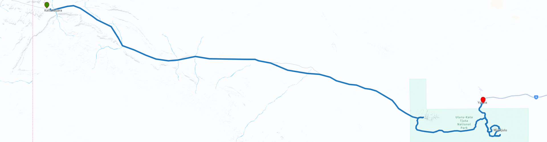
Starting Point: Kaltukatjara, Kaltukatjara Campground
End Point: Yulara, Outback Pioneer Hotel & Lodge
The route is made equal for TomTom, Garmin and MyRoute-app Navigation users.
NOTE: DRIVE LEFT!
 Share this route


Animation

Verdict


Duration
4h 30m

Mode of travel
Car or motorcycle

Distance
277.24 km

Countries

 RouteXpert Review
 But also get to know the Aborigines by booking one of the 101 tours, an experience you will not soon forget. The light show at Kata Tjuta, this is a formation of thirty rocks, the highest of which is more than 500 meters high, is phenomenal, as is the walk of about 8 KM through the Valley of the Winds.
This route also goes through the outback, these are regions that are far from civilization. The outback covers almost three quarters of Australia and mainly extends across the Northern Territory and Western Australia, and parts of the states of Queensland, New South Wales and South Australia.
The term outback includes different landscapes and climatic zones. Large parts of the outback in Western Australia are inaccessible: sometimes no rain falls here for years, while in summer the temperature rises above 50 ° C. The Queensland outback, on the other hand, consists partly of tropical rainforest.
The characteristics of the outback are:
- Only a few asphalt roads are present. Farms (stations) are often located on sandy paths that can only be used by off-road vehicles. It is no exception when a farm is located 80 kilometers from the asphalt road.
- Farms are designed for self-catering. It is not a problem if a supermarket cannot be visited for weeks.
- Settlements with a few houses, a gas station, a supermarket, a garage, a bank and catering establishments are hundreds of kilometers apart.
- Children receive distance education via the radio (School of the Air) and the Internet.
- The Royal Flying Doctor Service (RFDS) is called upon for serious illnesses and accidents.
Camels were imported from the Middle East in 1870. They live partly on farms, partly in the wild.
- Of the approximately 300,000 Aborigines (approximately 1.5% of the total population of Australia), approximately 20% live in the outback, most of them in reserves.
This 4-star rated route goes over beautiful roads and in Yulara you should definitely stay a few days to take in this environment.
General info:
The Northern Territory consists of the original northern part of the state of South Australia. However, this is again contested by the state of Western Australia, as heir to New Holland. It is now an area of limited self-government, has an area of 1,349,129 km² and a quarter of a million inhabitants. The population density is extremely low with one inhabitant per five square kilometers. The capital is Darwin, the country's most northerly city.
The Territory has the image of a large nature reserve and the few inhabitants like to see themselves described as tough, hardened nature people. Two of the most visited nature reserves in Australia are in the Northern Territory: the tropical Kakadu National Park in the north and the world-famous Uluṟu-Kata Tjuṯa National Park in the south (Uluṟu was formerly known as Ayers Rock). The province is also home to the wonderful Devils Marbles Conservation Reserve.
Most of the Simpson Desert is in the southeast corner, while the Tanami Desert is in the west. The MacDonnell Mountains stretch to the east and west of Alice Springs. Arnhemland, a large area belonging to the aboriginal population, is located in the north of the territory, and the Barkly plateau in the northeast.
The entire Northern Territory has only two cities: Darwin and Palmerston. Other places are Alice Springs, Katherine, Tennant Creek and Jabiru.
Only 1% of Australia's total population lives in the Northern Territory, more than half of them in the capital Darwin. 32.5% of them are Aboriginal people.


 Links
Links  Usage
Usage Want to download this route?
You can download the route for free without MyRoute-app account. To do so, open the route and click 'save as'. Want to edit this route?
No problem, start by opening the route. Follow the tutorial and create your personal MyRoute-app account. After registration, your trial starts automatically.  Disclaimer
Use of this GPS route is at your own expense and risk. The route has been carefully composed and checked by a MyRoute-app accredited RouteXpert for use on TomTom, Garmin and MyRoute-app Navigation.
Changes may nevertheless have occurred due to changed circumstances, road diversions or seasonal closures. We therefore recommend checking each route before use.
Preferably use the route track in your navigation system. More information about the use of MyRoute-app can be found on the website under 'Community' or 'Academy'.