Day 30 TCH North Sydney to Corner Brook

This route was brought to you by:
RouteXpert René Plücken (MRA Master)
Last edit: 24-11-2025
 Route Summary
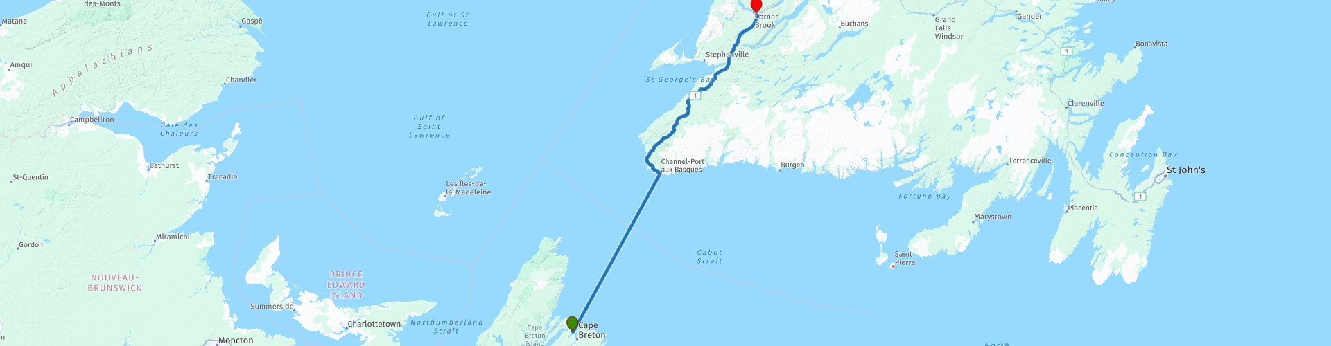
 This is section 30 which runs from North Sydney to Corner Brook.
The Trans-Canada Highway passes through all of the country's southern provinces. The route can be driven in various ways, as there are several alternative routes that also belong to the Trans-Canada Highway. The total distance is around 8,000 km. We won't be driving solely the Trans-Canada Highway, but will be taking as much of the country's back roads as possible, as highway driving alone is too boring, and Canada boasts many beautiful roads through its stunning landscape.
You'll drive through all the provinces and through very diverse and picturesque landscapes, from the Rockies in the west, the Central Prairies to the eastern Maritimes and the northern forest.
The riding season is generally from April to October with longer seasons on the west coast and southern Ontario.
Make sure you have good all-season clothing or bring rain gear. Depending on the province and the season, the weather can change suddenly and you might be surprised by a rain shower, or even a snow or hail shower, so be prepared.
In Canada, the metric system is used, so speeds are indicated in km/h. Helmets are mandatory throughout Canada (DOT approved).
Throughout Canada, you'll see plenty of wildlife. Similar animals vary from province to province, including deer, buffalo, moose, caribou, wolves, cougars, bears, mountain goats, sheep, lynx, coyotes, foxes, raccoons, badgers, various rodents, and a variety of birds.
Even though it is very tempting to stop for a photo, don't do it, it can be very dangerous.
There aren't many interesting stops along the route itself. However, you can stop at several spots to enjoy the beautiful panoramas. Therefore, I rate this route 3*** stars.
 Share this route


Animation

Verdict


Duration
13h 33m

Mode of travel
Car or motorcycle

Distance
394.94 km

Countries

 RouteXpert Review
 Today's itinerary includes a special leg: the crossing from Nova Scotia to Newfoundland. This is no ordinary journey, but a combination of sea and land, an experience you won't soon forget thanks to the stunning scenery and the unique ferry ride.
The ferry departs from North Sydney around midday (11:45, 12:30) or 11:15 pm, depending on the season and day. The crossing takes approximately 7 hours. Onboard, you'll find restaurants, bars, and the option to book a cabin for a comfortable journey.
Tip:
• Choose an evening crossing if you want to take another nice ride on day 29 and arrive rested.
• For an afternoon crossing, you can spend the night in Port aux Basques, because you will arrive between 7:00 and 8:00 PM.
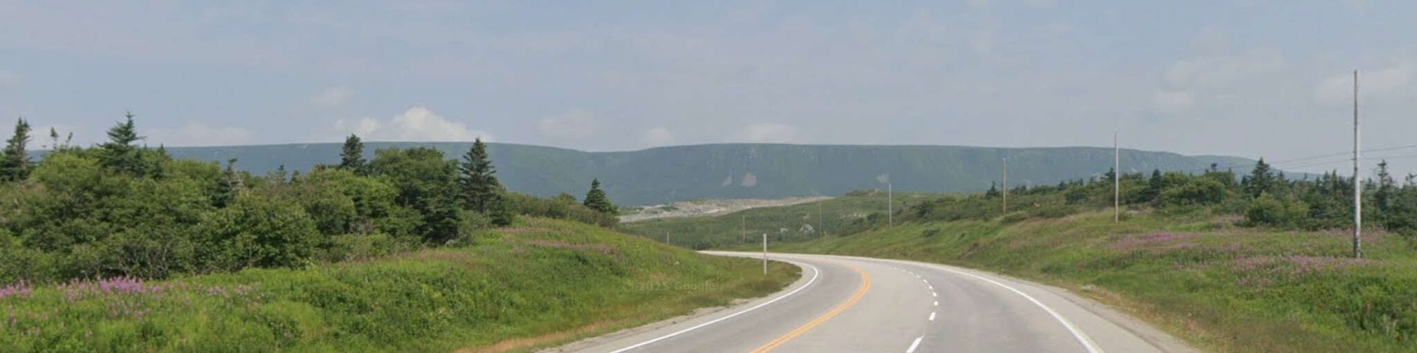
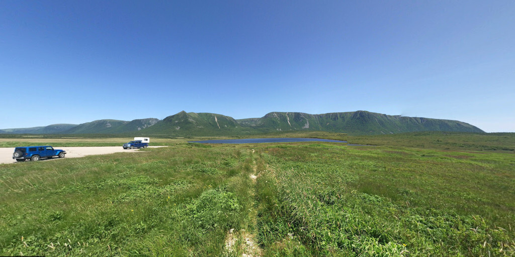
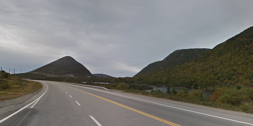
From Port aux Basques, it's another 220 km to Corner Brook on the Trans-Canada Highway (NL-1). This two-lane highway winds through a spectacular landscape of mountains, hills, rivers, and lakes. In some sections, the road is three or four lanes for safe passing.
Newfoundland was formed by a collision of tectonic plates 400 million years ago, creating impressive highlands and dramatic vistas. On one side, you see Saint Lawrence Bay, and on the other, mountains rise up.
There are no major sights along the route, but there are plenty of places to stop for photos of the stunning scenery.
The final destination, Corner Brook, is a town with a spectacular combination of ocean and mountain landscapes, four seasons, and friendly people. Corner Brook is known worldwide as a popular tourist attraction and one of the best places to live, work, and do business. Enjoy time to explore the town's beautiful network of walking trails. Peek into Corner Brook's unique culture at a local gallery or museum. Enjoy the great shops and restaurants in downtown.
My rating: ★★★, A unique day thanks to the ferry ride and Newfoundland's rugged landscape. No spectacular stops, just pure enjoyment of nature and the freedom of the road.
 Links
Links  Usage
Usage Want to download this route?
You can download the route for free without MyRoute-app account. To do so, open the route and click 'save as'. Want to edit this route?
No problem, start by opening the route. Follow the tutorial and create your personal MyRoute-app account. After registration, your trial starts automatically.  Disclaimer
Use of this GPS route is at your own expense and risk. The route has been carefully composed and checked by a MyRoute-app accredited RouteXpert for use on TomTom, Garmin and MyRoute-app Navigation.
Changes may nevertheless have occurred due to changed circumstances, road diversions or seasonal closures. We therefore recommend checking each route before use.
Preferably use the route track in your navigation system. More information about the use of MyRoute-app can be found on the website under 'Community' or 'Academy'.