06 Pastviny naar Spindleruv Mlyn

This route was brought to you by:
RouteXpert Leonor Orban - Sr. RouteXpert
Last edit: 17-12-2019
 Route Summary
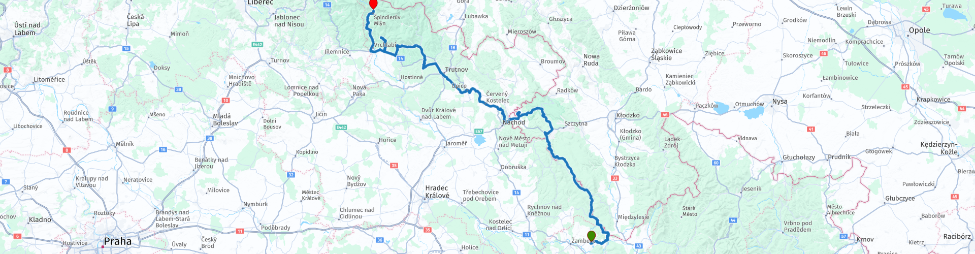
 The route leads you from Pastviny to Špindlerův Mlýn, a popular holiday destination in the middle of the Giant Mountains.
The route is approximately 180 kilometers. Not too long, so you have enough time to enjoy all the beauty that you encounter along the way. During the route you pass a number of beautiful nature reserves, but also a number of special points such as the Skull Chapel in Czermna and the Krkonoše Treetop Walkway in Janské Lázn. Both definitely worth a visit!
The route has been made the same for Garmin, TomTom and MyRoute-app Navigation.
 Share this route


Animation

Verdict


Duration
4h 7m

Mode of travel
Car or motorcycle

Distance
179.49 km

Countries


 RouteXpert Review
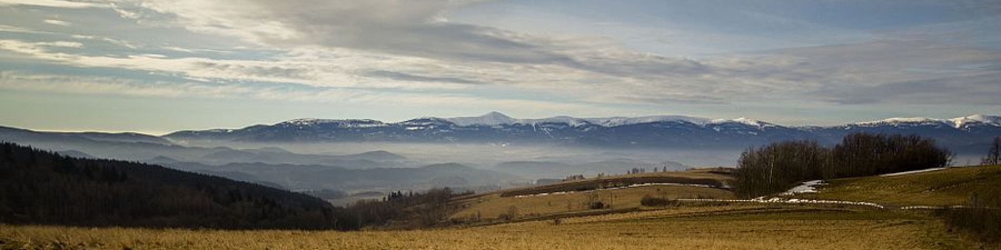
 This route gets 5 stars from me, because there is always something to see along the way and it is always different. The route runs from hilly to mountainous. One moment you come out of the woods and you see distant mountains, the other moment you stand on top of the mountain enjoying the view of the valley. In addition, there are a number of special places to visit along the route (culture and nature). Because the route is not too long, you also have time to stop and look around.
If you leave from Hotel Lesanka in the morning, you will drive down the mountain back into the village. You can stop at the bridge over the reservoir in the middle of the village. It is special to realize that more than a century ago you had to drive a little further down the mountain to reach the heart of the village: in the 1920s several houses had to make way for the reservoir and the dam.
Water remains a constant during this route. A little further on the route you drive a bit along the Divoká Orlice ("Wild Eagle"). This river flows into the reservoir where you have just stopped. The Divoká Orlice is in turn part of the Elbe catchment area. You will also drive along this river today and your route will end near the origin of this river.
While driving along the Divoká Orlice, which forms the border between the Czech Republic and Poland, you come across a number of cultural sights and a ski area.
First the Sint Jans Church of Nepomuk. This church looks poorly maintained and abandoned, but when you are inside you see a simple but atmospheric place. The second stop is in a small village a few kilometers away. Here is a pilgrim church (Maria Ascension Church), which was partly destroyed during the Second World War. The church has been restored in an original way: the roof is entirely made of glass.
After you leave the river you slowly climb the mountain to finally arrive in the Zieleniec Ski area. This is the highest and one of the largest ski areas in Poland. The area is around 900 meters, but due to the Alpine climate there is on average 150 days of snow per year here (November - March). In Zieleniec you have plenty of restaurants and hotels to pause. If you stop at restaurant Hanka, you also have a beautiful view of the "Upper Podgórze" area.
Hopefully you have a strong stomach, because after the break (with possible lunch) you stop in Czermna. Here is the famous "skull chapel". This chapel was built in 1776 and has been used as a mass grave for thousands of victims from the Thirty Years War. The bones of the deceased were used to "decorate" the chapel. Of this type of monument, there are only 6 in Europe.
The route goes smoothly after this chapel, so you can recover from all impressions. You cross a plain and then you enter the Krkonoše National Park (Giant Mountains). This National Park is also recognized as a UNESCO Biosphere Reserve. It is the highest mountain range in the Czech Republic, with the "famous" Czech Matterhorn: the Sněžka.
About ¾ of the route you will arrive in Janské Lázně. Just beyond this town you will find the Krkonoše Tree Top Walk. If you are interested in learning more about the National Park, or if you simply want to stretch your legs, it is worth stopping. You can park your motorcycle in the (paid) parking area at the entrance of the museum. Then you walk through a number of wooden footpaths above the treetops of the forest area. The walk is approximately 1300 meters long, the paths hang 23 meters in the air with a viewing tower of 45 meters as the highest point.
After this hike you drive through the Giant Mountains to the end point of the route in Špindlerův Mlýn. The last part of this route winds along the aforementioned Elbe. Before you enter the village, you will come across a nice little dam on the way that you can photograph if you wish.
In the village there are sufficient accommodation options throughout the year. It is a busy ski area in winter and popular with hikers and mountain bikers in the summer. If you feel like it and have the time, it is worth spending two nights here: this gives you time to take a walk in the mountains to the origins of the Elbe. Along the way you walk through a beautiful gorge and along the highest waterfall in the Czech Republic.


 Links
Links  Usage
Usage Want to download this route?
You can download the route for free without MyRoute-app account. To do so, open the route and click 'save as'. Want to edit this route?
No problem, start by opening the route. Follow the tutorial and create your personal MyRoute-app account. After registration, your trial starts automatically.  Disclaimer
Use of this GPS route is at your own expense and risk. The route has been carefully composed and checked by a MyRoute-app accredited RouteXpert for use on TomTom, Garmin and MyRoute-app Navigation.
Changes may nevertheless have occurred due to changed circumstances, road diversions or seasonal closures. We therefore recommend checking each route before use.
Preferably use the route track in your navigation system. More information about the use of MyRoute-app can be found on the website under 'Community' or 'Academy'.

Lower Silesia
About this region
Lower Silesia (Polish: Dolny Śląsk; Czech: Dolní Slezsko; German: Niederschlesien; Upper Sorbian: Delnja Šleska; Lower Sorbian: Dolna Šlazyńska; Latin: Silesia Inferior; Silesian German: Niederschläsing; Silesian: Dolny Ślůnsk) is the northwestern part of the historical and geographical region of Silesia; Upper Silesia is to the southeast.
In the Middle Ages Lower Silesia was part of Piast-ruled Poland. It was one of the leading regions of Poland, and its capital Wrocław was one of the main cities of the Polish Kingdom. Lower Silesia emerged as a distinctive region during the fragmentation of Poland, in 1172, when the Duchies of Opole and Racibórz, considered Upper Silesia since, were formed of the eastern part of the Duchy of Silesia, and the remaining, western part was since considered Lower Silesia. During the Ostsiedlung, German settlers were invited to settle in the sparsely populated region, which until then had a Polish majority. As a result, the region became largely Germanised in the following centuries.
In the late Middle Ages the region fell under the overlordship of the Bohemian Crown, however large parts remained under the rule of local Polish dukes of the Piast dynasty, some up to the 16th and 17th century. Briefly, under the suzerainty of the Kingdom of Hungary, it fell to the Austrian Habsburg Monarchy in 1526.
In 1742, Austria ceded nearly all of Lower Silesia to the Kingdom of Prussia in the Treaty of Berlin, except for the southern part of the Duchy of Nysa. Within the Prussian kingdom, the region became part of the Province of Silesia. In 1871, Lower Silesia was integrated into the German Empire. After World War I, the region became a separate province within the Weimar Republic.
After 1945, the main part of the former Prussian province fell to the Republic of Poland, while a smaller part west of the Oder-Neisse line remained within East Germany and historical parts of Austrian Lower Silesia (Jesenicko, Opavsko regions) remained as a part of Czechoslovakia. By 1949, almost the entire pre-war German population was expelled.The region is known for an abundance of historic architecture of various styles, including many castles and palaces, well preserved or reconstructed old towns, numerous spa towns, and historic burial sites of Polish monarchs and consorts (in Wrocław, Legnica and Trzebnica).
Read more on Wikipedia
In the Middle Ages Lower Silesia was part of Piast-ruled Poland. It was one of the leading regions of Poland, and its capital Wrocław was one of the main cities of the Polish Kingdom. Lower Silesia emerged as a distinctive region during the fragmentation of Poland, in 1172, when the Duchies of Opole and Racibórz, considered Upper Silesia since, were formed of the eastern part of the Duchy of Silesia, and the remaining, western part was since considered Lower Silesia. During the Ostsiedlung, German settlers were invited to settle in the sparsely populated region, which until then had a Polish majority. As a result, the region became largely Germanised in the following centuries.
In the late Middle Ages the region fell under the overlordship of the Bohemian Crown, however large parts remained under the rule of local Polish dukes of the Piast dynasty, some up to the 16th and 17th century. Briefly, under the suzerainty of the Kingdom of Hungary, it fell to the Austrian Habsburg Monarchy in 1526.
In 1742, Austria ceded nearly all of Lower Silesia to the Kingdom of Prussia in the Treaty of Berlin, except for the southern part of the Duchy of Nysa. Within the Prussian kingdom, the region became part of the Province of Silesia. In 1871, Lower Silesia was integrated into the German Empire. After World War I, the region became a separate province within the Weimar Republic.
After 1945, the main part of the former Prussian province fell to the Republic of Poland, while a smaller part west of the Oder-Neisse line remained within East Germany and historical parts of Austrian Lower Silesia (Jesenicko, Opavsko regions) remained as a part of Czechoslovakia. By 1949, almost the entire pre-war German population was expelled.The region is known for an abundance of historic architecture of various styles, including many castles and palaces, well preserved or reconstructed old towns, numerous spa towns, and historic burial sites of Polish monarchs and consorts (in Wrocław, Legnica and Trzebnica).
View region
 Statistics
  6
6Amount of RX reviews (Lower Silesia)
 10733
10733Amount of visitors (Lower Silesia)
 468
468Amount of downloads (Lower Silesia)
 Route Collections in this region
 Tour Poland Slovakia and the Czech Republic
This collection of routes is based on a 3-week vacation that I rode with my partner in June 2018.
The journey goes through Poland, Slovakia, the Czech Republic and a piece of Germany. In total there are 11 driving days, a combination of touristic tours and routes from A to B. All routes avoid the highway and go exclusively on the smaller roads, which makes it a beautiful and varied journey.
Along the way you regularly come across sights, where you can stop to look around. These vary from beautiful viewpoints, to museums and special buildings. You also visit various national nature parks along the way, such as the Tatra Mountains, the Giant Mountains, Eagle Mountains, Krkonoše and Bohemian Switzerland. Because the overnight places are often also located in these areas, you can alternate the driving days with days with wonderful hiking trips.
If you only want to ride a motorcycle, then this collection can also be done in 2 weeks (including a return trip from the Netherlands).
The routes themselves can be challenging from time to time, particularly because the quality of the road surface in Eastern Europe - especially on the small country roads - is not always good. In June 2018 all routes were on paved roads.
View Route Collection