R15 Roundtour Sirkka to North Cape part 1

This route was brought to you by:
RouteXpert Arno van Lochem - Senior RX
Last edit: 10-04-2021
 Route Summary
 You can also see this fifteenth part as part 1 of a 5-part tour from Sirkka to the North Cape.
The routes are easy for everyone to ride and are on well-paved roads. There may be a single hairpin bend to be taken, but these are easy to do.
If there is a piece of gravel in the route, a warning will be given and a detour will be indicated.
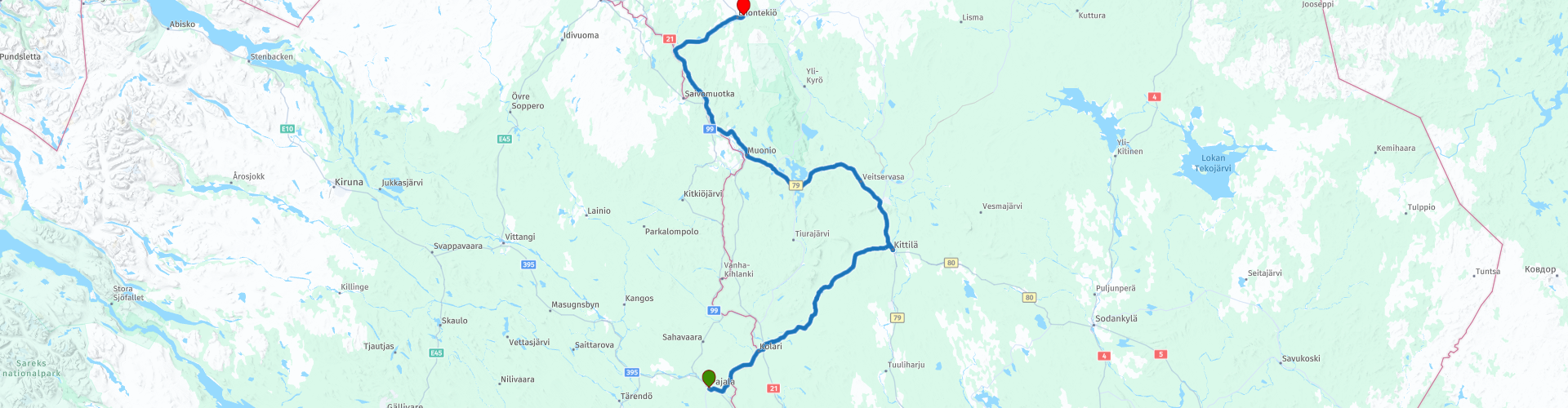
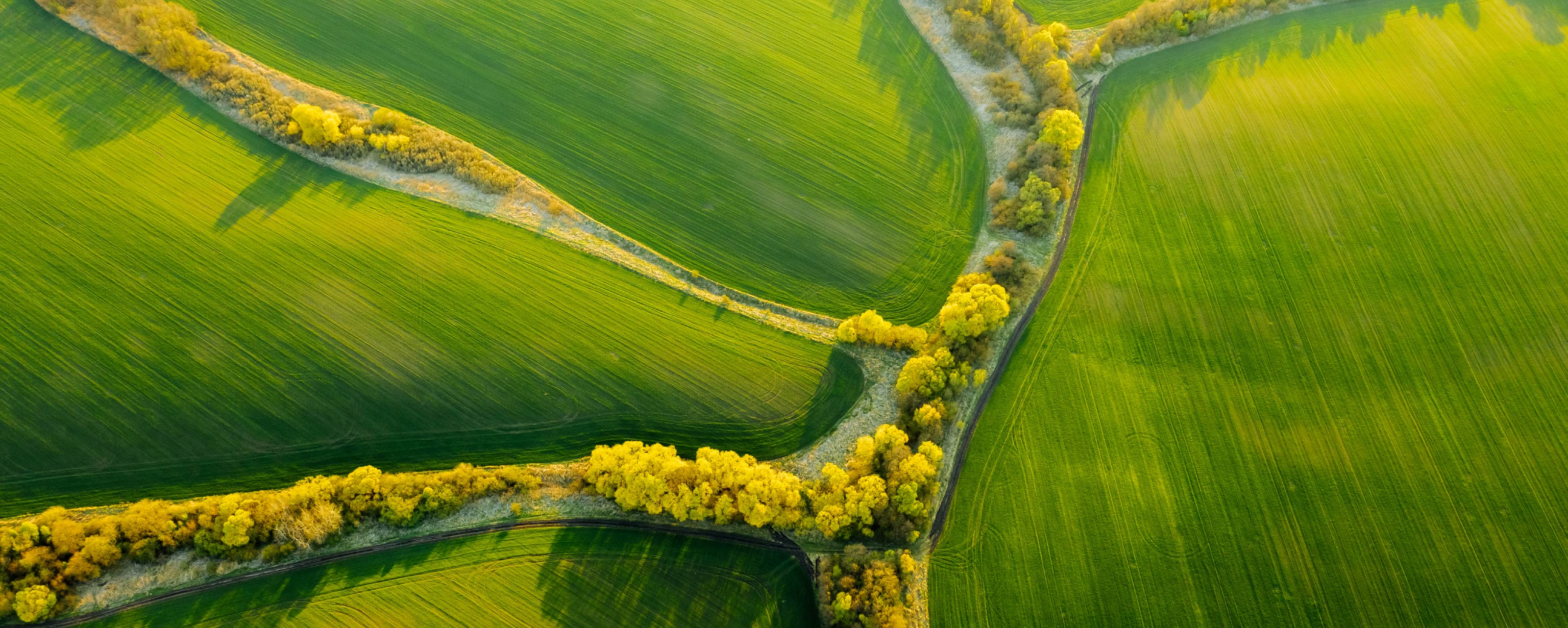
The route starts in Pajala, located in Finnish Lapland. The route again runs through a vast area, in which coniferous trees, mountain birch trees and lakes provide your view. Some nice sights along the way, such as the Einari Junittila Art Museum, the Palsa Museum and the Gallerie Raekallio. You can also walk through the (winter sports) place Sirkka. The route ends in Enontekiö, located in the northeast of Finland.
The North Cape is getting closer!
The expansive landscape is the reason that you better have some food and drink with you on the go, as the catering establishments in this area are not particularly abundant.
The participants of the Arctic Challenge were given the co-ordinates of the following destination in Gällivare (Sweden) at a petrol station. That destination turned out to be a hotel in Sirkka, where they stayed for three days. The route passes through Sirkka.
If you decide not to continue to the North Cape but only want to follow the route of the Arctic Challenge, it is best to stop in Sirkka. The hotel where the participants slept is indicated as POI. You can then continue the route with part 20.
Vast landscape and beautiful views, beautiful roads and nice sights, hence the rating of 4 stars.
 Share this route


Animation

Verdict


Duration
7h 19m

Mode of travel
Car or motorcycle

Distance
257.23 km

Countries


 RouteXpert Review
 Of all western European countries, the Scandinavian countries probably have the most more or less untouched nature. In addition, they are countries that are easily accessible from the Netherlands. Norway is characterized by, among other things, the fjords and the Trollstigen, known to many motorcyclists. And where Sweden is known as wide and relaxing, everyone knows Finland as the land of 1000 lakes. All in all, legitimate reasons to traverse this beautiful nature in the north of Europe by means of a number of routes.
The route starts in Pajala, a Swedish town close to the Finnish border. Before you start driving, however, it might be wise to walk into the supermarket diagonally opposite the hotel for some shopping for on the road. And once you drive you will find a gas station after the first corner where you can fill the tank if necessary. Only then do you really get going.
Soon you will cross a river, the Torne. This is a river that flows from Northern Sweden to Northern Finland, to flow into the Gulf of Bothnia. The Torne arises where two foothills on the east side of Torneträsk in Swedish Lapland join at Kurravaara, a few kilometers north of the city of Kiruna. It is then again not recognizable as a river. It flows through a swamp from the point of leaving Tornetråsk to Pajala.
Just after Pajala, the Muonio joins the Torne, the river then flows south through the Tornedal, forming the border between Sweden and Finland. The current of the Torne is small due to the small height difference. The current of the Muonio is faster due to the relative shallow depth, whereby a lot of water has to be drained away. In some places the current speed is so great that fishing boats regularly capsize and people drown.
By analogy with a national park, the Torne was declared a national river in 1993. This means that no hydropower plants may be built in the river and that any form of canalization is prohibited. For example, an attempt is made to preserve the natural course of the river and to protect populations of migratory fish species (such as salmon). Sweden's other three national rivers are Vindelälven, Pite älv and Kalixälven.
Just before Kolari in Finland, cross the Muonio and enter Finland, the land of reindeer sleigh rides and the Northern Lights. As far as the landscape is concerned, it is not much different. Lapland extends over the very northernmost part of Norway, Sweden, Finland and Russia. You are now in the Finnish part.
Via Palovaara you drive towards the first coffee break in Ylläsjärvi, a village located on the lake of the same name. Ylläs is a fjell (mountain area) and ski resort in the Finnish municipality of Kolari. It is the second largest ski resort in the Finnish province of Lapland after Levi. Ylläs is the highest fjell in Finland with a ski lift.
After the coffee break you continue the route towards Kittilä. You cross the Lainiojoki, among other things. The Lainio is a river that starts somewhere in the high mountains that lie at the border triangle between Sweden, Norway and Finland. Most of the water comes from the Råstojaure, which drains through the Råstr River, which, together with the Tavva River, forms the two largest source rivers. The Lainio soon flows through the swamp area that surrounds it and winds its way through Övre Soppero, Nedre Soppero, Lainio and Kangos to eventually contribute its water to the Torne. The river is approximately 250 kilometers long, its drainage area is 6300 km². Main tributaries are the Saanki River and the Pulsu River. This river is known for the huge populations of salmon that live there. The Lainio River has a namesake with the suffix 'joki' as a tributary, and that is the river you cross.
When you arrive in Kittilä you have the opportunity to visit two museums. First, here you will find the The Einari Junttila Art Museum. This museum is located in a house built by the artist in the 1930s. The native Kittilä artist Einari Junttila (1901-1975) is best known for his watercolors depicting the nature of Lapland. Opened in 1991, the museum showcases his art and home environment. The museum is owned and maintained by Einari Junttila's daughter, Terttu Junttila.
You will also find the Palso museum in this place. It includes the cottage and studio of Kalervo Palsa (1947-1987). The artist's father Hugo Palsa bought a small farm called Hyrynkangas in 1946 and it is one of the few surviving buildings in the parish of Kittilä that survived the devastation of the Lapland War. The museum is open from the beginning of June to the end of September,
Kalervo Palsa lived in the cottage with his parents and three brothers. Mother Hilja Kenttälä earned extra income for the family by selling liquor and housing men working in the area. At a young age, the existing courtyard became an important place for Kalervo Palsa, where he was allowed to write and paint his diary in peace. He called his bare studio Cloud Castle and Gethsemane. The last years of his life Palsa lived there alone, after the death of his mother and brother. On October 4, 1987, he died in his studio after contracting pneumonia.
The Palsa Museum in the center of Kittilä was opened on June 6, 2013. The house was uninhabited since the artist's death and has fallen into disrepair. The Kauko Sorjonen Foundation acquired Palsa buildings and furnishings in 2011, and restoration work was carried out the following year. In connection with the work, the paintings on the walls of the studio in Gethsemane have also been preserved.
About 20 kilometers further you arrive in Sirkka. The final destination of the Arctic Challenge 2020. In this place, which is also a winter sports area, the participants stayed for three days. They have participated in all kinds of activities here, such as ice karting and a trip on the snowmobile.
After these three days, the return journey started. If you are taking this tour to only drive the route that the participants have ridden, it is best to stop here at the hotel and continue with part 20 of the tour. You then skip the visit to the North Cape. That's a shame of course, because now that you're here ...
From Sirkka the route leads back to the border with Sweden, which you will also follow for a while. Before that, however, you pass Galleria Raekallio, where the work of the painter Reijo Raekallio can be viewed. Reijo has been painting art from life for 50 years, be it people, reindeer or just nature. Atmosphere and light are important aspects in his work.
The artist's wife, Maria Grandell, manages the gallery and associated café, as well as accommodation and restaurant activities. Not surprising since she has completed the training as a hotel and restaurant manager.
After the last coffee break of this route, you drive towards the final destination Enontekiö. Before you reach Enontekiö you will pass a number of lakes where it is worth stopping for a photo. Especially Sotkajärven Lintutorni is worth a stop. You reach the viewpoint over a jetty, after which you have a pleasant view over the lake.
Shortly after these last two lakes you will arrive in Enontekiö, where the route ends at Lapland Hotel Hetta. Again equipped with a bar, restaurant and a sauna. The hotel has a rating of 8.1 on a major booking site, so that's okay.
The midnight sun is also clearly visible in the north of Finland. The midnight sun never completely disappears; however the sun sinks quite low and floats just above the horizon. The sun now hangs for several hours between sunset and sunrise, radiating a soft glow: a dream come true for every photographer. Shady silhouettes against a golden sky with beautiful Finnish nature all around you, that is an experience that many people would love to experience.
In the north of Finland, the midnight sun shines from the end of May to mid-July. However, a warning is in order, exposure to this phenomenon can disrupt your sleep cycle.
A campsite is signposted for campers near the end point: Hetan Lomakylä.
Have fun driving this route!


 Links
Links  Usage
Usage Want to download this route?
You can download the route for free without MyRoute-app account. To do so, open the route and click 'save as'. Want to edit this route?
No problem, start by opening the route. Follow the tutorial and create your personal MyRoute-app account. After registration, your trial starts automatically.  Disclaimer
Use of this GPS route is at your own expense and risk. The route has been carefully composed and checked by a MyRoute-app accredited RouteXpert for use on TomTom, Garmin and MyRoute-app Navigation.
Changes may nevertheless have occurred due to changed circumstances, road diversions or seasonal closures. We therefore recommend checking each route before use.
Preferably use the route track in your navigation system. More information about the use of MyRoute-app can be found on the website under 'Community' or 'Academy'.
Lapland
About this region
Lapland may refer to:
Read more on Wikipedia
View region
 Statistics
  6
6Amount of RX reviews (Lapland)
 8002
8002Amount of visitors (Lapland)
 299
299Amount of downloads (Lapland)
 Route Collections in this region
 6500 kilometers through Scandinavia with the highlights of the Lofoten and the North Cape
The Arctic Challenge Tour, on which this 26-part tour is partly based, is not a speed race. It's a tour. It comes down to agility, good navigation and anticipation. The participants are obliged to adhere to the speed limit of the country concerned. The participants must find the ideal route with the shortest possible distance by complying 100% with the locally applicable traffic rules. Of course, also take maximum speeds into account. The organization checks for violations of the speed limit. In case of gross or repeated exceeding of the maximum speed, disqualification for the relevant stage and for the final classification will follow. Control of the route and speeds is done by means of a track and trace system. This equipment is installed in every vehicle. You can then follow each team accurately in the Back Office. Those staying at home, interested parties and participants can also see the performances of the teams, because you can be followed live via the Internet. The Back Office takes action when a team gets into trouble. (source: website The Arctic Challenge)
That's quite a luxury, having a back office behind you that keeps an eye on you. Most of us will not have that and are on our own or the fellow traveler(s). The only agreement you have with the participants is that you also have to abide by the rules. Fortunately, you don't have to complete this tour in 9 days, like the participants, but you can take it a little longer.
The highlight of the Arctic Challenge in 2020 was the Lofoten, an island group northwest of Norway. The Lofoten archipelago is located in the middle of the wild Norwegian Sea, well above the Arctic Circle. This special region offers a beautiful landscape with imposing mountains, deep fjords and long, wild sandy beaches where the sound of the seabird colonies can always be heard.
The archipelago is best known for its rich fishing tradition. The Lofoten makes a prosperous impression despite their isolated location. The entire economy revolves above all around fishing. The image of the Lofoten is mainly dominated by wooden racks with cod, which hangs to dry. Lofoten fishing has been a household name for centuries. In the middle of winter, the ships set out to catch the fish in just a few months. The rich fishing grounds are due to the North Atlantic Warm Gulf Stream around the islands, in which the fish have their spawning grounds. Oil drilling is not permitted around Lofoten and the cod spawning grounds there.
The next destination for the participants was Sirkka, also known as Levi, a winter sports resort in Finnish Lapland. They stayed there for a few days to go ice-karting and to enjoy the snow by going on a snowmobile or skiing trip. This tour also takes you to Sirkka, but instead of staying there for a few days, you have the option to continue to the North Cape, the second highlight of this trip.
Imagine a place in the far north, where the Atlantic Ocean meets the icy waters of the Arctic Ocean. This place is the North Cape in Western Finnmark in Northern Norway. From here, only the archipelago of Spitsbergen lies between you and the North Pole and the sun shines for 2.5 months at a time; from mid-May to the end of July. Many visitors admire the midnight sun or the sunset over the Barents Sea from the North Cape plateau.
With each route you will find a review with a description of the route, where you pass and what to see along the way. It is also briefly described how the participants in the Arctic Challenge in 2020 had to drive it anyway, from which point to which point. Along the way, markings (route points) have been included that indicate the end points of the stages that the participants had to complete. As mentioned, they covered the distance in 9 days, stages of more than 1000 kilometers were no exception.
Each route ends at a hotel. It is of course not an obligation to use these hotels, you can always find another place to stay in the area, that decision is up to you. My experience, however, is that they are all simple but good hotels for a very reasonable price. They are known and can be booked at booking.com.
The routes of these collections:
R01 - Puttgarden to Angelholm, 280km
R02 - Angelholm to Alingsas, 281km
R03 - Alingsas to Mysen, 261km
R04 - Mysen to Rena, 312km
R05 - Rena to Orkanger, 306km
R06 - Orkanger to Grong, 292km
R07 - Grong to Mo i Rana, 290km
R08 - Mo i Rana to Bodo, 231km
R09 - Roundtour Bodo to Lofoten part 1, 314km
R10 - Roundtour Bodo to Lofoten part 2, 250km
R11 - Roundtour Bodo to Lofoten part 3, 291km
R12 - Bodo to Arjeplog, 295km
R13 - Arjeplog to Jokkmokk, 244km
R14 - Jokkmokk to Pajala, 239km
R15 - Roundtour Sirkka to North Cape part 1, 257km
R16 - Roundtour Sirkka to North Cape part 2, 300km
R17 - Roundtour Sirkka to North Cape part 3, 244km
R18 - Roundtour Sirkka to North Cape part 4, 275km
R19 - Roundtour Sirkka to North Cape part 5, 332km
R20 - Sirkka to Kemi, 299km
R21 - Kemi to Ylivieska, 251km
R22 - Ylivieska to Jalasjarvi, 236km
R23 - Jalasjarvi to Turku, 279km
R24 - Stockholm to Askersund, 271km
R25 - Askersund to Varnamo, 224
R26 - Varnamo to Trelleborg, 259km
Have fun driving these routes!
View Route Collection