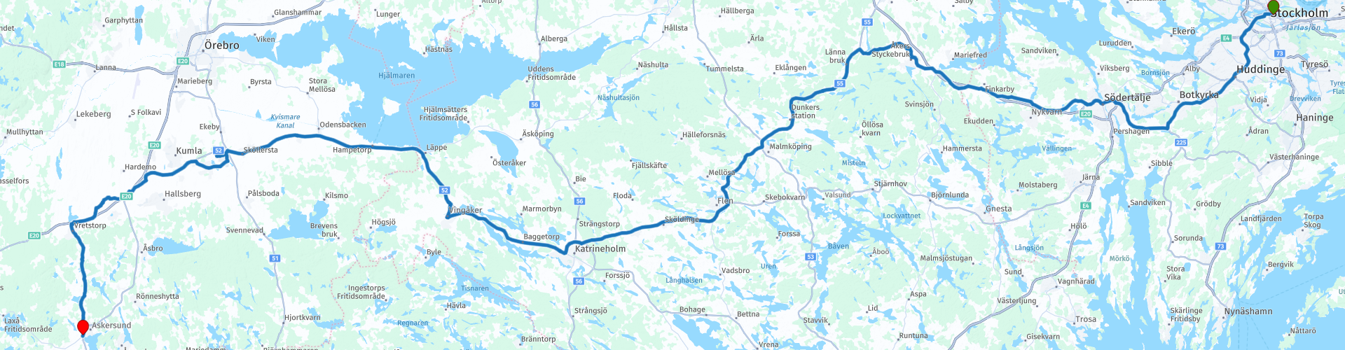
R24 Stockholm to Askersund

This route was brought to you by:
RouteXpert Arno van Lochem - Senior RX
Last edit: 18-05-2021
 Route Summary
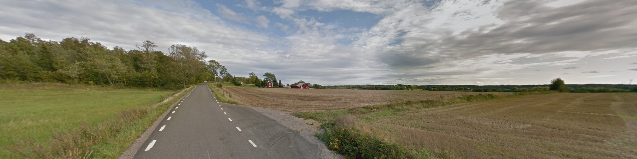
 The routes are easy for everyone to drive and are on well-paved roads. It may be necessary to take a single hairpin bend, but these are perfectly doable.
If there is a piece of gravel in the route, a warning will be given and, if possible, a detour will be indicated.
The route starts in Stockholm, where you arrived after a long journey on the boat from Turku. The first part is a bit busy, Stockholm is just a big city. After leaving the hustle and bustle, meander through the beautiful Swedish landscape towards the final destination in Askersund. Along the way fantastic landscapes, lots of water, forest and beautiful views through which the road winds wonderfully. Nice to drive. After every turn a different fantastic view. Beautiful and interesting sights include Tom Tits Experiments (is not what you think!), The Stone Working Museum and Art at height.
Beautiful rugged landscape, beautiful scenic views, tight roads and beautiful sights, hence the 4-star rating.
 Share this route


Animation

Verdict


Duration
8h 3m

Mode of travel
Car or motorcycle

Distance
270.78 km

Countries

 RouteXpert Review
 Of all western European countries, the Scandinavian countries probably have the most more or less untouched nature. In addition, they are countries that are easily accessible from the Netherlands. Norway is characterized by, among other things, the fjords and the Trollstigen known to many motorcyclists. And where Sweden is known as wide and peaceful, everyone knows Finland as the land of 1000 lakes. All in all, legitimate reasons to traverse this beautiful nature in the north of Europe by means of a number of routes.
When leaving the ferry in Stockholm, the participants of the Arctic Challenge were given the following coordinates to report to: Hamburg. A trip of almost 1000 kilometers ...
The route starts at the Viking Line Terminal in Stockholm. The first 25 kilometers you drive through urban areas, then you quickly drive between meadows and forest.
When you arrive in Södertälje you can visit Tom Tits Experiments. Tom what? Tom Tits Experiments! Science and technology are fun when someone explains them correctly. Only when you really start testing something can you understand it. Welcome to a science center for the whole family!
You will find four floors and a park (open from May-October) with experiments for you to enjoy. The experiments entice you to learn a little bit more about technology, physics, math, geography, biology, how humans work, illusions and much, much more.
All experiments are real hands-on experiments. No prior knowledge is required and most things can be done by anyone no matter how young or old. You will have the opportunity to use all your senses, and many of the experiments you experience very simply with your whole body, by twisting, jumping or bouncing.
You can test the experiments in any order. There are TV screens on every floor showing the day's program.
After all this experimentation you drive further westwards where you have the opportunity to visit the Swedish Urban Transport Museum in Malmköping. The museum has more than 40 wagons from the 12 Swedish cities that have had trams. One third of the cars have so far been renovated for use on the tram line of the museum in Malmköping. The oldest is from 1903; the newest is from the 50s.
You will also find the Swedish Bus Museum, which is also part of the City Transport Museum. It shows the development of the bus service in Sweden with vehicles, models, text and photos, and much more. The museum opened in the summer of 1999 to celebrate 100 years of bus service in Sweden.
If you pass Sweden's third largest lake, you have to stop there of course. It concerns Hjälmarenmeer, with a size of 484 square kilometers not a small one. There are numerous islands in the lake, of which Vinön is the largest. Coincidentally you look exactly at that island from the indicated place.
A few kilometers further, at Kvarntorp the route runs over the highest point in the area. You will find Kvarntorpshögen here. Kvarntorpshögen is an approximately 100 meter high slag heap. At 157 meters above sea level, it is the highest point in the Närkeslätten. The pole is associated with the art project Art on High. In winter there is a slalom slope here. There is a way up and in the summer there is a kiosk with easier handling and information. There is a 427-step staircase leading to the top which has become very popular for training. There are also several hiking trails in the area.
Art on High is a sculpture park with about 30 works of art. Concerts and theater performances are organized in summer. It was voted the most remarkable attraction in Sweden in 2010, nice to see.
A little further you will pass the Stone Working Museum. It is a museum that shows the history of the local stone treatment, with a marble collection and a unique marble floor, as well as a unique collection of full-size plaster models modeled by the sculptors. Organized stone treatment in the Hälla Quarry already existed during the Middle Ages. Hällabrottet stone was used in the reconstruction of Örebro Castle and also in the construction of a number of churches.
The large limestone quarry at Hällabrottet has long been the property of the Crown. It can be understood that it was important because King Gustav I visited it on several occasions, as did the son Duke Charles, later Charles IX.
The company became the private Yxhults stunhuggeri in the 1820s, which became a limited company in 1879.
In 1980 the quarrying business was closed, while the company, Yxhult AB, production of lightweight concrete, survived and enjoyed great success for a while. Over time, demand declined and the company closed in 2004.
After 270 kilometers you reach the final destination of this route, the Garvaregården Hotel in Askersund. A hotel with a restaurant and good reviews, located near the harbor and a gas station.
Two camping sites are signposted for campers in the vicinity of the end point: Husabergsudde Camping and Tivedsporten Eco Camp.
Have fun driving this route!


 Links
Links  Usage
Usage Want to download this route?
You can download the route for free without MyRoute-app account. To do so, open the route and click 'save as'. Want to edit this route?
No problem, start by opening the route. Follow the tutorial and create your personal MyRoute-app account. After registration, your trial starts automatically.  Disclaimer
Use of this GPS route is at your own expense and risk. The route has been carefully composed and checked by a MyRoute-app accredited RouteXpert for use on TomTom, Garmin and MyRoute-app Navigation.
Changes may nevertheless have occurred due to changed circumstances, road diversions or seasonal closures. We therefore recommend checking each route before use.
Preferably use the route track in your navigation system. More information about the use of MyRoute-app can be found on the website under 'Community' or 'Academy'.

Stockholms lan
About this region
Stockholm County (Swedish: Stockholms län [ˈstɔ̂kː(h)ɔlms ˈlɛːn]) is a county or län (in Swedish) on the Baltic Sea coast of Sweden. It borders Uppsala County and Södermanland County. It also borders Mälaren and the Baltic Sea. The city of Stockholm is the capital of Sweden. Stockholm County is divided by the historic provinces of Uppland (Roslagen) and Södermanland (Södertörn). More than one fifth of the Swedish population lives in the county. Stockholm County is also one of the statistical riksområden (national areas) according to NUTS:SE, Nomenclature of Territorial Units for Statistics within the EU. With more than two million inhabitants, Stockholm is the most densely populated county of Sweden.
Read more on Wikipedia
View region
 Statistics
  1
1Amount of RX reviews (Stockholms lan)
 4644
4644Amount of visitors (Stockholms lan)
 62
62Amount of downloads (Stockholms lan)
 Route Collections in this region
 6500 kilometers through Scandinavia with the highlights of the Lofoten and the North Cape
The Arctic Challenge Tour, on which this 26-part tour is partly based, is not a speed race. It's a tour. It comes down to agility, good navigation and anticipation. The participants are obliged to adhere to the speed limit of the country concerned. The participants must find the ideal route with the shortest possible distance by complying 100% with the locally applicable traffic rules. Of course, also take maximum speeds into account. The organization checks for violations of the speed limit. In case of gross or repeated exceeding of the maximum speed, disqualification for the relevant stage and for the final classification will follow. Control of the route and speeds is done by means of a track and trace system. This equipment is installed in every vehicle. You can then follow each team accurately in the Back Office. Those staying at home, interested parties and participants can also see the performances of the teams, because you can be followed live via the Internet. The Back Office takes action when a team gets into trouble. (source: website The Arctic Challenge)
That's quite a luxury, having a back office behind you that keeps an eye on you. Most of us will not have that and are on our own or the fellow traveler(s). The only agreement you have with the participants is that you also have to abide by the rules. Fortunately, you don't have to complete this tour in 9 days, like the participants, but you can take it a little longer.
The highlight of the Arctic Challenge in 2020 was the Lofoten, an island group northwest of Norway. The Lofoten archipelago is located in the middle of the wild Norwegian Sea, well above the Arctic Circle. This special region offers a beautiful landscape with imposing mountains, deep fjords and long, wild sandy beaches where the sound of the seabird colonies can always be heard.
The archipelago is best known for its rich fishing tradition. The Lofoten makes a prosperous impression despite their isolated location. The entire economy revolves above all around fishing. The image of the Lofoten is mainly dominated by wooden racks with cod, which hangs to dry. Lofoten fishing has been a household name for centuries. In the middle of winter, the ships set out to catch the fish in just a few months. The rich fishing grounds are due to the North Atlantic Warm Gulf Stream around the islands, in which the fish have their spawning grounds. Oil drilling is not permitted around Lofoten and the cod spawning grounds there.
The next destination for the participants was Sirkka, also known as Levi, a winter sports resort in Finnish Lapland. They stayed there for a few days to go ice-karting and to enjoy the snow by going on a snowmobile or skiing trip. This tour also takes you to Sirkka, but instead of staying there for a few days, you have the option to continue to the North Cape, the second highlight of this trip.
Imagine a place in the far north, where the Atlantic Ocean meets the icy waters of the Arctic Ocean. This place is the North Cape in Western Finnmark in Northern Norway. From here, only the archipelago of Spitsbergen lies between you and the North Pole and the sun shines for 2.5 months at a time; from mid-May to the end of July. Many visitors admire the midnight sun or the sunset over the Barents Sea from the North Cape plateau.
With each route you will find a review with a description of the route, where you pass and what to see along the way. It is also briefly described how the participants in the Arctic Challenge in 2020 had to drive it anyway, from which point to which point. Along the way, markings (route points) have been included that indicate the end points of the stages that the participants had to complete. As mentioned, they covered the distance in 9 days, stages of more than 1000 kilometers were no exception.
Each route ends at a hotel. It is of course not an obligation to use these hotels, you can always find another place to stay in the area, that decision is up to you. My experience, however, is that they are all simple but good hotels for a very reasonable price. They are known and can be booked at booking.com.
The routes of these collections:
R01 - Puttgarden to Angelholm, 280km
R02 - Angelholm to Alingsas, 281km
R03 - Alingsas to Mysen, 261km
R04 - Mysen to Rena, 312km
R05 - Rena to Orkanger, 306km
R06 - Orkanger to Grong, 292km
R07 - Grong to Mo i Rana, 290km
R08 - Mo i Rana to Bodo, 231km
R09 - Roundtour Bodo to Lofoten part 1, 314km
R10 - Roundtour Bodo to Lofoten part 2, 250km
R11 - Roundtour Bodo to Lofoten part 3, 291km
R12 - Bodo to Arjeplog, 295km
R13 - Arjeplog to Jokkmokk, 244km
R14 - Jokkmokk to Pajala, 239km
R15 - Roundtour Sirkka to North Cape part 1, 257km
R16 - Roundtour Sirkka to North Cape part 2, 300km
R17 - Roundtour Sirkka to North Cape part 3, 244km
R18 - Roundtour Sirkka to North Cape part 4, 275km
R19 - Roundtour Sirkka to North Cape part 5, 332km
R20 - Sirkka to Kemi, 299km
R21 - Kemi to Ylivieska, 251km
R22 - Ylivieska to Jalasjarvi, 236km
R23 - Jalasjarvi to Turku, 279km
R24 - Stockholm to Askersund, 271km
R25 - Askersund to Varnamo, 224
R26 - Varnamo to Trelleborg, 259km
Have fun driving these routes!
View Route Collection