Day 94 The Ultimate USA road trip Sioux Falls O'Neill

This route was brought to you by:
RouteXpert René Plücken (MRA Master)
Last edit: 27-11-2023
 Route Summary
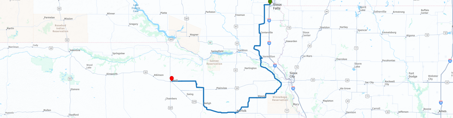
 I have further supplemented the Road Trip with even more special points that you can visit in the USA. Today we drive from Sioux Falls, South Dakota to O'Neill, Nebraska. It is a long drive of over 420 kilometers.
We drive on beautiful roads through the green agricultural areas of South Dakota and Nebraska. A number of stops at sights are planned. I rate this route 4 stars.
 Share this route


Animation

Verdict


Duration
10h 13m

Mode of travel
Car or motorcycle

Distance
433.03 km

Countries

 RouteXpert Review
 Agriculture in South Dakota is an important industry and therefore large parts are characterized by vast prairies, ranch landscapes, fertile farmland and glacial lakes. The natural vegetation of Nebraska, also known as the “Cornhusker State”, consists mainly of prairie, which is ideal for agriculture and ranching. “Cornhusking” is the harvesting of corn by hand.
During the ride there are some nice sights worth visiting such as the “National Music Museum: America's Shrine to Music & Center for Study of the History of Musical Instruments (NMM)” in Vermillion, South Dakota. This musical instrument museum was founded in 1973 on the campus of the University of South Dakota. The NMM is recognized by the National Music Council as “A Landmark of American Music.”
NMM's renowned collections, which include American, European, and non-Western instruments from a wide range of cultures and historical periods, are among the most inclusive in the world. They contain many of the earliest, best preserved, and most historically Western important instruments. The quality of the NMM has earned it international recognition.
The museum reopened in August 2023 after a multi-year renovation. In addition to being a modern addition to the historic Carnegie Library building, the new galleries offer more than 16,000 square feet of displays that show how musical instruments, across time and space, are a part of our lives.
In the town of Vermillion you can also visit the Austin-Whittemore House Museum, this is a historic building in Vermillion, originally a private home built in 1884, but now it is a historic house museum and the headquarters of the Clay County Historical Society. It is one of the last remaining examples of 19th century architecture in the Vermillion area and has been preserved largely as it was at the time of its construction. It reflects a fusion of late Victorian architecture, particularly Italianate, with stylistic adaptations of American architectural styles. It was listed on the National Register of Historic Places in 1972.
We cross the Missouri River, which is also the border between South Dakota and Nebraska and drive on NE-12 and US-20 between green meadows and corn fields south towards Sioux City, a real pioneer city, which can be seen in the historical museums and monuments. Enthusiasts can split the route and plan a day in Sioux City.
Just before Sioux City, along US-20, is the special open-air museum “Sentinels of the Prairie”, this is one of the largest private collections of antique windmills in the US! Dozens of windmills line the highway, with beautiful plaques telling about the history of these unique structures. Many of these date from the 19th century and most were used to pump water on farms. There are also a few other artifacts in the collection, including a train carriage and a wooden cart. The entire collection can be viewed outside and is free to visit. There is also a railway line in the area, so keep an eye out.
After a lunch and fuel stop in Norfolk we drive to the highlight of this trip The Ashfall Fossil Beds of Antelope County in northeastern Nebraska, these are rare fossil beds of the “Lagerstätten” (German for storage place) type. “Lagerstätten are a sedimentary rock that contains exceptionally well-preserved fossils, often with a great diversity of species. In some cases even tissue has been secured. The Ashfall Fossil Beds were formed by ash from an eruption of Bruneau-Jarbidge supervolcano in Yellowstone (in present-day Idaho), nearly 1,000 miles (1,600 km) west of the Ashfall site, 10 to 12 million years ago. The ash depth was a maximum of 30 cm, which means that the fossils are well preserved.
The site is protected as Ashfall Fossil Beds State Historical Park, a 150-acre park with a visitor center with interpretive displays, an active fossil preparation laboratory, and a protected ongoing excavation site, the Hubbard Rhino Barn, with fossil Teleoceras (native hippo-like ancestral rhino), camels, birds and ancestral horses. The Ashfall Fossil Beds are stratigraphically part of the Ogallala Group of Serravallian age.
After visiting the Ashfall Fossil Beds we drive to nearby O'Neill where we spend the night.


 Links
Links  Usage
Usage Want to download this route?
You can download the route for free without MyRoute-app account. To do so, open the route and click 'save as'. Want to edit this route?
No problem, start by opening the route. Follow the tutorial and create your personal MyRoute-app account. After registration, your trial starts automatically.  Disclaimer
Use of this GPS route is at your own expense and risk. The route has been carefully composed and checked by a MyRoute-app accredited RouteXpert for use on TomTom, Garmin and MyRoute-app Navigation.
Changes may nevertheless have occurred due to changed circumstances, road diversions or seasonal closures. We therefore recommend checking each route before use.
Preferably use the route track in your navigation system. More information about the use of MyRoute-app can be found on the website under 'Community' or 'Academy'.

South Dakota
About this region
South Dakota (Sioux: Dakȟóta itókaga) is a U.S. state in the upper Midwestern United States. It is named after the Lakota and Dakota Sioux Native American tribes, who comprise a large portion of the population with nine reservations currently in the state and have historically dominated the territory. South Dakota is the seventeenth largest by area, but the 5th least populous, and the 5th least densely populated of the 50 United States. As the southern part of the former Dakota Territory, South Dakota became a state on November 2, 1889, simultaneously with North Dakota. They are the 39th and 40th states admitted to the union; President Benjamin Harrison shuffled the statehood papers before signing them so that no one could tell which became a state first. Pierre is the state capital, and Sioux Falls, with a population of about 187,200, is South Dakota's largest city.
South Dakota is bordered by the states of North Dakota (to the north), Minnesota (to the east), Iowa (to the southeast), Nebraska (to the south), Wyoming (to the west), and Montana (to the northwest). The state is bisected by the Missouri River, dividing South Dakota into two geographically and socially distinct halves, known to residents as "East River" and "West River".Eastern South Dakota is home to most of the state's population, and the area's fertile soil is used to grow a variety of crops. West of the Missouri River, ranching is the predominant agricultural activity, and the economy is more dependent on tourism and defense spending. Most of the Native American reservations are in West River. The Black Hills, a group of low pine-covered mountains sacred to the Sioux, is in the southwest part of the state. Mount Rushmore, a major tourist destination, is there. South Dakota has a temperate continental climate, with four distinct seasons and precipitation ranging from moderate in the east to semi-arid in the west. The state's ecology features species typical of a North American grassland biome.
Humans have inhabited the area for several millennia, with the Sioux becoming dominant by the early 19th century. In the late 19th century, European-American settlement intensified after a gold rush in the Black Hills and the construction of railroads from the east. Encroaching miners and settlers triggered a number of Indian wars, ending with the Wounded Knee Massacre in 1890. Key events in the 20th century included the Dust Bowl and Great Depression, increased federal spending during the 1940s and 1950s for agriculture and defense, and an industrialization of agriculture that has reduced family farming.
While several Democrats have represented South Dakota for multiple terms in both chambers of Congress, the state government is largely controlled by the Republican Party, whose nominees have carried South Dakota in each of the last 13 presidential elections. Historically dominated by an agricultural economy and a rural lifestyle, South Dakota has recently sought to diversify its economy in areas to attract and retain residents. South Dakota's history and rural character still influence strongly the state's culture.
Read more on Wikipedia
South Dakota is bordered by the states of North Dakota (to the north), Minnesota (to the east), Iowa (to the southeast), Nebraska (to the south), Wyoming (to the west), and Montana (to the northwest). The state is bisected by the Missouri River, dividing South Dakota into two geographically and socially distinct halves, known to residents as "East River" and "West River".Eastern South Dakota is home to most of the state's population, and the area's fertile soil is used to grow a variety of crops. West of the Missouri River, ranching is the predominant agricultural activity, and the economy is more dependent on tourism and defense spending. Most of the Native American reservations are in West River. The Black Hills, a group of low pine-covered mountains sacred to the Sioux, is in the southwest part of the state. Mount Rushmore, a major tourist destination, is there. South Dakota has a temperate continental climate, with four distinct seasons and precipitation ranging from moderate in the east to semi-arid in the west. The state's ecology features species typical of a North American grassland biome.
Humans have inhabited the area for several millennia, with the Sioux becoming dominant by the early 19th century. In the late 19th century, European-American settlement intensified after a gold rush in the Black Hills and the construction of railroads from the east. Encroaching miners and settlers triggered a number of Indian wars, ending with the Wounded Knee Massacre in 1890. Key events in the 20th century included the Dust Bowl and Great Depression, increased federal spending during the 1940s and 1950s for agriculture and defense, and an industrialization of agriculture that has reduced family farming.
While several Democrats have represented South Dakota for multiple terms in both chambers of Congress, the state government is largely controlled by the Republican Party, whose nominees have carried South Dakota in each of the last 13 presidential elections. Historically dominated by an agricultural economy and a rural lifestyle, South Dakota has recently sought to diversify its economy in areas to attract and retain residents. South Dakota's history and rural character still influence strongly the state's culture.
View region
 Statistics
  10
10Amount of RX reviews (South Dakota)
 10985
10985Amount of visitors (South Dakota)
 135
135Amount of downloads (South Dakota)
 Route Collections in this region
 Top car and motorcycle tour through the Midwest of the USA
By car or motorcycle through the Midwest of America is a journey that you do not just make, so it is not a 13-day drive and then back home. No, book a stay of several days in Denver, Cheyenne, Rapid City (In August the Sturgis Bike Ralley, stay there for a day or 4), Yellowstone National Park, Estes Park and again Denver to also visit several places of interest in these cities, so that this tour becomes an unforgettable tour that you can remember with pleasure.
Do not forget to arrange and pack the following items:
*This is only a summary and completely personal and may differ per person.
Take out travel insurance, +31 for numbers in GSM, (partially) take out gas, Health insurance coverage at destination?, Switch off electrical appliances, Lighting (time clock), Check passport validity, Antenna from radio/TV due to lightning, Residence address for those left behind, Remote control house alarm, Book Smart Parking.
Hand luggage:
Liquids in packaging of max. 100 ml, Liquids in hand luggage in transparent plastic bag.
For on the road:
Candy, Book, Earplugs, Country and road map(s), Directions, Maps in your navigation system
Money & Securities:
Bank card / giro card, Credit card (think pin code), Cash, Calculator for Internet banking, Medical insurance card, Travel insurance card.
Travel documents:
Passport, (International) Driver's License, Ticket(s), Reservation Tickets, Hotel Vouchers, Arrival/Departure Time, Check-in & Check-out Times, Valid Visa (ESTA), Travel Guide.
Clothing:
Underwear, Belt, Shirts/ T-shirts, Shorts, Long pants, Shoes, Socks, Swim trunks, Towel, Slippers.
Personal stuff:
Watch, House Keys, Wallet, Sunglasses.
Toiletries:
Deodorant, Shower gel / Soap, Comb / brush, Shaving equipment, Shampoo, Toothbrush, Toothpaste, Sanitary pads
Health & Medicine:
Own medicines, Insect repellent, Cold sore ointment, Ointment for insect bites, Sunscreen, Norit, Paracetamol, Suction cup for insect bites, First aid bag.
Miscellaneous:
Travel bag / waist bag, Leatherman (= checked luggage), Pen or pencil, Headlamp, Lighter, Tools & Electronics, Mobile phone & charger, Photo/video camera & charger, Memory card(s), World plug / adapter, Ipod & charger, Adapter cable Ipod, Headphones, iPad & charger, Navigation & charger/plug, Plug socket, Fuelpack battery.
Engine (accessories):
Helmet, Motorcycle clothing, Motorcycle boots, Chain lock / disc brake lock, Gloves, Bandana, Inner bags (plastic shopping bag), Insulation bag, Tension straps, Tie wraps, Rain suit, Rainaway.
Addresses:
Address list, Embassy telephone number, Telephone number to block (bank) card(s), Telephone number (airline tickets).
View Route Collection
The 10 most downloaded routes in the USA from RouteXpert Hans van de Ven
Hello and welcome to this collection of the Top 10 MyRoute app downloaded routes in USA.
There will be a great new event to be announced soon, where all these routes can be driven.
Download them all now and place them in a new "Top 10" folder, so that you always have them at hand.
If you are going to drive one of these routes in the meantime, track them with the MRA Mobile App or with MRA Navigation. Take some photos (moments) along the way as these will come in handy.
Create a travelogue of your Top 10 driven routes and add the recorded track to it.
There will also be some great prizes on offer, so keep an eye on the MRA-RouteXperts page and your mail.
The 10 routes are:
1. D13 Estes Park Denver
2. D03 Chadron Custer
3. D01 Pigeon Forge round trip through the Smokey Mountains
4. D08 Kalispell Sandpoint
5. D10 Colville Wenatchee
6. D09 Sandpoint Colville
7. D04 Custer Wall
8. D11 Wenatchee Seattle
9. D08 Cody Yellowstone NP
10.R13 San Francisco Monterey
View Route Collection