Triglav Nationalpark Rundtour

This route was brought to you by:
RouteXpert Chantal HV
Last edit: 24-02-2021
 Route Summary
 Sloping with history
through 3 cultures - Carinthia, Italy and Slovenia ...
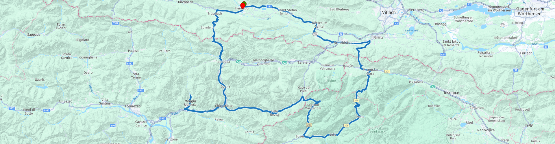
Hermagor - Nötsch - Arnoldstein - direction Rattendorf - Wurzenpass - Kranjska Gora - direction Vrsič - Soča - Passo di Predil - Sella Nevea - Chiusaforte - Moggio - Val d'Aupa - Dordolla - Pontebba - Passo Pramollo - Hermagor.
 Share this route


Animation

Verdict


Duration
4h 26m

Mode of travel
Car or motorcycle

Distance
209.29 km

Countries


 RouteXpert Review
 The tour falls under the category "medium" (Austria uses "easy, medium and hard"). Wide winding roads, criss-crossed by slightly narrower roads and passes with bends, but doable.
Sufficient stops on the way with a nice view or to eat or drink, gets 5 *.
From Hermagor south-east along the B 111 to Arnoldstein. Continue to Hart, there turn towards Kranjska Gora - Slovenia. About the Wurzenpass (1073 m) - with its narrow, winding roads and up to 18% slope offers here driving pleasure of a special kind. (To visit the Bunker Museum, past RP 3 500m further to the left.)
Along the Sava begins the challenging road to Vrsič Pass. Before we start this ride we will have a coffee break at RP 6 at Lake Jezero Jasna. and on RP 7 you can visit a Russian chapel.
The Vrsič pass at 1611 m is the highest mountain pass in Slovenia and represents the connection between Kranjska Gora and the Trenta valley. The 48 hairpin bends in the northern part of the pass road are partly made of cobblestones.
The pass road was built in the years 1914-1916 as a military road into the Isonzo Valley by Russian prisoners of war. More than 400 of them died on an avalanche in March 1916 alone. On the north side the "Russian Chapel" (Ruska kapelica) reminds of the victims RP7. Through this road was a large part of the supply for the great offensive of Austria-Hungary and Germany in the Twelfth Battle of Isonzo. Today's course follows only partially the original route; the south side is mostly newly created.
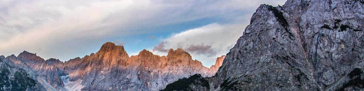
At the Vrsič Pass you have a wonderful panoramic view over the Triglav National Park.
At point 12, you can make another stop to visit Štoln. Štoln is the name of the 4.8 km long tunnel, the Log pod Mangartom (in Slovenia) with the mine in Cave del Predil (in Italy). During the First World War, this is an important strategic transport artery that allows the safest flow of military equipment and soldiers into the intractable vicinity of the first front line. It is the starting point of the peace path.
Continue towards Soča and Predelau (Predil), to Italy. Coffee stop and photo stop at route point 14 is possible. In the valley the route continues towards Sella Nevea, Chiusaforte, to Moggio. There you turn to the north running Val d'Aupa direction Pontebba. Now it goes up to the Nassfeld Pass (Passo di Pramollo) at 1552 m. The descent on the Austrian side offers great curves and bends, which, paired with a good road condition, make every biker's heart beat faster.


 Links
Links  Usage
Usage Want to download this route?
You can download the route for free without MyRoute-app account. To do so, open the route and click 'save as'. Want to edit this route?
No problem, start by opening the route. Follow the tutorial and create your personal MyRoute-app account. After registration, your trial starts automatically.  Disclaimer
Use of this GPS route is at your own expense and risk. The route has been carefully composed and checked by a MyRoute-app accredited RouteXpert for use on TomTom, Garmin and MyRoute-app Navigation.
Changes may nevertheless have occurred due to changed circumstances, road diversions or seasonal closures. We therefore recommend checking each route before use.
Preferably use the route track in your navigation system. More information about the use of MyRoute-app can be found on the website under 'Community' or 'Academy'.