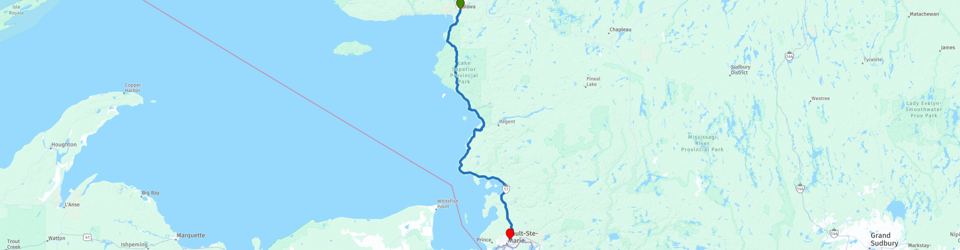
Day 17 TCH Wawa to Sault Ste Marie

This route was brought to you by:
RouteXpert René Plücken (MRA Master)
Last edit: 12-02-2021
 Route Summary
 This is part 17 that runs from Wawa to Sault Ste Marie.
The Trans Canada Highway passes through all the southern provinces of the country. The route can be driven in different ways. There are namely in various alternative routes that also belong to the TCH. The total distance is around 8,000 km. We not only drive the TCH, but will take the rural roads as much as possible, because only highway driving is too boring and Canada has many beautiful roads through its beautiful landscape.
You drive through all provinces and through very varied and scenic landscapes, from the Rockies in the West, the Central Prairies to the Eastern Maritimes and the Northern Forest.
The riding season is generally April through October with longer seasons on the west coast and southern Ontario.
Provide good all season clothing or bring rain gear, depending on the province and the season the weather can change and you may be surprised by a rain or even a snow or hail shower, so be prepared.
In Canada the metric system is used, so speeds are indicated in Km / h. A helmet requirement (DOT approved) applies throughout Canada.
You will see many wildlife throughout Canada. your similar animals from province to province, such as deer, buffalos, moose, caribou, wolves, pumas, bears, mountain goats, sheep, lynx, coyotes, foxes, raccoons, badgers, various rodents and all kinds of birds.
Even if it is very tempting to stop for a photo, don't do it, it can be very dangerous.
 Share this route


Animation

Verdict


Duration
2h 47m

Mode of travel
Car or motorcycle

Distance
226.40 km

Countries

 RouteXpert Review
 Before we leave Wawa we have to fill up the tank and buy some drinks and snacks. After about 15 kilometers, we enter Lake Superior Provincial Park at RP5, which is one of the largest provincial parks in Ontario and covers approximately 1,550 square kilometers (600 square miles) along the northeastern shores of Lake Superior between Wawa and Sault Ste Marie. Ontario Highway 17 (now part of the Trans-Canada Highway) passes through the park.
The Lake Superior Provincial Park has easily accessible as well as secluded areas with a spectacular and diverse landscape of cliffs, beaches, river valleys, waterfalls and many inland lakes. In the park you can walk and paddle, canoeing along the shore of Lake Superior. Everything is very well indicated with brown / yellow signs.
For fishing enthusiasts there is the possibility of trout fishing. There are about 200 back-country campsites in the park, two campsites with facilities for campers and tents if you want to plan a longer stay in the park.
As mentioned, there is a lot to see and do and a large number of points are indicated with a POI, of which there are a few where we definitely put the engine on the stand;
A must stop is Old Woman Bay and Beach (RP12). A beautiful long sandy beach with driftwood surrounds you with the true beauty of Algoma with a beautiful horizon with the 200 meter high cliffs on the left. The bay extends to the main section of Superior to the north and leads you to Entrance Island. The bay is a great place to picnic, sightsee, fish and even swim all year round if you don't mind the cold!
The next short stop is Katherine Stove (RP20), this is a small bay with a beautiful beach. Here you have a beautiful view of the bay.
At RP22 we stop a little longer to admire the historical icons drawn on Agawa Rock. This is one of the most famous icon sites in Canada. The area is also one of the most visited native archaeological sites in Canada. Most of the paintings from the Agawa site date from the 17th and 18th centuries. Icons are leftover messages from the past. This is a sacred place where generations of Ojibwe come to capture dreams, visions and events. Agawa Rock is a sacred place. Respect and save the icons. Do not touch the paintings. They have proven to be very resilient given the location to withstand the toughest elements. Nevertheless, the paintings fade over time. Sun, wind, waves and ice are all natural causes of gradual erosion of the rock face. Lichen or mineral deposits cover the figures in some places. We will never really know how many icons have already disappeared from Agawa Rock. An exceptional visitor center that highlights the park's cultural history, natural features and recreational opportunities
A little further on we stop for a photo at Agawa Bay Scenic Lookout (RP23). This is located to the left of the highway. Here you have a beautiful view of the Agawa bay.
At RP25 you can get some extra information about the park at the Lake Superior Provincial Park Visitors Center, also here you have a nice view of the bay and Montreal Island.
At RP27 we briefly leave the TCH to take a picture of the Montreal River Dam, one of the 4 hydro-electric dams in the river. It is a small dam, but definitely worth a stop.
We are now about halfway through the route and a good time to have lunch at Northgate Chip Wagon Plus Restaurant (RP28). They serve some great home cooked meals. Cash only!
After lunch we drive largely along the coastline and have a beautiful view of the bays through the trees, such as at RP30 Mica Bay, RP31 Flour Bay and RP34 Cottrell Cove.
At RP35 we stop briefly to refuel (if necessary) and to have a drink. Here is a small restaurant (fresh trout!) And a souvenir shop.
For those who love to lie on the beach, Batchawana Bay Provincial Park (RP36) offers the possibility to enjoy a beautiful sandy beach.
The next point where we stop is the Chippewa waterfall (RP38). Not a high but a long waterfall that rushes to the bay. There is also a restaurant with souvenir shop across the street.
After this last stop we have about 50 kilometers to drive to the end point in Sault Ste Marie. Along the way you can enjoy the view of the Batchawana Bay, the beautiful rocks and forests.
For the day, you should enjoy all the beauty, there are many more points to stop for, so be sure to adjust it to your own wishes.
Enjoy the Ride!


 Links
Links  Usage
Usage Want to download this route?
You can download the route for free without MyRoute-app account. To do so, open the route and click 'save as'. Want to edit this route?
No problem, start by opening the route. Follow the tutorial and create your personal MyRoute-app account. After registration, your trial starts automatically.  Disclaimer
Use of this GPS route is at your own expense and risk. The route has been carefully composed and checked by a MyRoute-app accredited RouteXpert for use on TomTom, Garmin and MyRoute-app Navigation.
Changes may nevertheless have occurred due to changed circumstances, road diversions or seasonal closures. We therefore recommend checking each route before use.
Preferably use the route track in your navigation system. More information about the use of MyRoute-app can be found on the website under 'Community' or 'Academy'.