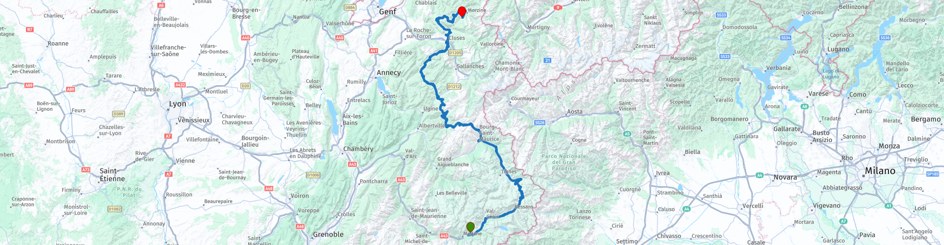
Route des Grandes Alpes van Avrieux naar Les Gets

This route was brought to you by:
RouteXpert Marcel Scherpenkate
Last edit: 27-02-2021
 Route Summary
 Starting point: The Cascade Guest House Inn in Avrieux
End point: Hotel Alpen Sports in Les Gets
Parking: Both hotels have a parking garage where the motorbikes can be parked.
The route has been made the same for TomTom, Garmin and MyRoute-app Navigation users.
 Share this route


Animation

Verdict


Duration
6h 18m

Mode of travel
Car or motorcycle

Distance
295.21 km

Countries

 RouteXpert Review
 The Col is named after the l'Iseran area, which in turn is named after the Isère river. This river rises down in Val-d'Isère. The ascent from the south side winds through the Maurienne side valley, which is very green in the summer, which lies entirely in the Vanoise National Park. With a bit of luck you can spot marmots or maybe a gems here.
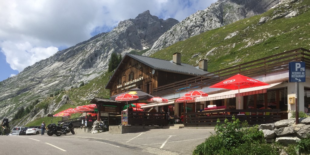
After a stop at the top, where the view, so impressive, cannot be told in text, that is something that you have to experience personally, there is still the possibility to drink a cup of coffee in the restaurant. Finally we continue the route via a beautiful descent with a view of the famous village of Val-d'Isère.
After half an hour's drive we arrive at Lake Chevril, a beautiful lake with a dam where it is very worthwhile to stop for a photo RP 6. We continue our way to Bourg-Saint Maurice at 1,200 m height. Via the characteristic hairpin bends of the Cormet de Roselend RP 8, we arrive at the Barrage de Roselend, RP 10.
The Roselend dam is a dam arch 5 km east of Beaufort in the Savoie department of the Rhône-Alpes region in southeastern France. The dam was designed by Coyne et Bellier and construction started in 1955. The reservoir covers 320 hectares. It lies at 1,600 m altitude between the alpine meadows and forms with the surrounding mountains a beautiful landscape with breathtaking views of the Alps and Mont-Blanc. After having let the surroundings work for us here too, we continue our route, to have lunch RP 14 in the village of Beaufort.
After lunch we drive another half hour through a beautiful area where on the way there is the possibility to refuel at ELAN RP 18 over a number of small Colls before we arrive at another very famous Coll: Col de la Colombière RP 19.
The Col de la Colombière is a 1,613 m high and very famous mountain pass in the Haute-Savoie department. The Colombière is regularly included in the Tour de France, making the pass very popular with cyclists. We drive 12 km from the south side, via no less than 13 firing pin bends to the top, mostly through bare mountain slopes. After the summit you should immediately pay attention because it drops more than 10% in the first km, followed by 5 hairpin bends.
After the descent of the Coll, the route continues through a somewhat more wooded area, meandering over another 3 Colls:
The Col de Romme RP 20 is a 1,297 m high mountain pass in the French department of Haute-Savoie. The village of Romme is located on top of the mountain. This mountain is sometimes climbed on the way to the col de la Colombière and Le Grand-Bornand. Romme can be reached via Cluses or Le Reposoir. This climb is less than 7 km long but has an average ascent rate of almost 8%.
Col de Ramaz RP 23 is a 1,559 m high mountain pass in the Alps in the Haute-Savoie department of France, where the Tour de France was transmitted during 2003, 2010 and 2016. The road through the pass culminates slightly higher, at 1,619 m.
Col de l'Encrenaz RP 24 is a 1,432 m high mountain pass, but is a relatively unknown pass. The road serves a chairlift that provides access to the Les Gets ski area. The ascent of the Col de L'Encrenaz is 15.5 km long.
Eventually we approach Les Gets and we refuel at Elan RP 25, before going to our final destination of the day Hotel Alpen Sport in Les Gets.
This route gets 5 stars from me, I have experienced for myself how beautiful this route is over the most beautiful and highest Alps in France.

 Links
Links  Usage
Usage Want to download this route?
You can download the route for free without MyRoute-app account. To do so, open the route and click 'save as'. Want to edit this route?
No problem, start by opening the route. Follow the tutorial and create your personal MyRoute-app account. After registration, your trial starts automatically.  Disclaimer
Use of this GPS route is at your own expense and risk. The route has been carefully composed and checked by a MyRoute-app accredited RouteXpert for use on TomTom, Garmin and MyRoute-app Navigation.
Changes may nevertheless have occurred due to changed circumstances, road diversions or seasonal closures. We therefore recommend checking each route before use.
Preferably use the route track in your navigation system. More information about the use of MyRoute-app can be found on the website under 'Community' or 'Academy'.