R09 Roundtour Bodo to Lofoten part 1

This route was brought to you by:
RouteXpert Arno van Lochem - Senior RX
Last edit: 20-05-2021
 Route Summary
 You can also see this ninth part as part one of a three-part round trip from Bodø to and across the Lofoten.
The routes are easy for everyone to drive and are on well-paved roads. There may be a single hairpin bend to be taken, but these are fine.
If there is a piece of gravel in the route, a warning will be given and a detour will be indicated.
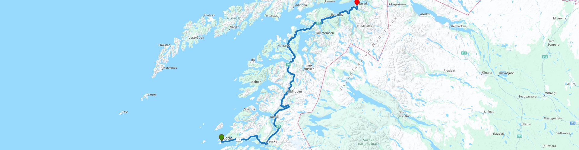
In this part you drive north again along beautiful fjords. The ferry takes you from Bognes to Skarberget. Then follow the E6 further north until you reach Narvik.
The final destination is a hotel, but the camper has also been thought of, there are a number of campsites indicated where you can rent a hiker's cabin or camp.
The participants of the Arctic Challenge started in Bodø and received a first coordinate which is in Bjerkvik, north of Narvik. The next coordinate turned out to be at the ferry in Moskenes, where the crossing to Bodø could be started. The same evening they reported back to the hotel.
Beautiful scenery and views, excellent roads and nice sights, hence the 4-star rating.
 Share this route


Animation

Verdict


Duration
9h 4m

Mode of travel
Car or motorcycle

Distance
314.45 km

Countries

 RouteXpert Review
 Of all western European countries, the Scandinavian countries probably have the most more or less untouched nature. In addition, they are countries that are easily accessible from the Netherlands. Norway is characterized by, among other things, the fjords and the Trollstigen, known to many motorcyclists. And where Sweden is known as wide and relaxing, everyone knows Finland as the land of 1000 lakes. All in all, legitimate reasons to traverse this beautiful nature in the north of Europe by means of a number of routes.
The route starts in Bodø and initially heads east. You drive on the road with number 80 to Fauske where it is time for coffee. In Fauske you pick up the E6 again and it goes north immediately after coffee.
You soon reach the Sørfolda, a fjord with a length of 40 kilometers. This fjord is a southeastern branch of the main Foldafjord. The deepest part of this fjord is 573 meters. So it is better to stay on the road.
When rounding this fjord you drive over the Trengsel bru. This is a concrete arch bridge with a high deck. The bridge has a total length of 179 meters and a main span of approximately 120 meters. The bridge spans the Nordfjord, a side arm of the Tørrfjord. The exact height of the bridge is unknown, but it is approximately 10 - 15 meters. The short Trengseltunnel is located directly east of the bridge.
A few kilometers further you can put the engine aside and enjoy the view over the Sørfolda for a moment. That's definitely worth a photo. Once back on the road, you will head towards the second coffee break, but not before you have the opportunity to stop at the Leirfjord, a 20-kilometer-long fjord.
When you've finished your coffee at Kobbelv Vertshus, you really have to walk down the back of the restaurant and go up the wooden bridge. You will then see a nice waterfall, the Polarbaan. Not very big, but the water still falls a few meters. Good enough for a lot of noise and a photo.
A number of viewpoints are indicated in the next part, but there is so much to see that you might want to stop a bit more often than indicated in the route. Do especially! You can't believe your eyes. Unfortunately you also pass a number of tunnels, in this area they are difficult to get around, there are not that many roads.
Twenty kilometers after the refueling stop you will arrive at the ferry, which will take you to Skarberget. But before you get on the boat you can first fill your stomach at Bognes Veikro. If you have good weather you can have lunch with a view of the ferries.
After lunch you will drive on the boat, but take the correct position (on the right), otherwise you will go to Lødingen, located on the Lofoten. Just a little while longer, that's where part 2 of the tour comes along. If you want to do the tour of the Lofoten in two days, you have the option to cut a piece here.
For information on sailing times and prices see the useful links below.
Once off the boat, continue on the E6. After only a few kilometers you have two parking spaces behind each other where both have a reason to stop: The view is great and you really don't want to miss it.
Five kilometers further you come to the Efjorden. You cross this by means of three bridges. The first, the Sørstraumen bru has a length of 162 meters and a sailing height of only a few meters.
The second bridge that you cross is the Mellastraumen bru with a length of 143 meters. The main span is 200 meters and the maximum distance to the water is 15 meters. This is the smallest of the three.
The last bridge is the Kjerringstraumen bru, a suspension bridge. With a length of 551 meters, a main span of 200 meters and a maximum distance to the water of 18 meters, this is the largest of the three. The bridge has 15 spans.
Further along the route you can visit the Ballangen Museum in Ballangen. This museum is part of Museum Nord, a museum consortium. The museum is located just outside Ballangen and is housed in the old Bjørkåsen mines administration building that was built in 1919. The museum focuses on exhibitions related to the mining activities that have taken place in Ballangen since the 17th century.
The museum previously had a 600-meter-deep visitor mine, which is unfortunately no longer open to the public. Using images, texts and objects, the museum presents the story of the Bjørkåsen mines from its inception in 1911 to its closure in 1964. Test operations started in 1910 at the mine and the mining company was licensed in 1913. There are also exhibits on daily life in the area, fishing, agriculture, local culture and education.
More than twenty kilometers further on the route you will find the Skjombrua. The Skjombrug spans the Skjomenfjord, approximately 20 kilometers south of Narvik. The suspension bridge has a total length of 711 meters and a main span of 525 meters. The bridge deck hangs 35 meters above the fjord. The E6 runs over the bridge with 1x2 lanes. From the bridge you have a good view of the Skjomenfjord.
The Skjombrug is one of Norway's older suspension bridges and was built in the early 1970s to replace a ferry service on the E6. The bridge opened to traffic on November 10, 1972. The bridge was built at one of the narrowest points in Norway, the distance between the border with Sweden and the Skjomenfjord is only 8 kilometers. The bridge itself is 28 kilometers from the Swedish border.
Once you have crossed the Skjombrua you will soon enter Narvik, the place where the hotel is located where the route ends. Just before the (last) bridge you can still fill the tank if necessary, so that you are ready for tomorrow's route again.
Scandic Narvik is a hotel with a restaurant and a bar, so that here again the route can be evaluated while enjoying a beer. That is of course also possible in the city, there are a few pubs indicated.
For campers there are two campsites in the vicinity of the end point indicated: Narvik Camping and Øyjord Camping.
Have fun driving this route!


 Links
Links  Usage
Usage Want to download this route?
You can download the route for free without MyRoute-app account. To do so, open the route and click 'save as'. Want to edit this route?
No problem, start by opening the route. Follow the tutorial and create your personal MyRoute-app account. After registration, your trial starts automatically.  Disclaimer
Use of this GPS route is at your own expense and risk. The route has been carefully composed and checked by a MyRoute-app accredited RouteXpert for use on TomTom, Garmin and MyRoute-app Navigation.
Changes may nevertheless have occurred due to changed circumstances, road diversions or seasonal closures. We therefore recommend checking each route before use.
Preferably use the route track in your navigation system. More information about the use of MyRoute-app can be found on the website under 'Community' or 'Academy'.