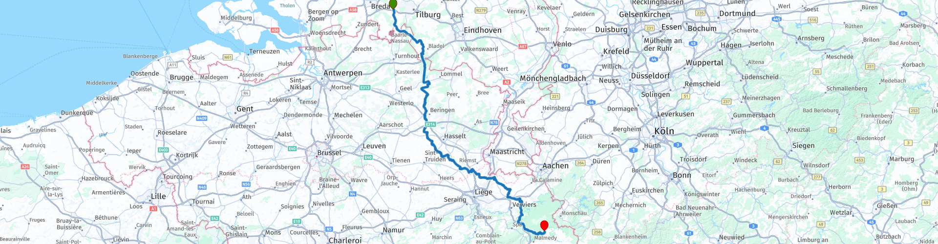
TTT 2010 06 Belgie D1 Gilze Waimes

This route was brought to you by:
RouteXpert Hans van de Ven (Mr.MRA)
Last edit: 20-07-2020
 Route Summary
 The 173 ANWB Promoter TankTasTocht (TTT) were scanned by Henry ten Dam and signed by Leon Stolk in Mapsource and later placed as a Track in a .gpx file. These have been made available through the MrGPS website with the approval of the ANWB Promoter so that everyone can enjoy it. The 1st TTT is from 1992, so the route may differ slightly from the original.
I have checked all route points and, where necessary, placed them neatly on the road. Also, if necessary, I have further spaced the start point and end point of the route to avoid navigating directly to the end point and I added the POI files from the start and end point just like a possible stopping point.
Finally, I made the route the same for TomTom, Garmin and MyRoute-app Navigation users.
Thanks to Henry, Leon, MrGPS and Promoter.
 Share this route


Animation

Verdict


Duration
5h 27m

Mode of travel
Car or motorcycle

Distance
222.64 km

Countries


 RouteXpert Review
 After coffee you drive further south to stop in Bassenge for lunch at L'Estaminet, L'Estaminet is a real Belgian Fries tent, so quality guaranteed.
After lunch you will also come to hilly areas, see elevation map, with the highest point at the end of the route. The end point is in the Hautes Fagnes Nature Park (Hoge Venen Eifel Nature Park) *.
* Hoge Venen-Eifel nature park; peatlands, limitless forests and deep river valleys. This German-Belgian nature park has an undeniable charm. One of the last highs in Europe. This cross-border area is part of the Eifel on the eastern side, while the western part belongs to the Ardennes. The peat area releases large amounts of water all year round and in this way feeds the western watercourses. Here you will also find the Signal of Botrange, the highest point in Belgium at 694 meters above sea level. More than 2700 km² of nature, located in North Rhine-Westphalia, Rhineland Palatinate and East Belgium. Near the end point is the Botrange Nature Park Center.
Because I have driven large parts of this route myself, this route gets 4 stars.
Route details:
rp 22 - Coffee stop at Frituur Heihoef
rp 53 - Lunch stop at L'Estaminet


 Links
Links  Usage
Usage Want to download this route?
You can download the route for free without MyRoute-app account. To do so, open the route and click 'save as'. Want to edit this route?
No problem, start by opening the route. Follow the tutorial and create your personal MyRoute-app account. After registration, your trial starts automatically.  Disclaimer
Use of this GPS route is at your own expense and risk. The route has been carefully composed and checked by a MyRoute-app accredited RouteXpert for use on TomTom, Garmin and MyRoute-app Navigation.
Changes may nevertheless have occurred due to changed circumstances, road diversions or seasonal closures. We therefore recommend checking each route before use.
Preferably use the route track in your navigation system. More information about the use of MyRoute-app can be found on the website under 'Community' or 'Academy'.