
Northumberland 250 South Berwick upon Tweed to Allenhead

This route was brought to you by:
RouteXpert Nick Carthew - (MRA Master)
Last edit: 14-12-2021
 Route Summary
 This is the south route that returns to Allenheads. Like the north route, this route visits castles, roman history and travels through beautiful landscapes including a 12 mile section of Forest Drive (gravel road) in the Kielder Forest. The gravel is compact and easy to ride on for experienced riders. Forest Drive is closed from December to May and there is a charge of £3.00. To avoid Forest Drive, remain on the A68 and follow the signs for Bellingham.
With such a great landscape and with so many things to see, this route deserves 5***** stars.
 Share this route


Animation

Verdict


Duration
10h 40m

Mode of travel
Car or motorcycle

Distance
250.01 km

Countries

 RouteXpert Review
 Norham Castle is the first castle and is free to visit. Norham Castle ranks among the finest sights in the border country, commanding a vital ford over the River Tweed. It was one of the most important strongholds in this once turbulent region and was also the one most frequently attacked by the Scots. The castle was besieged at least 13 times, once for nearly a year by Robert the Bruce. But eventually, even its powerful 12th century keep could not resist James IV's heavy cannon, and it fell to him and Scotland in 1513, shortly before his defeat at Flodden Field.
The nearby Duddo Tower was built by the Clavering family and stood in a commanding position overlooking the village. Tower houses are a type of defensible house particularly characteristic of the borderland of England and Scotland. Virtually every parish had at least one of these buildings. The need for such secure buildings relates to the unsettled and frequently war-like conditions which prevailed in the Borders throughout much of the medieval period. The Duddo Tower was destroyed in 1496 when King James IV of Scotland crossed the border with a large army. James hoped the northern counties would rise against King Henry VII but he found little support and returned to Scotland four days later after learning that an English army was marching from Newcastle. The remains can be seen above the tree line.
Next is Etal Castle. (£5.90 entrance fee) Built by Robert Manners as a defence against Scots raiders in the mid 14th century, it fell to James IV’s invading Scottish army in 1513, immediately before their catastrophic defeat at the nearby Battle of Flodden.
Flodden Field and the Battle of Flodden Field Monument. Free to visit. The battle took place on 9 September 1513 and is one of the bloodiest battles in British history. The Anglo-Scottish clash proved a devastating defeat for the Scots, who lost an estimated 10,000 - 17,000 men. The Battle of Flodden was essentially a retaliation for King Henry VIII‘s invasion of France in May 1513. The invasion provoked the French King Louis XII to invoke the terms of the Auld Alliance, a defensive alliance between France and Scotland to deter England from invading either country, with a treaty that stipulated that if either country was invaded by England the other country would invade England in retaliation. The outcome of The Battle of Flodden was mainly due to the choice of weapons used. The Scots had advanced in the continental style of the time. This meant a series of massed pike formations. The Scottish armies’ great advantage of using high ground became its downfall as the hilly terrain and ground became slippery underfoot, slowing down the advances and attacks. Unfortunately, the pike is most effective in battles of movement which The Battle of Flodden was not. The English chose a more familiar weapon, the bill hook. This favoured the terrain and the flow of the battle, proving to have the stopping power of a spear and the power of an axe. It was very bloody!
Maelmin Henge, just a short ride through beautiful and now peaceful countryside is also free to visit. Maelmin takes you back a further 1000 years in history from the Anglo Scottish wars. Maelmin was the name of a royal township that existed near the modern day village of Milfield in Anglo-Saxon times. Today it is the site of a series of reconstructions of local archaeological prehistoric structures.
The Cheviot Hills become more noticeable as you progress along this route. The Cheviots are a range of rolling hills straddling the Anglo-Scottish border for more than 30 miles. Millions of years ago, lava cooled to form the distinctive rounded Cheviot Hills, which are full of hidden delights and a delight to travel through.
At Shotton burn (burn is Scottish for small river) you will cross the border into Scotland, but most bizarrely, you'll be travelling due south! I think this is the only road where you can do this.
Back into England with the opportunity of riding 12 miles of forest roads through the Kielder Forest. Although it's England's largest forest, Kielder is not just about trees. At any one time, a quarter of the area of Kielder is open space, including England’s largest area of blanket bog. Kielder is also England’s most important red squirrel reserve, home to the biggest remaining population of red squirrels in the country. Forest Drive is a toll road (£3.00) made of compacted gravel that is open from May to December. An alternative route on the A68 and B6320 will get you back to the route at the charming village of Bellingham where I have suggested a lunch stop.
Roman history is what you'll see after lunch as the route follows the course of Hadrian's Wall for several miles along the B6318 known as Military Road. Many sections of the defensive wall are visible on your right as you head east.
Built to guard the wild northern frontier of the Roman Empire in AD122, Hadrian’s Wall was more than just a barricade; it was a vibrant and multi-cultural occupied military zone of mile-castles, barracks, ramparts, forts and settlements; sprawling almost 80 miles in length from the North Sea to the Irish Sea. The building of the Wall required vision and an outstanding level of engineering skill. Set amongst the wild beauty of Cumbrian and Northumbrian landscapes, it still impresses today and stands as a testimony to the power and reach of the mighty Roman Empire.
Chesters Roman Fort at Chollerford (£9.00 to enter) is the most complete Roman cavalry fort in Britain. You can wander around the unusually well-preserved baths and steam room, and the officers' quarters. Discover an amazing collection of Roman objects and inscriptions in the Clayton Museum, re-launched in 2016.
Carrawburgh Fort & Temple of Mithras. One of the least known & yet, most interesting, of the Roman sites along the course of Hadrian's Wall. The Temple of Mithras is a 'mithraeum', or temple dedicated to the god Mithras, a form of sun god whose cult became extremely popular among soldiers of the Roman legions. The Temple stands close to the site of Carrawburgh Roman Fort, known to the Romans as Brocolitia. The fort is largely unexcavated, but the temple has been well examined.
Housesteads Roman Fort (£9.00 to enter). The best preserved of the thirteen permanent Roman army posts along the length of Hadrian's Wall and is easily the most complete Roman military fort in Britain. Interestingly, the fort was built before the wall in either direction was complete. The fort is very large, covering 2.2 hectares, and was designed to hold a cohort, a garrison of 800 auxiliary troops drawn from around the Empire.
The B6318 Military Road travels through a beautiful open landscape on high ground that offers great views. One of the things to look out for is the Sycamore Gap or Robin Hood's tree. The Sycamore Gap tree is one of the most photographed in the country. It stands in a dramatic dip in Hadrian’s Wall. In late 2016 it took the crown for English Tree of the Year in the Woodland Trust’s awards. The lonely sycamore tree has become something of a star. Most notably as the scene-stealer in Robin Hood Prince of Thieves starring Kevin Costner.
Vindolanda Fort is next, the jewel in the crown for any Roman historians. Vindolanda is a Roman fort predating Hadrian’s Wall by 40 years, being built sometime around AD 85 to guard the major road known as the Stanegate, which stretched roughly east to west across the top of Roman Britannia. Vindolanda is one of Europe's most important Roman archaeological sites. The on-site museum down the hill to the east of the fort provides a magnificent display of the many stunning objects found during the excavations. Cost of entry is £8.30.
Cawfields (Free to enter) boasts one of the best-preserved and most scenic stretches of Hadrian's Wall in Northumberland. The wall at Cawfields stretches across a steeply sloped site and terminates abruptly in high cliffs, where the land has been cut away by quarrying. On this stretch of the Wall is a large milecastle, easily accessed on foot.
Set next to a sweeping section of Hadrian's Wall, the Roman Army Museum is owned and managed by the Vindolanda Charitable Trust. (a combined ticket can be purchased) The nearby fort of Magna was occupied by a regiment of Syrian archers. The museum is an authentic and dramatic tribute to Rome’s extraordinary military legacy. Step into the life of a Roman soldier and experience life on the front line of Emperor Hadrian’s formidable British frontier. The Roman Army Museum is the last Roman site to see before turning off of the Military road and heading south out of the Northumberland National Park.
Just a couple of miles south is Featherstone Castle, the final historic sight to see along this route. Featherstone Castles origins can be traced back to the early medieval period when the Manor House belonged to the Featherstonehaugh family. Originally a 13th-century hall house, a square three-storey pele tower was added in 1330 by Thomas de Featherstonehaugh. The castle played an important role in the battles between the English and the Scots. Today it is privately owned and used by various groups as a base for activity holidays.
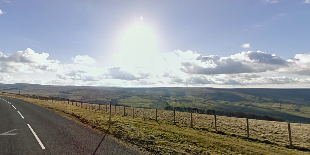
Now you enter the North Pennines AONB, a beautiful landscape with a mixture of open moorland and patchwork fields. The official Nland250 route takes you into Allendale then follows the River East Allen to Allenheads. This route turns off just before Allendale and travels over the high moorland of Brownley Hill which offers you more great views of the North Pennines. The route ends at the historic mining village of Allenheads where you can book a night at the Allenheads Inn.
Enjoy.

 Links
Links  Usage
Usage Want to download this route?
You can download the route for free without MyRoute-app account. To do so, open the route and click 'save as'. Want to edit this route?
No problem, start by opening the route. Follow the tutorial and create your personal MyRoute-app account. After registration, your trial starts automatically.  Disclaimer
Use of this GPS route is at your own expense and risk. The route has been carefully composed and checked by a MyRoute-app accredited RouteXpert for use on TomTom, Garmin and MyRoute-app Navigation.
Changes may nevertheless have occurred due to changed circumstances, road diversions or seasonal closures. We therefore recommend checking each route before use.
Preferably use the route track in your navigation system. More information about the use of MyRoute-app can be found on the website under 'Community' or 'Academy'.