Day 107 The Ultimate USA road trip Fort Peck Fort Benton

This route was brought to you by:
RouteXpert René Plücken (MRA Master)
Last edit: 15-01-2024
 Route Summary
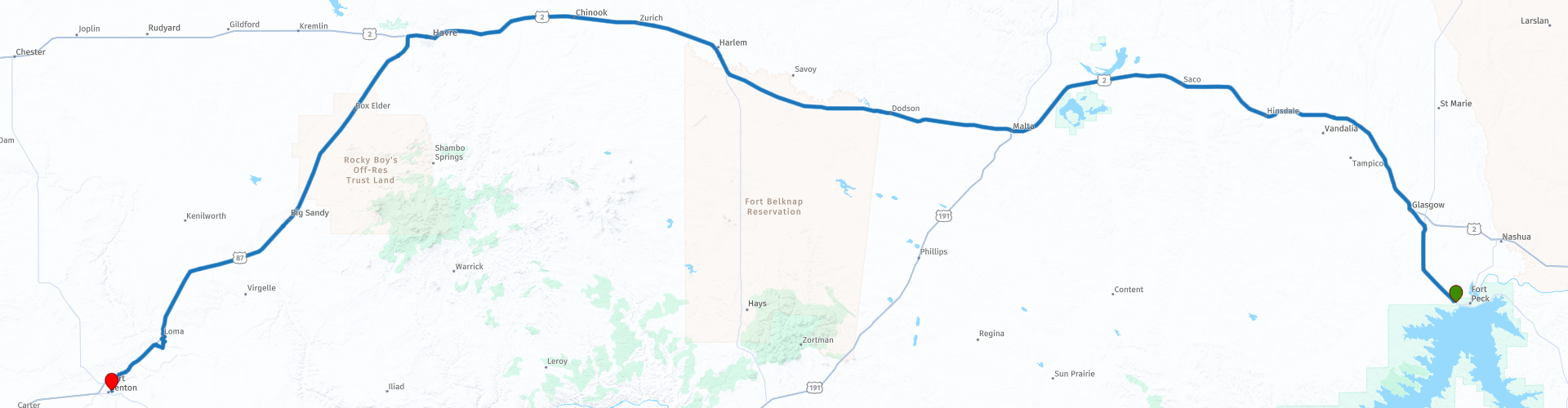
 I have further supplemented the Road Trip with even more special points that you can visit in the USA. Today we drive in Montana from Fort Peck to Fort Benson. It is a long drive of more than 400 kilometers.
Today we drive on US Route 2, many stops are planned along the route, including museums and other historical sights. The roads take you through the vast flat part of “The Great Plains” of Montana with wide panoramas. This route is full of historical sights. I rate this route 5 stars.
 Share this route


Animation

Verdict


Duration
10h 1m

Mode of travel
Car or motorcycle

Distance
404.75 km

Countries

 RouteXpert Review
 The “Corps of Discovery” was a select group of American military and civilian volunteers commanded by Captain Meriwether Lewis and his close friend Second Lieutenant William Clark. Clark and thirty members set sail from Camp Dubois (Camp Wood), Illinois, on May 14, 1804, met Lewis and ten other members of the group at St. Charles, Missouri, and then proceeded up the Missouri River. The expedition crossed the Continental Divide of the Americas near Lemhi Pass and finally reached the Columbia River and the Pacific Ocean in 1805. The return journey began on March 23, 1806 at Fort Clatsop, Oregon, and ended on September 23, 1806 the same year.
President Thomas Jefferson ordered the expedition shortly after the Louisiana Purchase in 1803 to explore and map the newly acquired territory, find a practical route through the western half of the continent, and establish an American presence in this area before the European powers tried to conquer this area.
The secondary objectives of the campaign were scientific and economic: to study the plants, animal life and geography of the area, and to establish trade with local Native American tribes. The expedition returned to St. Louis to report its findings to Jefferson, maps, sketches, and journals in hand.
We are riding the part of the Lewis and Clark expedition where it was decided to follow the Missouri River, which was ultimately the right choice to reach the West. We drive across the “Great Plains”, sometimes simply called “the Plains”, this is a vast flat land in North America. It is located just east of the Rocky Mountains and is largely covered with prairie, steppe and grassland. The Great Plains are spread across both the Central United States and Western Canada and cover one of the American states;
-Kansas,
-Nebraska,
-North Dakota,
-South Dakota,
-Colorado,
-Montana
-Wyoming,
-New Mexico,
-Oklahoma,
-Texas,
-Iowa,
-Minnesota
-Missouri
Just outside Fort Peck in the town of Glasgow, you can visit the Valley County Pioneer Museum on Wednesdays through Saturdays from 10 a.m. to 4 p.m. So you will have to adjust your departure time and schedule for the day slightly. The museum tells the history of Valley County through the nation's largest Assiniboine collection, railroad and agricultural exhibits, the Fort Peck Dam, Lewis and Clark and the Titanic. The museum also has genealogical archives and a library on Montana and Valley County. There are gift shops with items such as jewelry, paintings, T-shirts, Montana magnets and books!
There are “Historical Markers” along the route, which are a nice stop to learn more about Montana history. The first Marker we encounter is the “Historical Marker Buffalo Country” commemorating the thousands of buffalo that roamed the great plains of eastern Montana before Euro-American hunters nearly wiped them out in the early 1800s. The animals were central to the Indian lifestyle.
The second Marker is the “Sleeping Buffalo Rock”. Native people of Montana revere this boulder that once sat high on a windswept ridge overlooking the Cree Crossing on the Milk River. The age-old, weather-worn effigy in a gray granite rock resembles the leader of a herd of recumbent buffalo. Ancient markings define the horns, eyes, spine and ribs. Since late prehistoric times, the indigenous people of the Northern Plains have honored the spiritual power of the Sleeping Buffalo.
In the town of Malta we visit two museums that are within walking distance of each other. The Phillips County Museum is dedicated to interpreting and promoting the unique history of this area. Their diverse collections reflect the history and culture of Phillips County. The exhibits showcase several fossils excavated from the rich “Judith River Formation,” the rich outlaw heritage of famed outlaw Kid Curry and his gang “The Wild Bunch.” Parts of the museum are dedicated to displaying unique Native American artifacts. The museum's collections of these artefacts were originally acquired by early settlers and traders in the Malta area. Throughout the museum you are reminded of the hardships and enjoyments of the early settlers in the Phillips County area.
The Great Plains Dinosaur Museum, located in the rich landmass of Northeastern Montana, where some of the world's best preserved dinosaur fossils have been discovered. A premier location on the Montana Dinosaur Trail, the museum features permanent exhibits of dinosaurs and other prehistoric fossils, curated in a natural setting to enhance the visitor experience, allowing them to appreciate and enjoy the rich prehistoric history of this region. and fully understand. The museum also offers the opportunity for visitors to dig up fossils under the guidance of museum staff and paleontologists during scheduled laboratory sessions and on-site excavation programs.
The next stop is at the third Historical Marker, the “Early Day Outlaws”, which is placed to commemorate the old gruesome gunslingers of the Wild West, such as Kid Curry's and the “Wild Bunch”, “Butch Cassidy”, “The Sundance Kid ” and “Deaf Charlie”.
We stop for lunch at “The Smoke House Grill and Sacred Grounds Coffee Shop” in the town of Fort Belknap. After lunch we drive via the town of Havre, where you can plan a break to stretch your legs, to the town of Box Elder, where we stop for a nice cup of coffee at the “Prairie Brew Espresso”, where they serve delicious drinks. espresso base, hot and cold, mixed drinks, tea and pastries.
From Box Elder to Fort Benton is about 50 miles and on this part of the “Lewis and Clark Expedition” we stop at a number of important points. The first is the “Lewis and Clark Observation Point”. You can see it from the road on a hill. There is a short trail to this viewpoint, where the corps once camped. Lewis and Clark spent five days here exploring the two rivers, the Missouri and the Marias River, which ran in two opposite directions. They had to determine which river to follow to the West. Ultimately, they chose the right choice and followed the Missouri River and soon found themselves at the great falls of the Missouri River in “Great Falls”.
Before we arrive at the next point, we stop briefly at the “Loma Grain Elevator Row”. A row of historic grain elevators used to unload grain from trucks and store it for a short time until it was loaded onto the train for distribution. The second point is the “Lewis and Clark Decision Point” at the confluence of the Marias and Missouri rivers, where the Lewis and Clark expedition arrived on June 2, 1805. They camped at “Lewis and Clark Observation Point” for five days and on June 8 determined that the south branch at the confluence should be the Missouri River and decided to follow the Missouri River at the “Lewis and Clark Decision Point.” The expedition spent the next few days rebuilding equipment and stockpiling supplies that could be picked up during the return journey.
We continue to the end of this scenic drive in Fort Benton, a city and county seat of Chouteau County, Montana. Founded in 1846, Fort Benton is the oldest continuously occupied settlement in Montana. Fort Benton was the most upstream navigable port on the Mississippi River System and is considered "the innermost port in the world." The city's waterfront area, the most important aspect of the 19th century growth, was designated a “Fort Benton Historic District,” a National Historic Landmark, in 1961. Here we visit the “Museum of the Northern Great Plains” which exhibits the last hundred years of life on the vast plains of Montana. The fur traders, wildlife and open country had given way to the cowboy and herds of cattle and families began to populate the land. It was not gold or silver that brought people to these plains, but dreams for a better life. Thousands of families came by train and wagon to settle the vast shortgrass prairie; families that became known as the “Homesteaders”.
The “Homesteaders” endured the extreme conditions of the high plains. Lived in the most primitive conditions, alone and often without sufficient water. They braved weather that was more often extreme than average. The story of the “Homesteaders” is told here. Throughout the museum you can discover the hardships and triumphs of three generations of families living on these northern Great Plains.
On the banks of the Missouri is the “Historic Old Fort Benton”, originally “Fort Lewis”. The fort basically consists of the northeastern bastion of the original fort, which is the only thing left of the old structure. The fort was built at a time when Montana was still an undiscovered wilderness and, apart from local tribes, inhabited only by fur traders and adventurers. When the Blackfeet requested that Fort Lewis be moved further north in 1846, the fort's walls, log cabins and bastions were dismantled and floated upriver to the site of Fort Benton.
American Fur Company agent Alexander Culbertson, while visiting Fort Laramie, had seen adobe buildings and realized they would provide better protection against the area's extreme weather. The reconstructed fort thus had a fourteen-meter-high mud wall that enclosed the quadrangle of the fort and connected all the buildings.
Unfortunately, by 1900, during the last years of the fur trade, all that remained of the fort was the rapidly decaying northeastern bastion. In 1908, the Daughters of the American Revolution intervened and saved the building from further disintegration, leaving one of the oldest buildings in Montana still standing. Near the Fort is also a heroic statue by famed Western artist Bob Scriver, depicting Lewis, Clark and Sacagawea with her infant son. The monument commemorates the nine days the “Corps of Discovery” camped at the confluence of the Marias River and the Missouri River while research determined which river was actually the Missouri and the path to the Pacific Ocean.
On the way to the hotel we pass the Old Fort Benton Bridge, it is the first steel bridge over the Missouri River in Montana, which allowed ranchers and farmers to ship their cattle and grain from Fort Benton. The construction of the bridge was dangerous, two men died during construction. The Milwaukee Bridge and Iron Works Company built the superstructure of steel and iron. Upon completion, the newspaper declared that the 800-foot-tall, six-span, pin-jointed truss bridge was “as strong and durable as it is handsome.” Worth stopping and taking some pictures or walking to the other side of the Missouri River. We spend the night at the “Grand Union” Hotel.


 Links
Links  Usage
Usage Want to download this route?
You can download the route for free without MyRoute-app account. To do so, open the route and click 'save as'. Want to edit this route?
No problem, start by opening the route. Follow the tutorial and create your personal MyRoute-app account. After registration, your trial starts automatically.  Disclaimer
Use of this GPS route is at your own expense and risk. The route has been carefully composed and checked by a MyRoute-app accredited RouteXpert for use on TomTom, Garmin and MyRoute-app Navigation.
Changes may nevertheless have occurred due to changed circumstances, road diversions or seasonal closures. We therefore recommend checking each route before use.
Preferably use the route track in your navigation system. More information about the use of MyRoute-app can be found on the website under 'Community' or 'Academy'.