Day 96 The Ultimate USA road trip Niobrara Valentine

This route was brought to you by:
RouteXpert René Plücken (MRA Master)
Last edit: 03-12-2023
 Route Summary
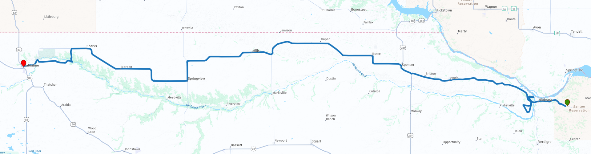
 I have further supplemented the Road Trip with even more special points that you can visit in the USA. Today we drive through Nebraska from Niobrara to Valentine. It is a ride of almost 290 kilometers.
We drive on beautiful roads through the green agricultural area of Nebraska and we drive the 2nd part of Nebraska's “Outlaw Trail Scenic Byway Highway 12”. A beautiful route with a number of stops at sights. I rate this route 4 stars.
 Share this route


Animation

Verdict


Duration
9h 34m

Mode of travel
Car or motorcycle

Distance
285.84 km

Countries

 RouteXpert Review
 Along the route there are several small villages and neighborhood communities where a variety of accommodations and dining options are offered for breaks, food and possibly an overnight stay.
During the year there are also events along the OTSB that are worth a visit, these range from rodeos and Pow Wows (a gathering where Native Americans dance, sing and party) to winery tours and arts and crafts shows. There are a number of museums and murals along the route. This region of Nebraska offers seasonal opportunities to hunt fauna or flora with guns or cameras.
“Outlaw Trail Scenic Byway Highway 12” crosses three excellent state parks: “Ponca State Park”, which we visited on day 95, “Niobrara State Park”, “Smith Falls State Park” we visit today. Enjoy this part of this “Scenic Byway” through the varied landscape of the state of Nebraska.
We make sure the bikes are fully fueled and also take something to eat and drink with us for a lunch picnic in “Smith Falls Park”. The first stop is about a 20-minute drive at Niobrara State Park, a public recreation area located at the confluence of the Missouri and Niobrara rivers. There is a Visitor Center in the park where you can learn more about the history. We explore the park along more than eleven kilometers of roads, with several nice places to stop along the route.
A particularly beautiful place to visit is the Niobrara River Bridge, a decommissioned railroad bridge that is listed on the National Register of Historic Places. A nice stop to take some photos.
The park is home to a variety of animals, especially white-tailed deer and wild turkey, which roam the park during the day, as well as nocturnal animals such as coyotes and whip-poor-wills.
The park also has a swimming pool, RV parks and campsites, as well as cabins with river views. For hikers, there are fourteen kilometers of hiking trails.
About 3 miles south of the park is the Powpow site of the Ponca tribe in Nebraska. There is a nice walking trail on a quiet property and a life-size bronze statue of Standing Bear overlooking the Ponca Cemetery. Definitely worth a visit, especially if a Powpow is planned, a Powpow is a tradition among Indians from the United States and Canada. It is a festive ceremony where Indians gather to dance, sing and make music.
We continue our drive on the Scenic Byway that follows the course of Ponca Creek, we cross this river several times, along the way you can enjoy the beautiful green landscape of Nebraska. We plan a short break in Spencer for something to drink.
The next stop is planned at the “Smiths Falls State Park”, where you can view the “Smith Falls” waterfalls, which at 19 meters are the highest waterfall in the state of Nebraska and the centerpiece of the Smith Falls State Park. Access to the falls is via a footbridge over the river from the north side of the park.
The waterfall, first known as Arikaree Falls, bears the name of Orrin B. Smith, a pioneer of the Seven Creeks area (state census of 1885). The park also has a campsite and a picnic area, where we eat our lunch.
We leave the park via the winding Allen Bridge Road and we stop briefly at the Allen bridge from which this road takes its name. The bridge is also known as Bell Bridge or Niobrara River Bridge. It is a historic bridge that was listed on the National Register of Historic Places in 1992. It is a “Pratt through Truss” truss bridge that was built in 1903. It is one of only four bridges in Cherry County to survive a flood in February 1916 and is known as one of Cherry County's oldest, longest and best preserved bridges. Highly recommended to stop briefly to photograph this bridge.
We drive through the Fort Niobrara National Wildlife Refuge to the Fort Niobrara Visitor Center. The site was selected by General George Crook in 1879 and the fort was built in 1880 on the south bank of the Niobrara River, for which it was named. After the Great Sioux War of 1876, “The 7 Bands of Lakota” (Brulé, Oglala, Itazipco, Hunkpapa, Mnikoju, Blackfoot, and Two Kettle) were confined to the Sioux Reservation. The site of the fort can be visited today, with the exception of one barn, unfortunately little evidence remains of its historical past.
We cross the Niobrara River via the Cornell Bridge to drive to Valentine, the end point for the day. In Valentine we stop at the Security First Bank to take photos of the beautiful brick “Murals” designed by Lincoln artist Jack Curran. The upper “Mural,” depicting longhorn cattle running north, symbolizes the cattle industry as it moved into the Sandhills from the southern plains.
In Valentine, visit the Cherry County Historical Society Museum, a virtual treasure trove of Cherry County history, starting with how it was settled and by whom. The museum has a variety of exhibits devoted to early ranchers, Fort Niobrara, Native Americans, American wars, and daily life of the pioneer era. An archive library contains historical newspapers and genealogical data. We will spend the night in one of the hotels or lodges in Valentine.


 Links
Links  Usage
Usage Want to download this route?
You can download the route for free without MyRoute-app account. To do so, open the route and click 'save as'. Want to edit this route?
No problem, start by opening the route. Follow the tutorial and create your personal MyRoute-app account. After registration, your trial starts automatically.  Disclaimer
Use of this GPS route is at your own expense and risk. The route has been carefully composed and checked by a MyRoute-app accredited RouteXpert for use on TomTom, Garmin and MyRoute-app Navigation.
Changes may nevertheless have occurred due to changed circumstances, road diversions or seasonal closures. We therefore recommend checking each route before use.
Preferably use the route track in your navigation system. More information about the use of MyRoute-app can be found on the website under 'Community' or 'Academy'.

Nebraska
About this region
Nebraska is a state in the Midwestern region of the United States. It is bordered by South Dakota to the north; Iowa to the east and Missouri to the southeast, both across the Missouri River; Kansas to the south; Colorado to the southwest; and Wyoming to the west. It is the only triply landlocked U.S. state.
Indigenous peoples, including Omaha, Missouria, Ponca, Pawnee, Otoe, and various branches of the Lakota (Sioux) tribes, lived in the region for thousands of years before European exploration. The state is crossed by many historic trails, including that of the Lewis and Clark Expedition.
Nebraska's area is just over 77,220 square miles (200,000 km2) with a population of over 1.9 million. Its capital is Lincoln, and its largest city is Omaha, which is on the Missouri River. Nebraska was admitted into the United States in 1867, two years after the end of the American Civil War. The Nebraska Legislature is unlike any other American legislature in that it is unicameral, and its members are elected without any official reference to political party affiliation.
Nebraska is composed of two major land regions: the Dissected Till Plains and the Great Plains. The Dissected Till Plains region consists of gently rolling hills and contains the state's largest cities, Omaha and Lincoln. The Great Plains region, occupying most of western Nebraska, is characterized by treeless prairie. Nebraska has two major climatic zones. The eastern two-thirds of the state has a humid continental climate (Köppen climate classification Dfa); a unique warmer subtype considered "warm-temperate" exists near the southern plains, which is analogous to that in Kansas and Oklahoma, which have a predominantly humid subtropical climate. The Panhandle and adjacent areas bordering Colorado have a primarily semi-arid climate (Köppen BSk). The state has wide variations between winter and summer temperatures, variations that decrease moving south within the state. Violent thunderstorms and tornadoes occur primarily during spring and summer and sometimes in autumn. Chinook wind tends to warm the state significantly in the winter and early spring.
Read more on Wikipedia
Indigenous peoples, including Omaha, Missouria, Ponca, Pawnee, Otoe, and various branches of the Lakota (Sioux) tribes, lived in the region for thousands of years before European exploration. The state is crossed by many historic trails, including that of the Lewis and Clark Expedition.
Nebraska's area is just over 77,220 square miles (200,000 km2) with a population of over 1.9 million. Its capital is Lincoln, and its largest city is Omaha, which is on the Missouri River. Nebraska was admitted into the United States in 1867, two years after the end of the American Civil War. The Nebraska Legislature is unlike any other American legislature in that it is unicameral, and its members are elected without any official reference to political party affiliation.
Nebraska is composed of two major land regions: the Dissected Till Plains and the Great Plains. The Dissected Till Plains region consists of gently rolling hills and contains the state's largest cities, Omaha and Lincoln. The Great Plains region, occupying most of western Nebraska, is characterized by treeless prairie. Nebraska has two major climatic zones. The eastern two-thirds of the state has a humid continental climate (Köppen climate classification Dfa); a unique warmer subtype considered "warm-temperate" exists near the southern plains, which is analogous to that in Kansas and Oklahoma, which have a predominantly humid subtropical climate. The Panhandle and adjacent areas bordering Colorado have a primarily semi-arid climate (Köppen BSk). The state has wide variations between winter and summer temperatures, variations that decrease moving south within the state. Violent thunderstorms and tornadoes occur primarily during spring and summer and sometimes in autumn. Chinook wind tends to warm the state significantly in the winter and early spring.
View region
 Statistics
  6
6Amount of RX reviews (Nebraska)
 10080
10080Amount of visitors (Nebraska)
 76
76Amount of downloads (Nebraska)
 Route Collections in this region
 Top car and motorcycle tour through the Midwest of the USA
By car or motorcycle through the Midwest of America is a journey that you do not just make, so it is not a 13-day drive and then back home. No, book a stay of several days in Denver, Cheyenne, Rapid City (In August the Sturgis Bike Ralley, stay there for a day or 4), Yellowstone National Park, Estes Park and again Denver to also visit several places of interest in these cities, so that this tour becomes an unforgettable tour that you can remember with pleasure.
Do not forget to arrange and pack the following items:
*This is only a summary and completely personal and may differ per person.
Take out travel insurance, +31 for numbers in GSM, (partially) take out gas, Health insurance coverage at destination?, Switch off electrical appliances, Lighting (time clock), Check passport validity, Antenna from radio/TV due to lightning, Residence address for those left behind, Remote control house alarm, Book Smart Parking.
Hand luggage:
Liquids in packaging of max. 100 ml, Liquids in hand luggage in transparent plastic bag.
For on the road:
Candy, Book, Earplugs, Country and road map(s), Directions, Maps in your navigation system
Money & Securities:
Bank card / giro card, Credit card (think pin code), Cash, Calculator for Internet banking, Medical insurance card, Travel insurance card.
Travel documents:
Passport, (International) Driver's License, Ticket(s), Reservation Tickets, Hotel Vouchers, Arrival/Departure Time, Check-in & Check-out Times, Valid Visa (ESTA), Travel Guide.
Clothing:
Underwear, Belt, Shirts/ T-shirts, Shorts, Long pants, Shoes, Socks, Swim trunks, Towel, Slippers.
Personal stuff:
Watch, House Keys, Wallet, Sunglasses.
Toiletries:
Deodorant, Shower gel / Soap, Comb / brush, Shaving equipment, Shampoo, Toothbrush, Toothpaste, Sanitary pads
Health & Medicine:
Own medicines, Insect repellent, Cold sore ointment, Ointment for insect bites, Sunscreen, Norit, Paracetamol, Suction cup for insect bites, First aid bag.
Miscellaneous:
Travel bag / waist bag, Leatherman (= checked luggage), Pen or pencil, Headlamp, Lighter, Tools & Electronics, Mobile phone & charger, Photo/video camera & charger, Memory card(s), World plug / adapter, Ipod & charger, Adapter cable Ipod, Headphones, iPad & charger, Navigation & charger/plug, Plug socket, Fuelpack battery.
Engine (accessories):
Helmet, Motorcycle clothing, Motorcycle boots, Chain lock / disc brake lock, Gloves, Bandana, Inner bags (plastic shopping bag), Insulation bag, Tension straps, Tie wraps, Rain suit, Rainaway.
Addresses:
Address list, Embassy telephone number, Telephone number to block (bank) card(s), Telephone number (airline tickets).
View Route Collection
The 10 most downloaded routes in the USA from RouteXpert Hans van de Ven
Hello and welcome to this collection of the Top 10 MyRoute app downloaded routes in USA.
There will be a great new event to be announced soon, where all these routes can be driven.
Download them all now and place them in a new "Top 10" folder, so that you always have them at hand.
If you are going to drive one of these routes in the meantime, track them with the MRA Mobile App or with MRA Navigation. Take some photos (moments) along the way as these will come in handy.
Create a travelogue of your Top 10 driven routes and add the recorded track to it.
There will also be some great prizes on offer, so keep an eye on the MRA-RouteXperts page and your mail.
The 10 routes are:
1. D13 Estes Park Denver
2. D03 Chadron Custer
3. D01 Pigeon Forge round trip through the Smokey Mountains
4. D08 Kalispell Sandpoint
5. D10 Colville Wenatchee
6. D09 Sandpoint Colville
7. D04 Custer Wall
8. D11 Wenatchee Seattle
9. D08 Cody Yellowstone NP
10.R13 San Francisco Monterey
View Route Collection