Rondrit Herbitzheim Saarland

This route was brought to you by:
RouteXpert Hans van de Ven (Mr.MRA)
Last edit: 28-06-2021
 Route Summary
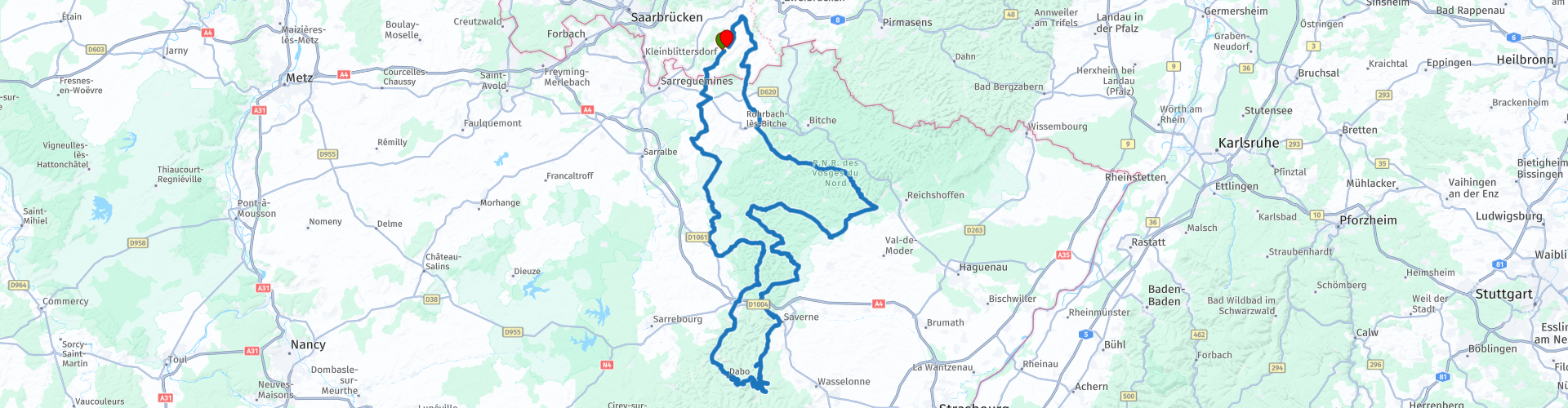
 We drove this route on 30 August 2014 as a tour of the Autumn weekend in Herbitzheim (Saarland).
Start and end: Hotel Bliesbruck.
I have made the route right for TomTom, Garmin and MyRoute-app Navigation users.
 Share this route


Animation

Verdict


Duration
5h 21m

Mode of travel
Car or motorcycle

Distance
270.44 km

Countries


 RouteXpert Review
 After breakfast, the group left for Lutzelbourg for the 1st stop for coffee. After about 1H45M drive we arrive at Bierstub d'Eselbahn, where they also serve delicious coffee.
After the coffee to the high (s) point of this tour, namely: Le Rocher De Dabo * (Drasburg), where you have a beautiful view of the surroundings on top of the rock. After enjoying the view and taking some pictures, it is time to continue to the lunch location.
* This rock is located in the southeast of the department of Moselle, in the country Sarrebourg, about 2 km before the departmental border. It rises to 664 m - at the top of Schlossberg - and is 30 m high, 80 m long and 26 m wide. (Source: Wikipedia).
We have lunch 14 km away at Restaurant des Vosges, where we take a delicious salad. The restaurant is located on a nice road for motorcyclists, witness the number of motorcyclists passing during lunch.
After lunch we set off for the north to wind down through the Vosges to spend another pleasant evening at the hotel. On the way we stop for a glass of soda at Au Soleil in Wimmenau, before we arrive at the hotel in Saarland again.
Because I have driven this route myself, this route gets 5 stars.
Route details:
rp 12 - Coffee at Bierstub d'Eselbahn in Lutzelbourg
rp 19 - Lunch at Restaurant des Vosges in Steigenbach
rp 27 - Break at Au Soleil in Wimmenau


 Links
Links  Usage
Usage Want to download this route?
You can download the route for free without MyRoute-app account. To do so, open the route and click 'save as'. Want to edit this route?
No problem, start by opening the route. Follow the tutorial and create your personal MyRoute-app account. After registration, your trial starts automatically.  Disclaimer
Use of this GPS route is at your own expense and risk. The route has been carefully composed and checked by a MyRoute-app accredited RouteXpert for use on TomTom, Garmin and MyRoute-app Navigation.
Changes may nevertheless have occurred due to changed circumstances, road diversions or seasonal closures. We therefore recommend checking each route before use.
Preferably use the route track in your navigation system. More information about the use of MyRoute-app can be found on the website under 'Community' or 'Academy'.