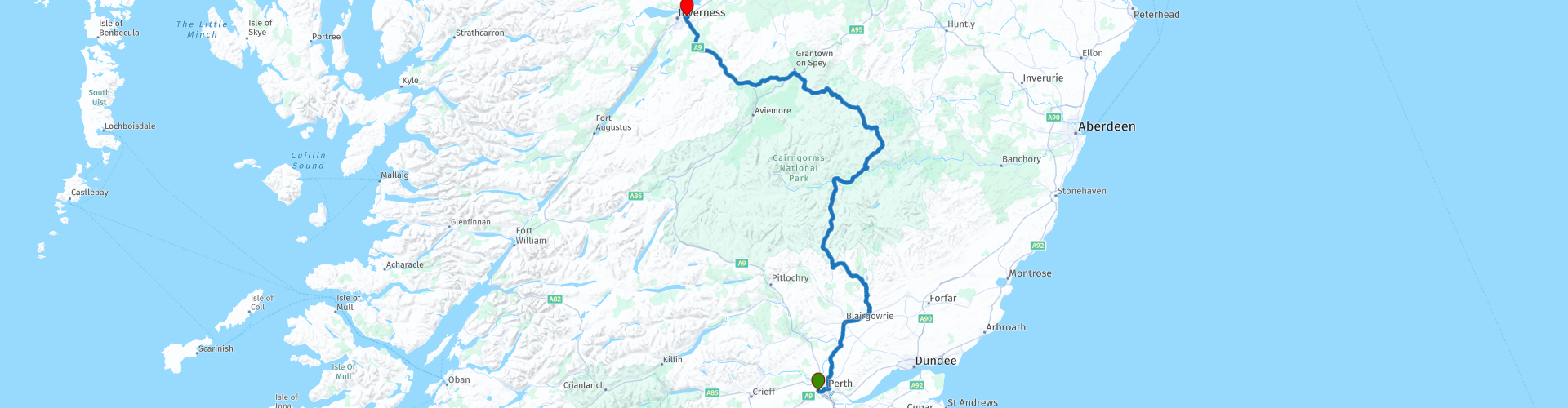
Perth to Inverness through the Cairngorms National Park

This route was brought to you by:
RouteXpert Nick Carthew - (MRA Master)
Last edit: 08-04-2025
 Route Summary
 I have awarded 5***** stars for this route as it has everything that a great motorcycle ride needs. Excellent roads and scenery and plenty of sights to see.
 Share this route


Animation

Verdict


Duration
6h 31m

Mode of travel
Car or motorcycle

Distance
222.37 km

Countries

 RouteXpert Review
 This route starts from a Travelodge Hotel where there is a McDonald's and fuel station nearby. It travels through the breathtakingly beautiful Cairngorms National Park on the Old Military Road A93. As the road heads north from Perth, you start to get glimpses of the high peaks that can be snow covered and you start to gather expectations of your ride to come.
You will not be disappointed, the views along this route will take your breath away. The beauty of the heather covered mountains, the crystal clear waters of the rivers and streams and the conifer woodlands are almost too beautiful to take in, you need to make frequent stops on this route to fully absorb it all.
The Bridge of Craigisla crossing over the River Isla is a popular picnic spot because of the Reekie Linn waterfall a few hundred metres downstream. This has to be one of your first stops, there is a convenient car park allowing you to easily stop for some photos.
You'll follow the course of the River Isla upstream for the next few miles and see it get physically smaller as you head towards the mountains of its birth, the Cairngorms.
A short distance futher on and you'll cross Shee Water, this marks the boundary of the Cairngorms National Park. Established in 2003, the park covers the Cairngorms range of mountains, a sub range of the larger Grampian range. Already the largest national park in the United Kingdom, in 2010 it was expanded into Perth and Kinross. The Cairngorms National Park has everything from castles and distilleries and arguably some of the most breathtaking landscapes and scenery on this planet!
I've scheduled a coffee stop at Tea@TheShee, the name of the cafe at the Glenshee Ski Centre. Glenshee is Britain's largest alpine snowsports area and is referred to as the 'Scottish Three Glens' in reference to Les Trois Vallées. Situated on the Old Military Road, Tea@TheShee is the ideal pit stop whether you are looking for a delicious freshly prepared lunch, afternoon tea and cake or a take away coffee for the road.
After the pit stop the route continues on the Old Military Road into Braemar.
At 1,100 feet above sea level, Braemar holds the record for Britain's lowest recorded temperature, of -27.2 degrees C, on 10 Jan 1982. But this is not this attractive village's only claim to fame. Braemar is probably best known for its highland games, the annual Braemar Gathering. The games date back over 900 years, to the time when an annual contest between local clans was watched by King Malcolm III.
The route follows the magnificent River Dee from Braemar to Balmoral, carry on past the turning for a further 200 m to visit Balmoral Castle. You never know, you might see some royalty!
You'll turn left onto the B976, a smaller road that takes you through some open moorland with stunning views and then over the new Gairnsheil Jubilee Bridge, named to commemorate HM Queen Elizabeth II’s Platinum Jubilee in 2022 - the year in which construction began and the two main beams of the bridge - each weighing an impressive 100 tonnes - were lifted into place. Sadly, HM Queen Elizabeth II died on the 8th September 2022 so never saw the opening on 11th August 2023.
Another must stop place is shortly after the bridge and is not that well known about, the Ringing Stone, this particularly large boulder is surrounded by small rocks as visitors come to listen to the intriguing ringing, hollow sound it makes as you tap it with a stone. It really does ring, and it will leave you astonished! This would have been revered or even worshipped in days gone by!
Next comes Corgarff Castle.
Sitting alone and situated in stunning scenery with magnificent views, this tower house is thought to have been built in 1550 before being converted in to a barracks for government troops in 1748. The castle’s last military use was to control the smuggling of illicit whisky between 1827 and 1831. Today the site is still complete with its 18th century star-shaped fortification. A layby a short distance after the castle gives you the chance to see the castle from another angle.
Go past the Lecht Ski Centre and I have added a lunch stop at the village of Tomintoul, part of the Scottish Whisky Trail.
There are several places to stop for lunch ranging from a full 3 course to a sandwich or just an ice cream.
The Whisky Castle shop here has been selling the finest malt whiskies of Scotland from its premises in the quaint village of Tomintoul for over 100 years. It is located at the gateway to Scotland's Malt Whisky Trail. They have over 600 malt whiskies with many being single cask, independently bottled and from small batches.
Shortly after lunch you can stop at an art installation titled The Still by Angus Ritchie. It offers views overlooking Tomintoul reflected in its mirrored sides as it towers over the softly textured and colourful landscape.
More incredible open beautiful scenery takes you to the River Spey, the third longest in Scotland (the Tay and the Clyde are the top two) with a length of 107 miles. It is very well know for it’s Salmon and also for the whisky distilleries that have grown up along its banks.
Crossing the Spey puts you on the A95 and then the A9, two fast roads that'll take you to the end of the route on the outskirts of Inverness. I would allow a minimum of 7 hours to complete this route, this will allow plenty of time to stop for photographs.
Enjoy


 Links
Links  Usage
Usage Want to download this route?
You can download the route for free without MyRoute-app account. To do so, open the route and click 'save as'. Want to edit this route?
No problem, start by opening the route. Follow the tutorial and create your personal MyRoute-app account. After registration, your trial starts automatically.  Disclaimer
Use of this GPS route is at your own expense and risk. The route has been carefully composed and checked by a MyRoute-app accredited RouteXpert for use on TomTom, Garmin and MyRoute-app Navigation.
Changes may nevertheless have occurred due to changed circumstances, road diversions or seasonal closures. We therefore recommend checking each route before use.
Preferably use the route track in your navigation system. More information about the use of MyRoute-app can be found on the website under 'Community' or 'Academy'.