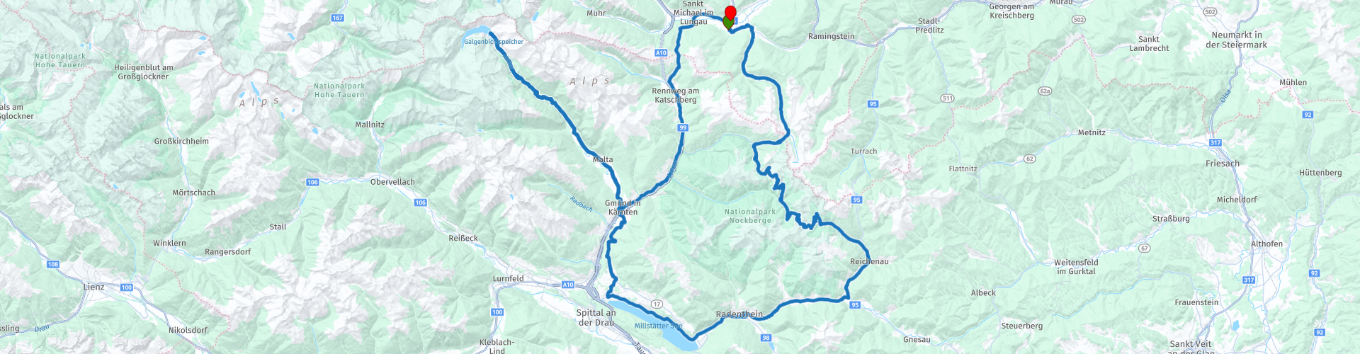
Sankt Margarethen im Lungau Nockalmstrasse Milstatter See Maltatal Rundtour

This route was brought to you by:
RouteXpert Chantal HV
Last edit: 12-04-2020
 Route Summary
  Share this route


Animation

Verdict


Duration
4h 12m

Mode of travel
Car or motorcycle

Distance
200.26 km

Countries

 RouteXpert Review
 Beyond Lake Millstatt, Carinthia's second largest lake, the Malta Hochalmstrasse (toll road) leads us to Austria's highest dam, the Kölnbreinsperre. Before that we had a nice stop on RP 8 at the “Wasserspiele- und Erlebenispark Fallbach with a nice view of the Fallbach waterfall. Innumerable waterfalls give the valley the nickname "Tal der stürzend Wasser".
The route from the 14.4 km long alpine road to Kölnbrein-Staumauer is really beautiful! The tunnels and hairpin bends hewn from the rocks are examples of high alpine road construction techniques and there are several beautiful "viewpoints".
We continue to the end at the Maltatal RP 9 with its "skywalk" dam.
You will find a hotel, a museum and a nice restaurant, open from the beginning of May to usually the end of October.
The Kölnbrein-Staumauer is with 200 meters the highest dam in Austria and can also be viewed from inside during a tour. In the "Erlebniszentrum" next to the tower hotel you learn more about the construction and technology of this dam.
We return the same way and visit the private Porsche car museum of Mr. Helmut Pfeifhofer RP 10 in Gmünd. Do not expect anything gigantic modern here, no it is the private collection in a very large garden house, say this gentleman. When the weather is nice there is a terrace in the garden where you can get coffee and ice cream. http://www.auto-museum.at/
Over the Katschberg or Katschberghöhe RP 14, known as a beautiful ski area in winter, we head back to the hotel.
This was a beautiful motorcycle tour!
Due to the toll roads: Most hoteliers give motorcyclists a pass (Kärnten Card) for a free ride on Nockalmstrasse, Malta Hochalmstrasse and Grossglockner when booking a minimum of 3 nights.
When creating the route, the settings in the toolkit, "disable seasonal closure" were checked (this is only possible in the Lord map), since these passes are closed in the winter.


 Links
Links  Usage
Usage Want to download this route?
You can download the route for free without MyRoute-app account. To do so, open the route and click 'save as'. Want to edit this route?
No problem, start by opening the route. Follow the tutorial and create your personal MyRoute-app account. After registration, your trial starts automatically.  Disclaimer
Use of this GPS route is at your own expense and risk. The route has been carefully composed and checked by a MyRoute-app accredited RouteXpert for use on TomTom, Garmin and MyRoute-app Navigation.
Changes may nevertheless have occurred due to changed circumstances, road diversions or seasonal closures. We therefore recommend checking each route before use.
Preferably use the route track in your navigation system. More information about the use of MyRoute-app can be found on the website under 'Community' or 'Academy'.