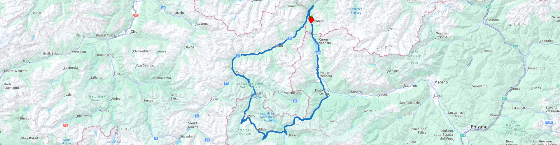
Nauders Livigno Stelvio

This route was brought to you by:
RouteXpert Gerard Martens Route Expert
Last edit: 16-02-2019
 Route Summary
 We drive along streams over a dam through hairpin bends to reach the top of the Stelvio. On the way back to our hotel we drive past a small village which is put under the water, but the church tower is still in the water.
 Share this route


Animation

Verdict


Duration
3h 58m

Mode of travel
Car or motorcycle

Distance
209.76 km

Countries


 RouteXpert Review
 At the three-country point at an altitude of 2179 meters in the south-western point of the municipality, the borders of Austria, Switzerland and Italy meet. We drive a short 10 km to the north and then drive past the Inn.
The Inn is a right-hand tributary of the Danube and one of the main drainage routes of the Alps.
At rp 3 you see the dam of Lago di Livigno that lies on the border of Switzerland and Italy.
Over the dam we drive along Lago di Livigno through a long tunnel that is open on both sides.
Then we arrive in Livigno, Livigno is a municipality in the Italian province of Sondrio.
The inhabitants of Livigno are called Livignezen, the village is now mainly known as a ski area and duty-free zone.
In Livigmo we can take a break, here are plenty of restaurants and terraces.
After our break we meander through many small villages to drive towards the Stelvio.
And then we arrive at the top of the Stelvio, everyone known for one of the most beautiful (motorcycle) passes of the Alps.
Equipped to have a terrace and souvenirs to have scored driving down through the many hairpin bends.
At rp 10 we pass Reschenmeer near the original village Graun, which is located at the bottom of Lake Reschen.
By building a dam between 1948 and 1950 to create a reservoir for generating energy, the village came under water.
All buildings were demolished, only the church tower of the old village was preserved and nowadays it protrudes above the water surface of the lake.
After chewing the church tower we drive back to Nauders where this beautiful route started.
This route is certainly 5 star curves and another curve with many differences and beautiful landscapes, highly recommended.
This route has been adapted for MRA Navigation / Garmin and TomTom.


 Usage
Usage Want to download this route?
You can download the route for free without MyRoute-app account. To do so, open the route and click 'save as'. Want to edit this route?
No problem, start by opening the route. Follow the tutorial and create your personal MyRoute-app account. After registration, your trial starts automatically.  Disclaimer
Use of this GPS route is at your own expense and risk. The route has been carefully composed and checked by a MyRoute-app accredited RouteXpert for use on TomTom, Garmin and MyRoute-app Navigation.
Changes may nevertheless have occurred due to changed circumstances, road diversions or seasonal closures. We therefore recommend checking each route before use.
Preferably use the route track in your navigation system. More information about the use of MyRoute-app can be found on the website under 'Community' or 'Academy'.