R15 QLD Karumba to Mount Isa

This route was brought to you by:
RouteXpert Hans van de Ven (Mr.MRA)
Last edit: 10-04-2020
 Route Summary
 Australia is very large; 8 million km2, which is more than 226 times larger than the Netherlands! Has a diversity of flora and fauna; the most diverse types of plants, trees and animals, especially birds and a lot of typical Australian marsupials, which you will not find anywhere else in the world!
Enjoy all the beauty immensely: From the evergreen tropical rainforests, to the vast Outback; from the desert to the countless and peaceful idyllic palm beaches; from the winter sports areas in the southeast to the vibrant and impressive metropolis of Melbourne, Sydney and Perth.
You will see it all and experience it in this amazing tour through Australia, a tour to remember!
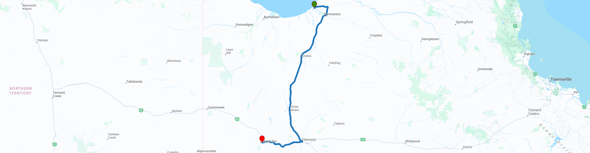
Starting point: Karumba Lodge Hotel & Motel
End Point: Mount Isa, Copper City Motel
The route has been created for TomTom, Garmin and MyRoute-app Navigation users.
ATTENTION: DRIVE LEFT!
 Share this route


Animation

Verdict


Duration
7h 19m

Mode of travel
Car or motorcycle

Distance
579.69 km

Countries

 RouteXpert Review
 The city was founded because the area in which Mount Isa is located contains huge mineral reserves. The city was founded after John Campbell Miles discovered a silver-lead vein west of Cloncurry in 1923. Mount Isa is probably one of the most productive mines in history: lead, silver, copper and zinc are mined. The minerals are transported 900 kilometers to the port of Townsville and from there shipped to countries such as Great Britain. With an area of 41,225 km², Mount Isa has long been considered the largest city in the world.
This route also goes through the outback, these are the regions that are far from civilization. The outback covers nearly three-quarters of Australia and extends mainly across the Northern Territory and Western Australia, and parts of the states of Queensland, New South Wales and South Australia.
The term outback includes various landscapes and climatic zones. Large parts of the outback in Western Australia are inaccessible: sometimes there is no rain here in years, while in summer the temperature rises above 50 ° C. The Queensland outback, on the other hand, consists partly of tropical rainforest.
The characteristics of the outback are:
- Only a few paved roads are present. Farms (stations) are often located on sandy paths that can only be driven with off-road vehicles. It is no exception when a farm is 80 kilometers from the paved road.
- Farms are self-catering. It is no problem if a supermarket cannot be visited for weeks.
- Settlements with several houses, a gas station, a supermarket, a garage, a bank and catering facilities are hundreds of kilometers apart.
- Children receive remote education via radio (School of the Air) and the Internet.
- In the event of serious illness and accident, the Royal Flying Doctor Service (RFDS) is called upon.
Camels were imported from the Middle East in 1870. They live partly on farms, partly in the wild.
- Of the approximately 300,000 Aborigines (approximately 1.5% of Australia's total population), approximately 20% live in the outback, most of them in reservations.
So bring food and drink for the road and stop in the places included in the route along the way such as: Normanton and Cloncurry, you can refuel here and have some food and drink.
In Cloncurry, you can visit the "John Flynn Place". It was in Cloncurry that John Flynn started his experiment with flying doctors and pioneered his scheme of inland radio communication. The first flying doctor's flight took off from Cloncurry Airport in 1928, and the following year, Flynn's radio expert Alfred Traeger installed the world's first household pedal radio at a local home. In 1983, when the Queensland Branch of the Australian Bicentennial Authority called for submissions to major commemoration projects, the Cloncurry Culture Show and Sports Association decided to respond with the proposal to develop a museum commemorating the Royal Flying Doctor Service and the work from John Flynn and his successors.
With the success of the proposal, the building began in October 1987 and was officially dedicated and opened on April 27, 1988 by Rev. Fred McKay and Duke and Duchess of York. The CSR Hinkler Bicentennial Air Race overnighted in Cloncurry on the same day. In 2018, we celebrated the 90th anniversary of the birth of the Royal Flying Doctors Service on May 17, 1928.
If you're looking for an absolutely beautiful campsite around Mount Isa and Cloncurry, this is the campsite for you. The Corella Dam and Clem Walton Park represent rippling water and greenery in the otherwise dry Outback landscape. For free camping near Cloncurry, Corella Dam is the best place. Corella Lake was originally built to support the nearby community of Mary Kathleen and the uranium mine, which are now empty and abandoned.
This 4-star rated route takes you on paved roads. But you also have the choice to visit the Clem Walton Park, here you go partly over sandy paths. You will pass through two towns, where you can stop for a snack or refuel.
General info:
Queensland (literally translated: Queensland) is a state in northeastern Australia. Queensland is the second largest in area and Australia's third largest state in terms of population. The state was named after Queen Victoria, the monarch at the time of the settlement of the former colony. The capital and largest city of Queensland is Brisbane, located in the southeast of the state. The northern portion of the state, separated by the Tropic of Capricorn, is tropical. The south is subtropical. Queensland was originally a British crown colony that emerged in 1859 after secession from New South Wales. The city of Brisbane originally started as the Moreton Bay penal colony, which held convicts who again committed errors while serving their sentences in New South Wales.
Brisbane is located about 100 kilometers north of the border between Queensland and New South Wales. Southeast Queensland also has two larger population centers: the Gold Coast south of Brisbane, and the Sunshine Coast north of Brisbane. Along the approx. 2000 km long coast (from south to north) are the following cities: Coolangatta - Gold Coast - Brisbane - Sunshine Coast - Gympie - Maryborough - Hervey Bay - Bundaberg - Gladstone - Rockhampton - Mackay - Townsville - Cairns. The following cities are inland (counterclockwise): Warwick - Toowoomba - Roma - Charters Towers - Mount Isa. The world's largest city by surface, Mount Isa is located in northwestern Queensland. The area of the city is 42,904 km² (approximately the area of the Netherlands!), But the city has a population of approximately 20,000 (2003).
The state is home to five World Heritage Sites: Australian Mammal Fossil Sites (Riversleigh / Naracoorte),
Gondwana rainforests, Fraser Island, The Great Barrier Reef and the Tropical wetlands of Queensland.
Queensland can be roughly divided into three parts:
1.The eastern coastal strip, dominated by the Great Australian Separation Mountains. From north to south there are also the Darling Downs, the Bunya Mountains, the Carnarvon Gorge, the Whitsunday Islands, Hinchinbrook Island and the Atherton Tableland. Off the coast, north of Fraser Island, the Great Barrier Reef begins.
2.The tropical Cape York Peninsula in the north. To the north of this is the Straits Torres with the Straits Torres Islands and to the east most of the Great Barrier Reef.
3 Most of the dry interior, called the Queensland outback, with the Channel Country in the southwest.


 Links
Links  Usage
Usage Want to download this route?
You can download the route for free without MyRoute-app account. To do so, open the route and click 'save as'. Want to edit this route?
No problem, start by opening the route. Follow the tutorial and create your personal MyRoute-app account. After registration, your trial starts automatically.  Disclaimer
Use of this GPS route is at your own expense and risk. The route has been carefully composed and checked by a MyRoute-app accredited RouteXpert for use on TomTom, Garmin and MyRoute-app Navigation.
Changes may nevertheless have occurred due to changed circumstances, road diversions or seasonal closures. We therefore recommend checking each route before use.
Preferably use the route track in your navigation system. More information about the use of MyRoute-app can be found on the website under 'Community' or 'Academy'.