Rondrit Appietto Osani Appietto

This route was brought to you by:
RouteXpert Hans van de Ven (Mr.MRA)
Last edit: 18-04-2021
 Route Summary
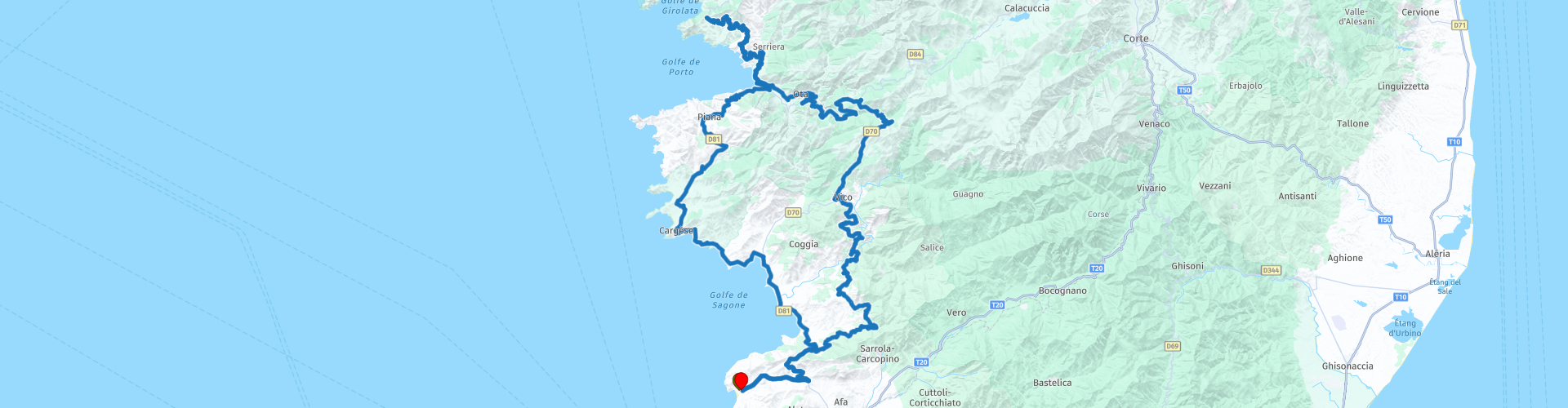
 Start and end point: MARINA DI LAVA in Appietto.
 Share this route


Animation

Verdict


Duration
7h 18m

Mode of travel
Car or motorcycle

Distance
224.58 km

Countries

 RouteXpert Review
 After coffee on to the lunch location, which is on the main road to today's turning point, namely Col de la Croix *, so if meandering and climbing to lunch at Aria Marina, you are now driving 3H10M.
* The Col de la Croix-de-Fer is a mountain pass in the French Alps. This mountain pass lies at an altitude of 2068 meters and is situated in the heart of the Grandes Rousses massif, 2500 meters as the crow flies from the Col du Glandon. The mountain pass lends itself as a passage between the departments of Savoie and Isère. (Source: Wikepedia).
After lunch, continue the same way to Col de la Croix, where you can lower the meal you just had while enjoying the beautiful view. After the pictures have been taken and the food has settled, go to Marine de Porto, where you can take a break and admire the beautiful boats in the harbor. After this stop, you set course for Cargèse
, you have now driven +/- 180 KM so if necessary you can refuel here. Then you wind 20 KM along the coast to Casaglione, where you can also refuel along the way at Vito in Casaglione.
After the last refueling option, it is still a small 25 km to the hotel, where after arrival, lying on the beach, you can reminisce about this beautiful day.
This route was ridden by members of MTC-Zeilberg and has everything that makes you happy as a motorcyclist, hence 5 stars.


 Links
Links  Usage
Usage Want to download this route?
You can download the route for free without MyRoute-app account. To do so, open the route and click 'save as'. Want to edit this route?
No problem, start by opening the route. Follow the tutorial and create your personal MyRoute-app account. After registration, your trial starts automatically.  Disclaimer
Use of this GPS route is at your own expense and risk. The route has been carefully composed and checked by a MyRoute-app accredited RouteXpert for use on TomTom, Garmin and MyRoute-app Navigation.
Changes may nevertheless have occurred due to changed circumstances, road diversions or seasonal closures. We therefore recommend checking each route before use.
Preferably use the route track in your navigation system. More information about the use of MyRoute-app can be found on the website under 'Community' or 'Academy'.