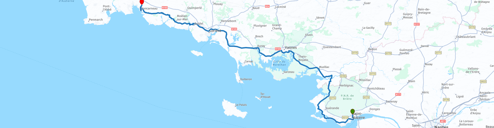
08 Saint Nazaire to Concarneau

This route was brought to you by:
RouteXpert Nick Carthew - (MRA Master)
Last edit: 16-03-2025
 Route Summary
 Excellent attractions, good roads in a very nice landscape earn this route 4**** stars.
 Share this route


Animation

Verdict


Duration
8h 54m

Mode of travel
Car or motorcycle

Distance
218.10 km

Countries

 RouteXpert Review
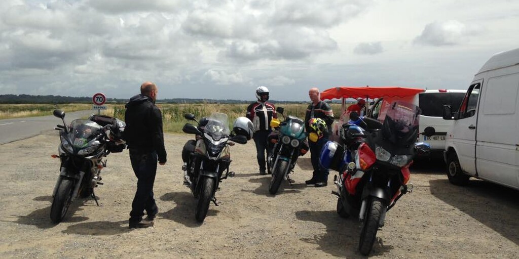
 This route, like many of my routes, is relaxing and scenic as it avoids most of the major roads. The roads are not busy (we went in July) and the ever changing scenery is a joy to travel through. Grab a coffee and a filled baguette just after leaving the submarine base, I highly recommend this as they were really good. The route travels through the strange salt production 'fields' of Guerande where the method for producing salt hasn't changed since the 9th century.
The U-Boat pens at Saint Nazaire:
The strategic location of Saint-Nazaire led the Germans to build a huge submarine base there during World War 2. The construction of this base began at the beginning of 1941.
It contained 14 cells: 8 for repairs and 6 larger cells in which the U-Boats could remain afloat. It housed two U-Boat fleets. It spread over a total surface area of 4 hectares and its concrete ceiling was up to 9 metres thick.
In 1942 a British commando raid attempted to destroy the base. The civilian population suffered greatly from this Allied policy and 80% of the town was destroyed. More can be read about 'The Greatest Raid Of All' in the link below.
The salt marshes of the Guérande and Mès basins are artificially dammed marshes fashioned by man over the centuries. The salt marshes stretch out before you, a breath taking immense mosaic of colours. These 2 000 hectares of salt marshes bear the quality label of ‘Site remarquable du Goût’ (a site of culinary interest and excellence) and are supplied with seawater via the inlets of ‘Les traicts du Croisic and Mesquer’.
Salt workers are the guardians of a unique natural heritage (in French, they're called paludiers, from the Latin word "palus" for marsh). The salt harvest takes place in the summer, but salt workers take care of the marshes throughout the year. In spring, they empty the salt pans where rainwater has accumulated and remove the mud and algae. In autumn, salt must be protected from high tides and from future frosts, while winter is for maintenance of the bottom of the basins.
After seeing how it is produced, you can buy some at the side of the road to take home with you.
As you continue north and cross into Brittany you'll go over the Arzal Dam. This was constructed on the Vilaine river between 1965 - 1970 to protect the town of Redon from flooding. It is one of the few estuarine dams in the world and it includes a fish ladder for migratory fish.
The route travels around the south of the city of Vannes first passing the Noyalo reservoir that supplies drinking water for the city and then an historic tide mill dating back to the 16th centaury.
I have suggested a lunch stop in the medieval city of Auray at the port of Saint-Goustan. There are several restaurants to choose from. Nestled at the bottom of an estuary, Saint-Goustan takes you back in time with its cobbled streets, stone bridge, half-timbered houses and bustling quays.
After lunch there is a succession of 8 bridges to cross as you make your way to Concarneau, a small town in western Brittany famed for its beautiful old town located on a small island called the Ville close. There are lots of fun things to do in Concarneau from exploring its ancient, cobbled streets to sipping coffee in one of the many streetside cafes. Ville close is packed with old stone buildings, many of which have been turned into shops and cafes, where you can grab a coffee, a crêpe (Brittany’s classic snack) and just get lost in the winding alleyways. There are lots of historic landmarks to discover from the old clock tower to the belfry, the Governor's tower, Moor tower, Dog tower, and Horseshoe tower to name a few.
The hotel that I suggest is another ibis that is just short distance away. We booked in and took a taxi back to explore Ville close and all that it has to offer.
Enjoy.

 Links
Links  Usage
Usage Want to download this route?
You can download the route for free without MyRoute-app account. To do so, open the route and click 'save as'. Want to edit this route?
No problem, start by opening the route. Follow the tutorial and create your personal MyRoute-app account. After registration, your trial starts automatically.  Disclaimer
Use of this GPS route is at your own expense and risk. The route has been carefully composed and checked by a MyRoute-app accredited RouteXpert for use on TomTom, Garmin and MyRoute-app Navigation.
Changes may nevertheless have occurred due to changed circumstances, road diversions or seasonal closures. We therefore recommend checking each route before use.
Preferably use the route track in your navigation system. More information about the use of MyRoute-app can be found on the website under 'Community' or 'Academy'.

Pays de la Loire
About this region
Pays de la Loire (French: [pe.i d(ə) la lwaʁ]; lit. 'Loire Lands'; Breton: Broioù al Liger) is one of the 18 regions of France, in the west of the mainland. It was created in the 1950s to serve as a zone of influence for its capital, Nantes, one of a handful of "balancing metropolises" (métropoles d'équilibre)¹. Pays de la Loire is in western France, bordered by Brittany on the northwest, Normandy on the north, Centre-Val de Loire on the east, Nouvelle-Aquitaine on the south, and the Bay of Biscay of the North Atlantic Ocean on the southwest.
Read more on Wikipedia
View region
 Statistics
  6
6Amount of RX reviews (Pays de la Loire)
 13725
13725Amount of visitors (Pays de la Loire)
 354
354Amount of downloads (Pays de la Loire)
 Route Collections in this region
 Along the beautiful castles of the Loire
It is impossible to talk about the Loire without thinking of its beautiful castles. They are inextricably linked, one resonates in the other: on the banks of the Loire and its tributaries, in the forests of the Loire region, in the heart of characteristic towns or near authentic villages... .. they are all symbols of the French Renaissance. Showpieces of the Loire region include the castles of Chenonceau, Chambord, Amboise, Nantes! But there are many more to visit. Some still inhabited castles allow you to dream about life as it used to be.
The majestic Loire is one with nature and crosses a very varied landscape. The Loire is fascinating, amazingly beautiful, relaxing and has many surprises in store. Part of the Loire Valley is on the UNESCO World Heritage List and is a very atmospheric destination.
Enjoy beautiful landscapes in a protected nature reserve. There are four natural parks in the Loire Valley (Parc Naturel de la Brenne, Loire-Anjou-Touraine, Parc de Brière and Parc Naturel du Perche) where rivers flow through rolling green landscapes.
View Route Collection
The 10 most downloaded routes in France from RouteXpert Catherine De Groote
Hello and welcome to this collection of the Top 10 MyRoute app downloaded routes in France.
A great new event will be announced soon, where all of these routes can be driven.
Download them all now and place them in a new "Top 10" folder so that you always have them at hand.
If you are going to drive one of these routes in the meantime, track them with the MRA Mobile App or with MRA Navigation. Take some photos (moments) along the way as they will come in handy.
Create a travelogue of your Top 10 driven routes and add the recorded track to it.
There will also be some great prizes on offer, so keep an eye on the MRA-RouteXperts page and your email.
View Route Collection