Geirangerfjord

This route was brought to you by:
RouteXpert Hans van de Ven (Mr.MRA)
Last edit: 24-04-2021
 Route Summary
 The roads in Norway are good to very good, the gravel roads themselves are well maintained and can therefore be driven very well with any type of motorcycle. For motorbikes you hardly have to pay toll anywhere, with some exceptions such as Dalsnibba, where you can pay with a credit card. Note that you have to pay toll on a few passes, a credit card is therefore a must if you go to Norway. It can also happen that roads / passes are closed in the summer due to snowfall, we have experienced this on July 4, 2019, the road to Dalsnibba was closed due to snowfall.
In these routes I have assumed overnight stays at holiday parks or campsites, where you can spend the night without a reservation outside the high season, if you go during the high season, it is advisable to book in advance.
 Share this route


Animation

Verdict


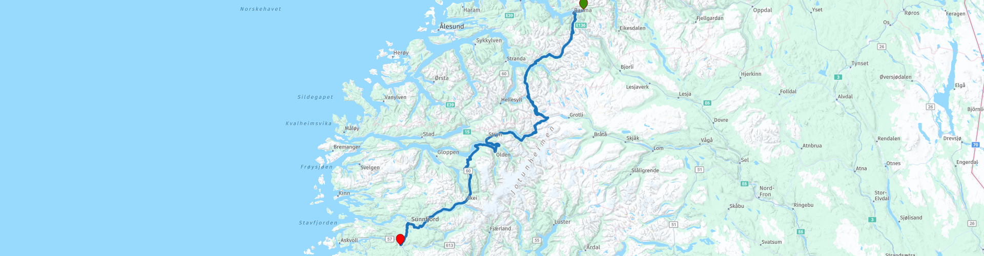
Duration
8h 41m

Mode of travel
Car or motorcycle

Distance
315.13 km

Countries

 RouteXpert Review
 The fjords are surrounded by majestic cliffs and have beautiful blue water, but make no mistake: the water is just salty. That is no wonder if you know that fjords are actually long sea arms that often stretch far inland. Sometimes you see huge waterfalls along the meter-high mountain walls - created on the almost invisible glaciers.
A special attraction are the many impressive waterfalls that plunge into the deep fjord from the cliffs. The most famous are De Syv Søstrene ("the Seven Sisters"), Friaren ("The Bridegroom") and Brudesløret ("the Bridal Veil"). The large amount of water covers the cliffs in a delicate shutter of fog which, with the least ray of sunshine, casts rainbow after mountain along the mountain slopes. The combination of the many colors in this beautiful environment will leave an impression for many visitors that will be cherished for a long time.
The Geirangerfjord is a fjord in the Sunnmøre region in the very south of the Norwegian province of Møre og Romsdal. It is a 15 kilometer long arm of the Storfjord. There is a ferry connection between the places Geiranger and Hellesylt, located in the fjord. The deep blue Geirangerfjord - about an eight-hour drive from the Norwegian city of Bergen - is surrounded by beautiful mountains and has countless wild waterfalls. When the sun shines, this produces the most beautiful rainbows. Drive along the fjord on the well-known mountain road Trollstigen, cut out of the cliff. Not for the scared!
The Trollstigen is not only an absolute must-see, but also an alternative route to the Geirangerfjord and surrounding area. This road with eleven hairpin bends winds along steep mountain walls, runs along waterfalls, is here and there narrow and sometimes even nerve-racking. So you fall from one surprise to the other. The Trollstigen is carved into the cliff with the simplest tools during the difficult 1930s. A stone wall is often everything that lies between the asphalt and the hundreds of meters deep canyon. The road, opened in 1936, bears witness to the architectural craftsmanship of the Norwegians from this difficult period.
This 5-star rated route, through a dazzling nature, takes you along beautiful roads and along fantastic viewpoints. A memory that you will remember for a long time.
This route has the terminus in Sande, from where you can explore the 2nd route along the Sognefjord.


 Links
Links  Usage
Usage Want to download this route?
You can download the route for free without MyRoute-app account. To do so, open the route and click 'save as'. Want to edit this route?
No problem, start by opening the route. Follow the tutorial and create your personal MyRoute-app account. After registration, your trial starts automatically.  Disclaimer
Use of this GPS route is at your own expense and risk. The route has been carefully composed and checked by a MyRoute-app accredited RouteXpert for use on TomTom, Garmin and MyRoute-app Navigation.
Changes may nevertheless have occurred due to changed circumstances, road diversions or seasonal closures. We therefore recommend checking each route before use.
Preferably use the route track in your navigation system. More information about the use of MyRoute-app can be found on the website under 'Community' or 'Academy'.