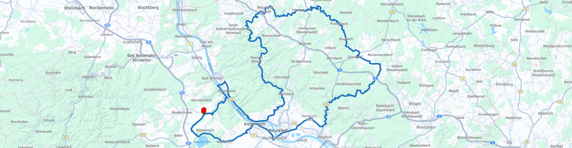
Visit to the Rhein and Andernach out of Burgbrohl Roundtour Small

This route was brought to you by:
RouteXpert Guy Heyns - Adv. RouteXpert
Last edit: 01-02-2025
 Route Summary
 It is a super nice fun tour, simple and very nice to ride, where you also get the chance to admire the Rhine in all its glory.
It is precisely because of its simple and playful character that this route easily deserves 4 stars.
Everyone will appreciate the route, although the technical guys might want it a bit more challenging...
But as a relaxing ride in between, this is definitely recommended and suitable for everyone!
 Share this route


Animation

Verdict


Duration
6h 58m

Mode of travel
Car or motorcycle

Distance
153.49 km

Countries

 RouteXpert Review
 Quite soon after the start you pass the Laacher See, but because of the vegetation you probably won't see that much of it. However, you will notice from the rapid descent that you are quickly approaching the Rhine valley.
At Andernach, one of the oldest cities in Germany, we meet the Rhine.
Andernach itself was founded in 12 BC by the Romans on the foundations of an old Celtic village. If you like, there are a number of nice things to see in Andernach…
One of the attractions from the old industrial past is the "Old Crane" of Andernach, a 16th century stone treadmill tower crane with a diameter of 8.8 and a height of 9.4 meters. The crane is located just outside the city, close to the shore of the old harbor, where it replaced an even older 14th century wooden floating treadmill crane.
It was in operation for 350 years, from 1561 to 1911. It took two to four men to turn the crane top using a huge lever attached to the vertical wooden crane beam, and four others (the treadmill men…) on huge wooden double treadmills with a diameter of over 4.3 metres.
These men were responsible for lifting and lowering cargo, mainly millstones, blocks of peat stone and wine barrels. This treadmill crane with stone walls (most cranes had a wooden casing) is one of the few examples of its kind preserved in Europe.
The other local attraction is the Andernach Geyser.
This is a so-called cold water geyser and the one in Andernach is even the highest in the world.
The principle of the cold water geyser is as follows…
CO2, originating from the magma deep below the Eifel, creeps through all sorts of fissures, cracks and holes in the volcanic rock into the groundwater and dissolves in it. Every cold-water geyser, unlike hot-water geysers, needs a borehole. The Andernach borehole is 350 metres deep and barely 15 cm in diameter.
When there is little water in the well, the pressure in the water is low and little happens. The gas escapes easily from the water, rises and remains above the well.
However, when the well fills up, the water pressure at a depth of 350 metres rises to 35 bar. This high pressure keeps the CO2 locked in the water.
At a certain point, however, the water is saturated and CO2 bubbles form in the water that want to rise. As they do this, not only does the speed increase, but also the volume due to the snowball effect.
This increasing volume creates even more pressure in the water and the well begins to overflow. The pressure then drops again and the CO2 can escape again. A domino effect then ensures that the pressure and the force that the CO2 exerts on the water are reinforced again and again. Due to the small diameter of the borehole, the rising CO2 bubbles are sometimes 10 to 15 meters long and they form a piston that pushes the overlying water upwards so that an eruption follows that lasts about 15 minutes and spews the mass of about 8000 liters of water up to 60 meters high. The geyser empties itself, the pressure decreases further, the geyser stops and the process starts all over again... Every two hours or so there is an eruption that lasts about 15 minutes.
After a possible visit to Andernach and some of its attractions, we continue our route and cross the Rhine at Weisenthurm and enter Rhineland-Palatinate. We leave the main road again quite quickly to arrive at a particularly smooth, winding road that takes us through this part of the Rhineland at lightning speed. There seems to be no end to the serpentine of long, playful bends that are also provided with wonderfully smooth asphalt.
I can imagine that there are motorcyclists who would like to continue like this forever….
Unfortunately, this particular pleasure comes to an end at Wollendorf… Here you reach the other bank of the Rhine and at Leutesdorf you can enjoy the beauty of the Rhine for a short break. Afterwards, the ferry from Bad Breisig-Bad Hönningen is taken to return to the Eifel region. 10 kilometers later you end up at the hotel where you started.


 Links
Links  Usage
Usage Want to download this route?
You can download the route for free without MyRoute-app account. To do so, open the route and click 'save as'. Want to edit this route?
No problem, start by opening the route. Follow the tutorial and create your personal MyRoute-app account. After registration, your trial starts automatically.  Disclaimer
Use of this GPS route is at your own expense and risk. The route has been carefully composed and checked by a MyRoute-app accredited RouteXpert for use on TomTom, Garmin and MyRoute-app Navigation.
Changes may nevertheless have occurred due to changed circumstances, road diversions or seasonal closures. We therefore recommend checking each route before use.
Preferably use the route track in your navigation system. More information about the use of MyRoute-app can be found on the website under 'Community' or 'Academy'.

Rheinland Pfalz
About this region
Rhineland-Palatinate (German: Rheinland-Pfalz, [ˈʁaɪ̯nlant ˈp͡falt͡s] (listen)) is a western state of Germany. It covers 19,846 km2 (7,663 sq mi) and has about 4.05 million residents. It is the ninth largest and sixth most populous of the sixteen states. Mainz is the capital and largest city. Other cities are Ludwigshafen am Rhein, Koblenz, Trier, Kaiserslautern and Worms. It is bordered by North Rhine-Westphalia, Saarland, Baden-Württemberg and Hesse and by the countries France, Luxembourg and Belgium.
Rhineland-Palatinate was established in 1946 after World War II, from parts of the former states of Prussia (part of its Rhineland province), Hesse and Bavaria (its former outlying Palatinate kreis or district), by the French military administration in Allied-occupied Germany. Rhineland-Palatinate became part of the Federal Republic of Germany in 1949 and shared the country's only border with the Saar Protectorate until the latter was returned to German control in 1957. Rhineland-Palatinate's natural and cultural heritage includes the extensive Palatinate winegrowing region, picturesque landscapes, and many castles and palaces.
Read more on Wikipedia
Rhineland-Palatinate was established in 1946 after World War II, from parts of the former states of Prussia (part of its Rhineland province), Hesse and Bavaria (its former outlying Palatinate kreis or district), by the French military administration in Allied-occupied Germany. Rhineland-Palatinate became part of the Federal Republic of Germany in 1949 and shared the country's only border with the Saar Protectorate until the latter was returned to German control in 1957. Rhineland-Palatinate's natural and cultural heritage includes the extensive Palatinate winegrowing region, picturesque landscapes, and many castles and palaces.
View region
 Statistics
  132
132Amount of RX reviews (Rheinland Pfalz)
 41243
41243Amount of visitors (Rheinland Pfalz)
 24572
24572Amount of downloads (Rheinland Pfalz)
 Route Collections in this region
 Top 5 Car and Motorcycle Routes in the Eifel
The Eifel is the eastern part of the medium plateau Eifel-Ardennes. It is located north of the Moselle and west of the Rhine. The largest part is in Germany, a small part is in Belgium, in the East Cantons. The German part of Eifel is located in the federal states of North Rhine-Westphalia and Rhineland-Palatinate. The highest point is the Hohe Acht with 747 meters.
Several chains can be distinguished in the Eifel:
The northernmost part is called the Nordeifel, which in Belgium connects to the High Fens;
To the east of this is the Ahrgebirge, this part is located north of the Ahr in the Ahrweiler district;
South of the Ahr is the Hohe Eifel (or Hocheifel), of which the Hohe Acht (747 m) is the highest point, and also the highest point in the entire Eifel region;
To the west, near the Belgian border, the hills are known as Schneifel, part of the wider Snow Eifel area with peaks reaching up to 698 metres;
South and east of the Hohe Eifel is the Volcano-Eifel, a volcanic area with many crater lakes (Maare).
The southern part of the Eifel is less high. The area is bisected by streams and rivers running southwards. These streams flow into the Moselle. The largest of these rivers is the Kyll; the hills around this river are known as the Kyllwald;
In the south, the Eifel ends in the Voreifel.
In the north of the Eifel there are some large reservoirs. The largest of these is the reservoir in the Roer that was created by the construction of the Roerdal dam.
The Nürburgring is also located in the Eifel, a well-known car circuit for Formula 1 races, among other things. Since 2004, part of the north of the Eifel has become the Eifel National Park. This National Park falls entirely within the German-Belgian nature park High Fens-Eifel. Another part of the Eifel falls within the South Eifel Nature Park.
Well-known throughout the Netherlands and Belgium by car and motorcyclists, so reason enough for the MyRoute app RouteXpert to compile a Top 5 of Car and Motorbike routes for you.
All routes in this collection have been checked and made equal for TomTom, Garmin and MyRoute-app Navigation by a MyRoute-app RouteXpert.
If you think, I have a very nice route that should certainly not be missing from this collection, send it to:
email: routeexpert@myrouteapp.com
Subject: New Route for the Top 5 collection Eifel composed by Hans van de Ven.
The route will then be reviewed and then added to the Top 5. To make the Top 5 also the Top 5, 1 route will have to disappear from the Top 5, you can indicate this when submitting the new route.
Have fun with this collection and while driving one of these routes. Enjoy all the beauty that the Eifel has to offer. Click on “View route” to read the review of the chosen route.
I would like to hear your findings about the route(s).
View Route Collection
Route collection hairpins in the Eifel
This collection is composed of the most beautiful and winding roads in the Eifel. Forget Bundesstraßen, forget the road along the Moselle, if you have driven these roads, you can really say that you have been to the Eifel.
No less than 6 routes and 1,800 kilometers are waiting for you!
No less than 6 routes and 1,800 kilometers are waiting for you!
View Route Collection