Fort William to Glencoe Pass and onto Gretna Green

This route was brought to you by:
RouteXpert Nick Carthew - (MRA Master)
Last edit: 17-04-2025
 Route Summary
  Share this route


Animation

Verdict


Duration
8h 43m

Mode of travel
Car or motorcycle

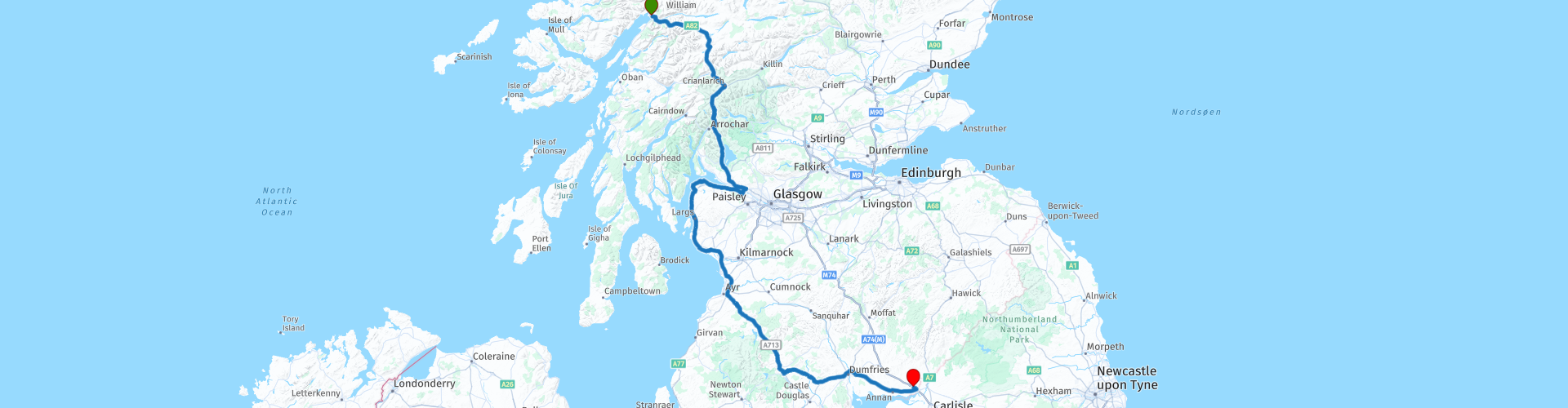
Distance
373.38 km

Countries

 RouteXpert Review
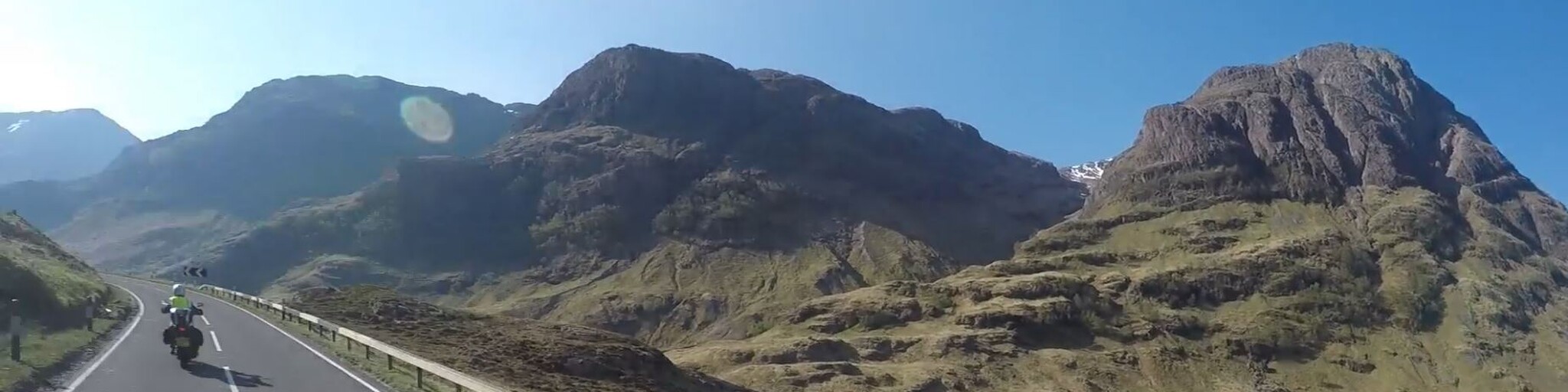
 The approach to the Glencoe Pass could not be more beautiful with the mountain Beinn a' Bheithir ('mountain of the beast' in English) right in front of you. It has two Munro summits: Sgorr Dhearg at 1,024 metres and Sgorr Dhonuill at 1,001 metres. The more rounded Creag Ghorm at 758 metres sits to the right. A Munro is any Scottish mountain over 3,000 feet (914 meters) in height.
Then you use the Ballachulish Bridge to cross over the 'Narrows of Patrick's Son' the stretch of water between Loch Leven and Loch Linnhe. The bridge opened on 23rd December 1975, replacing a long standing commercial service running since 1733, although doubtless ferry boats had criss-crossed the narrows long before that. The structure of the large steel box truss bridge seems to perfectly frame the approaching landscape.
Then comes the pass. This is one of those passes that you have to ride again, turn around at the top and ride back down to get a different view and then turn around again ride back up just in case you missed something. It truly is gorgeous.
As you leave the pass behind, you have the option to ride into Glen Etive, the fictional ancestral home of James Bond. The road leading down to Loch Etive, is a well-known filming location in the James Bond movie Skyfall.
A little further on as you ride over Rannoch Moor you get a fantastic view of the Grampian mountain range, one of the three major mountain ranges in Scotland.
This route stops at the famous Green Welly Stop, this gives you a chance to discuss with your buddies, what you have just ridden through! The Green Welly Stop is a refuelling and meeting place for motorcycles where you can buy just about anything remotely connected to Scotland. From a Haggis and a tartan kilt to a bottle of Whisky or a fluffy Loch Ness monster!
Next comes the beautiful Loch Lomond and the Trossachs National Park, great roads and great scenery. Loch Lomond, nestled in the heart of Scotland's first National Park, is renowned for its stunning natural beauty and diverse wildlife. As the largest freshwater lake in Britain by surface area, Loch Lomond draws visitors from around the world, attracted by the sweeping landscapes, myriad activities, and rich history. At approximately 22 miles long, with varying widths up to 5 miles and a maximum depth of around 153 the ride alongside Loch Lomond seems to take forever.
There is a shock to your eyes as the route travels further south when it reaches the edge of Glasgow and civilization. This route avoids most of the hustle and bustle of city life by crossing the River Clyde over the Erskine Bridge and following the coast road which offers great views of the Isle of Bute and Isle of Arran. The route leaves the coast and heads inland at Ayr on the A713. This is a really great road on the edge of The Galloway Forest National Park and this route follows it for about 35 miles on towards the hotel for the night at Gretna Green.
Gretna Green is where young English couples would elope to, to marry their sweethearts as the laws in Scotland were different to those in England. The blacksmith would perform the wedding ceremony and the Old Blacksmiths is still there today, the route passes right by it so you can stop for a photo.
We spent our last night in Scotland at The Days Inn Hotel.
Enjoy


 Links
Links  Usage
Usage Want to download this route?
You can download the route for free without MyRoute-app account. To do so, open the route and click 'save as'. Want to edit this route?
No problem, start by opening the route. Follow the tutorial and create your personal MyRoute-app account. After registration, your trial starts automatically.  Disclaimer
Use of this GPS route is at your own expense and risk. The route has been carefully composed and checked by a MyRoute-app accredited RouteXpert for use on TomTom, Garmin and MyRoute-app Navigation.
Changes may nevertheless have occurred due to changed circumstances, road diversions or seasonal closures. We therefore recommend checking each route before use.
Preferably use the route track in your navigation system. More information about the use of MyRoute-app can be found on the website under 'Community' or 'Academy'.