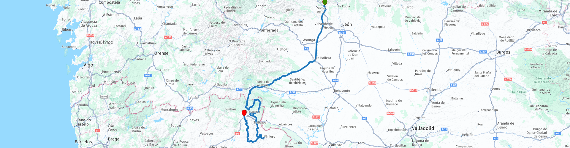
Day 09 Carrocera to Braganza

This route was brought to you by:
RouteXpert René Plücken (MRA Master)
Last edit: 12-02-2021
 Route Summary
 This ride runs from Carrocera to Braganca. You drive through beautiful nature parks with beautiful winding roads, such as The Sierra de la Culebra and Montesinho.
 Share this route


Animation

Verdict


Duration
6h 11m

Mode of travel
Car or motorcycle

Distance
339.15 km

Countries


 RouteXpert Review
 There are no scheduled stops for refueling, eating or drinking. When the opportunity arises, stop at one of the points indicated by a POI. Along the way there are several small villages with restaurants or cafes.
Hotels, sights and recommended points to stop to enjoy the view are also marked with a POI.
On day 9 we leave Spain and drive to Bragance in Portugal. You drive through two beautiful nature parks where you can enjoy the beautiful panoramas, nature and winding roads along the way.
RP6 The Sierra de la Culebra, a 95 km long regular mountain range of medium height, which forms a natural border with the Portuguese region of Tras os Montes on the west side. The slopes are wooded, occasionally plagued by forest fires. The tops of the range are often covered with snow in the winter and there are odd-looking rocky quartzite rocks on it.
A nice town to visit is Puebla de Sanabria (RP11), for some sight seeing and maybe lunch in one of the cafe's or restaurants
At RP16 we cross the border with Portugal and enter the National Park Montesinho. This park is located in the northwestern region of Portugal, close to Bragan and is a very beautiful nature park, with a few small towns such as Franca (RP17), Meixedo, Carragosa or Vinhais, for this you have to deviate from the route but it is certain beautiful towns for a walk. There is also the possibility of hiking. The park is located in northwestern Portugal, in the Trás-os-Montes region and is one of the largest nature parks in Portugal. The slate and granite mountains form deep valleys and the clear river water that flows through them offers the perfect habitat for a wide range of plants and animals.
The last part of the ride we drive on a beautiful road with many curves and beautiful panoramas to the end point in Braganca.
A nice ride that deserves 5 stars because of the beautiful winding roads through great nature reserves.


 Links
Links  Usage
Usage Want to download this route?
You can download the route for free without MyRoute-app account. To do so, open the route and click 'save as'. Want to edit this route?
No problem, start by opening the route. Follow the tutorial and create your personal MyRoute-app account. After registration, your trial starts automatically.  Disclaimer
Use of this GPS route is at your own expense and risk. The route has been carefully composed and checked by a MyRoute-app accredited RouteXpert for use on TomTom, Garmin and MyRoute-app Navigation.
Changes may nevertheless have occurred due to changed circumstances, road diversions or seasonal closures. We therefore recommend checking each route before use.
Preferably use the route track in your navigation system. More information about the use of MyRoute-app can be found on the website under 'Community' or 'Academy'.