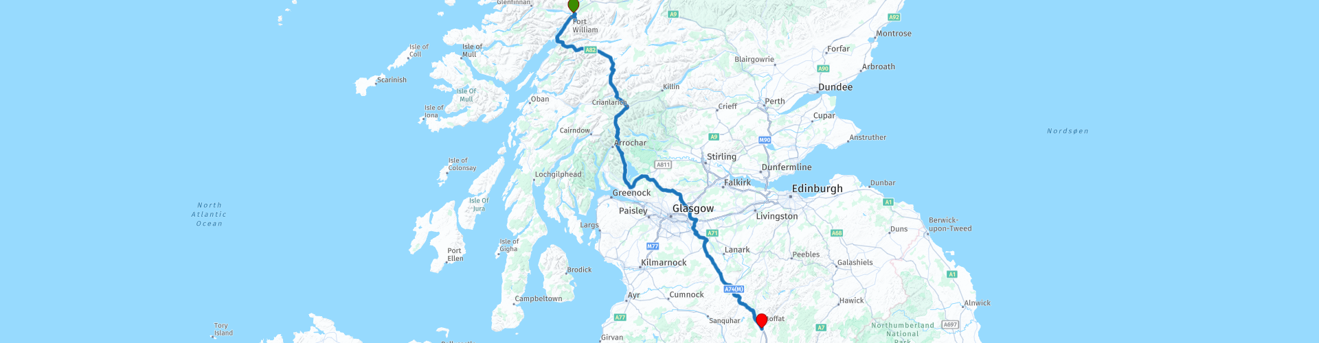
UK Scotland 08 Fort William to Moffat 293km svd

This route was brought to you by:
RouteXpert Serge van Driel - RouteXpert
Last edit: 22-12-2018
 Route Summary
  Share this route


Animation

Verdict


Duration
4h 14m

Mode of travel
Car or motorcycle

Distance
290.43 km

Countries

 RouteXpert Review
 Scotland Travel; 9 Days Singletrack Roads Day 8: Fort William to Moffat Today is a day of extremes. We are in Fort William, near the highest mountain in Scotland; Ben Nevis.Of course, we want to see it in all its glory before we leave and that, if it is a bit clear, is great with RP4, after you have first refueled at RP2 of course.When we have seen Ben, we drive along the coastline to the south, passing a slate quarry where you see the history of the slate-roofs before your eyes, and then drive through the beautiful landscape of Glen Coe to Loch Lomond. Navigating is not really necessary, you can just follow the road and the RPs that are there in this route, at least in the beginning are mainly to point to beautiful viewpoints etc. After Loch Lomond the environment is different, and we get into the ring around Glasgow and like I do at Edinburgh I recommend driving around there. Nothing for the engine in my opinion, and so we go around it with a curve. The next piece is along secondary roads, which unfortunately partly run parallel to a relatively large highway, and there is not much more fun to imagine. Look in your head the pictures of Glencoe only once, and then you stand after more than 290 km suddenly on the sidewalk of a beautiful old country house, where we will spend the last night in Bonny Scotland. The distance from here to the boat, is great to do in a morning and even allows time to take a quiet look at the Hadrian's Wall Visitor Center. But that's only tomorrow


 Usage
Usage Want to download this route?
You can download the route for free without MyRoute-app account. To do so, open the route and click 'save as'. Want to edit this route?
No problem, start by opening the route. Follow the tutorial and create your personal MyRoute-app account. After registration, your trial starts automatically.  Disclaimer
Use of this GPS route is at your own expense and risk. The route has been carefully composed and checked by a MyRoute-app accredited RouteXpert for use on TomTom, Garmin and MyRoute-app Navigation.
Changes may nevertheless have occurred due to changed circumstances, road diversions or seasonal closures. We therefore recommend checking each route before use.
Preferably use the route track in your navigation system. More information about the use of MyRoute-app can be found on the website under 'Community' or 'Academy'.