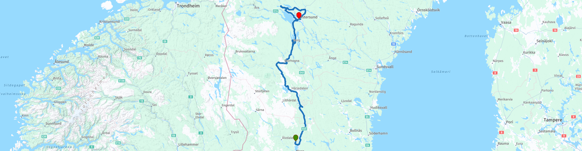
03 Orsa to Ostersund

This route was brought to you by:
RouteXpert Leon Bodegom
Last edit: 21-03-2021
 Route Summary
 This was part 3 of our 2019 tour and introduction to Sweden. There is plenty to see and visit along the way. However, keep in mind the opening times of places to visit. The tourist season is short and in various places the sights were sometimes only opened after Whit Monday. In this part there are several beautiful stops for a visit and even though the number of daylight hours is high in the summer, the days are still short to see everything.
Beautiful roads, curves, lakes, rivers, heather and swamps alternate with forests and green hills. Watch out for the bears, lynx, wolves and moose that live here. So you have to watch out.
Start: Fryksas, Fryksås Hotell
End: Orsa, Clarion Grand
I have awarded this route with 3 *** stars because the rolling forest landscape is a pleasant and quiet ride, the roads are generally good and the historical attractions very good.
 Share this route


Animation

Verdict


Duration
13h 20m

Mode of travel
Car or motorcycle

Distance
483.37 km

Countries

 RouteXpert Review
 On this route in the sparsely populated part of Sweden, the places of residence are getting smaller and the number of possible stops for coffee or lunch is also limited. Therefore the advice to bring something to drink and eat in case the eateries have a rest day.
There are also plenty of places for a picnic in this quiet area. Drive onto a side road and you feel like you are alone in the world.
You will leave the beautiful overnight stop of Frykas and drive out of the province of Dalarna. Another day to the far north of Sweden, so with the sun behind you. After 100 Km you will pass the Hamra national park. By turning right at route point 2 and then right again on the side road you will arrive at the parking lot in Hamra national park. Here is the opportunity to stretch your legs with a short walk to a viewpoint. You may not be completely alone there, there is still plenty of game in the woods.
A bear will come your way further on in the town of Sveg. There is a very large wooden bear set up. There you will also find the first opportunity for a cup of coffee.
When you have taken the picture of the bear in Sveg, follow the signs to Duvdalen. Here you have to drive to the end of the road. Then you drive through a vast historic mountain village with special painted farms. Just nice to have a look and then continue your way on road 84.
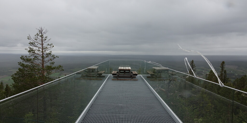
Upon entering the ski village Vemdalen you pass an old church with a separate bell tower (campanille). A construction method that you encounter in many places in Sweden. In the center you will find various lunch options. You have to search for a Swedish restaurant. Many dining options are a sandwich Donner, Thai or pizza restaurant. It is a matter of checking whether the first possible stop on the route is open and otherwise continue to the next eatery. If you can't find anything for a meal here in Vemdalen, you will only find something 60Km away before or on the Hoverberg. This mountain is located on a peninsula in Lake Storsjon. At the top of the Hoverberg is a viewpoint with a Kiosk. From the east side you drive up the mountain to the viewpoint. After the summit, the route follows the road along the peninsula and on the west side you come to a gorge of 400 meters long and 25 meters deep that you can walk through.
Halfway along the Storsjonmeer the route ends at the town of Hackas. Here is a medieval church on the shore. On the edge of the lake, in good weather, it is a pleasant place to linger on the jetty by the boathouse.
After Hackas you are almost at the final destination in Ostersund. After the bridge you can already see the hotel on the right side across the street. However, you turn left in Ostersund for another round of over 130Km. On this part of this inner winding route you drive to Glosa with old rock paintings. These rock paintings, applied with red paint, can be found in several places in Scandinavia and date back 3,500 years.
The last visit on this route is the Landhandeln in Krokom on the route. A typical Swedish shop that offers all kinds of merchandise for sale. From Supermarket to fishing tackle and tools.
For camping enthusiasts, 2 poi's have also been added from campsites in the woods and on the waterfront near Ostersund. Except for endless cruising on quiet roads, there is also plenty to see on this route.

 Links
Links  Usage
Usage Want to download this route?
You can download the route for free without MyRoute-app account. To do so, open the route and click 'save as'. Want to edit this route?
No problem, start by opening the route. Follow the tutorial and create your personal MyRoute-app account. After registration, your trial starts automatically.  Disclaimer
Use of this GPS route is at your own expense and risk. The route has been carefully composed and checked by a MyRoute-app accredited RouteXpert for use on TomTom, Garmin and MyRoute-app Navigation.
Changes may nevertheless have occurred due to changed circumstances, road diversions or seasonal closures. We therefore recommend checking each route before use.
Preferably use the route track in your navigation system. More information about the use of MyRoute-app can be found on the website under 'Community' or 'Academy'.

Dalarnas lan
About this region
Dalarna County (Swedish: Dalarnas län) is a county or län in middle Sweden (Svealand). It borders the counties of Uppsala, Jämtland, Gävleborg, Västmanland, Örebro and Värmland. It is also bordered by the Norwegian counties of Hedmark and Trøndelag in the west. Its former name was Kopparberg County (Swedish: Kopparbergs län) until it was changed to the name of the provincial region on 1 January 1997.
The term Dalarna County is mainly used for administrative purposes, being further subdivided into municipalities (kommuner). Dalarna County virtually encompasses the historical province Dalarna (literally, "the valleys"), that deals with history and culture of the area. The widespread and often sparsely populated wilderness areas combine to make Dalarna almost as large as Belgium in terms of land area.
Read more on Wikipedia
The term Dalarna County is mainly used for administrative purposes, being further subdivided into municipalities (kommuner). Dalarna County virtually encompasses the historical province Dalarna (literally, "the valleys"), that deals with history and culture of the area. The widespread and often sparsely populated wilderness areas combine to make Dalarna almost as large as Belgium in terms of land area.
View region
 Statistics
  2
2Amount of RX reviews (Dalarnas lan)
 9011
9011Amount of visitors (Dalarnas lan)
 91
91Amount of downloads (Dalarnas lan)