TTT 2013 03 Zeeuws Vlaanderen vanuit Terneuzen

This route was brought to you by:
RouteXpert Hans van de Ven (Mr.MRA)
Last edit: 24-09-2019
 Route Summary
 The 173 ANWB Promoter TankTasTocht (TTT) were scanned by Henry ten Dam and signed by Leon Stolk in Mapsource and later placed as a Track in a .gpx file. These are made available through the MrGPS website with the approval of the ANWB Promoter so that everyone can enjoy them. The 1st TTT is from 1992, so the route may differ slightly from the original.
I have checked all route points and, where necessary, placed them neatly on the road. I have also, if necessary, set the starting point and end point of the route a little further apart to prevent navigation to the end point directly and added the POI files of the starting point and end point just like a possible stopping point.
Finally, I made the route the same for TomTom, Garmin and MyRoute-app Navigation users.
Thanks to Henry, Leon, MrGPS and Promoter.
 Share this route


Animation

Verdict


Duration
3h 47m

Mode of travel
Car or motorcycle

Distance
131.11 km

Countries


Breskens
 RouteXpert Review
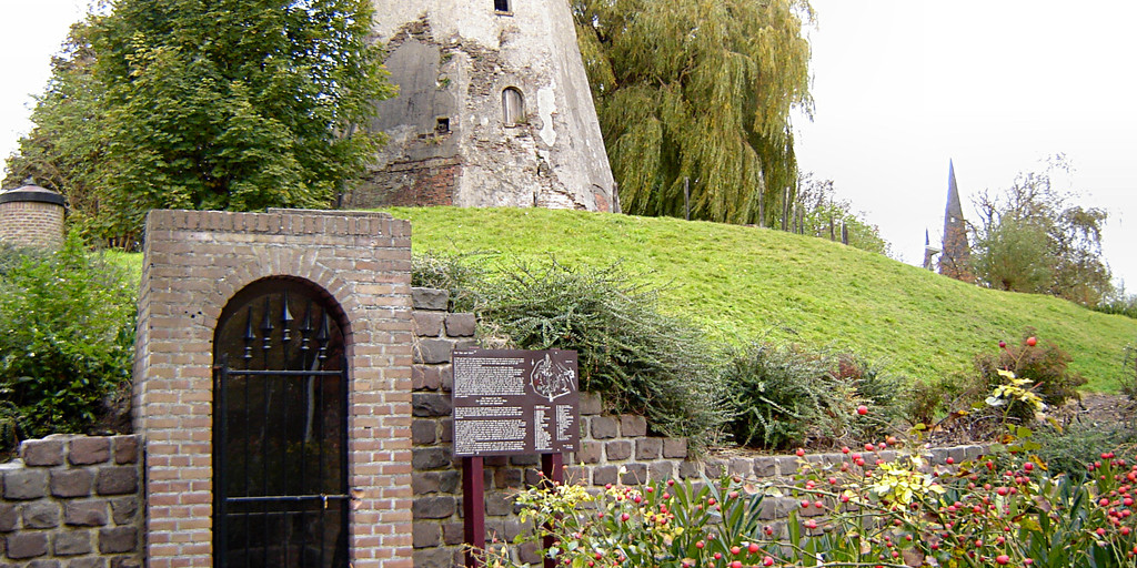
 Quite soon after departure you arrive in Sas van Gent, where you can see the water flour mill, also known as the tidal mill *
* After the liberation of Sas van Gent on the Spaniards by Frederik Hendrik of Orange in 1644, the fortress was strengthened.
In order to provide food to the garrison and the city in the event of a possible siege, a water mill was built in 1696 in the ramparts. The water from the main channel could be diverted along the water corn mill, driving a mill wheel. The mill was bomb-free, so less vulnerable than a traditional mill, and in addition there were large storage rooms and a bakery.
The mill was built in 1696 and acted as a flour mill. There was a bakery next door. It was built in the ramparts to make it invulnerable for the ammunition of the time. After all, windmills showed greater vulnerability and flour mills were necessary for the food supply in times of siege. This mill, however, did not work so much on the tides and tides, because the water wheel was usually driven by excess polder water, which was subsequently drained to the channel.
The mill was located between the bastions Hollandia and Zeelandia. In 1747 a siege took place by the French in the context of the Austrian War of Succession, and then the mill was ground. From 1795 the demolition of the large fortress that Sas van Gent once started. The mill was then no longer used. The Zeelandia Bastion was also demolished from 1930-1935 and in 1951 the mill water was filled in. What remained was a wall with an opening through which the water once flowed. This was preserved in 1988.
After the possible viewing it continues and you enter Belgium, after a little less than 30 km you are back in the Netherlands and it's time for coffee, you can do this in Sint-Kruis at Café Zeelandia. After coffee it continues towards the coast, where you can stop at Retranchement and enjoy the view and take some pictures on top of the dike.
Then it goes along the coastline and you pass the famous seaside resorts where you can stop for a break, plenty of choice, then you leave the coastline and head towards Biervliet and then Terneuzen to close this TTT.
Because I have not (yet) driven this route myself, this route gets 3 stars.
Route details:
rp 1 - Starting point McDonalds terneuzen
rp 10 - Water flour mill Sas van Gent
rp 27 - Coffee stop in Sint-Kruis at café Zeelandia
rp 35 - Photo viewpoint in Retranchement
rp 58 - End point in Terneuzen near De Kreek
! Adaptation to the route made on the advice of Menno Burg, for which thanks:
Just before the Heem, route point 39, the Panoramaweg is included in the route, because the original road in the route no longer exists. After route point 43 you are back on the original route.

Sluis in Terneuzen

Bolwek, Sas van Gent
 Links
Links  Usage
Usage Want to download this route?
You can download the route for free without MyRoute-app account. To do so, open the route and click 'save as'. Want to edit this route?
No problem, start by opening the route. Follow the tutorial and create your personal MyRoute-app account. After registration, your trial starts automatically.  Disclaimer
Use of this GPS route is at your own expense and risk. The route has been carefully composed and checked by a MyRoute-app accredited RouteXpert for use on TomTom, Garmin and MyRoute-app Navigation.
Changes may nevertheless have occurred due to changed circumstances, road diversions or seasonal closures. We therefore recommend checking each route before use.
Preferably use the route track in your navigation system. More information about the use of MyRoute-app can be found on the website under 'Community' or 'Academy'.
