Day 106 The Ultimate USA road trip Sidney Fort Peck

This route was brought to you by:
RouteXpert René Plücken (MRA Master)
Last edit: 08-01-2024
 Route Summary
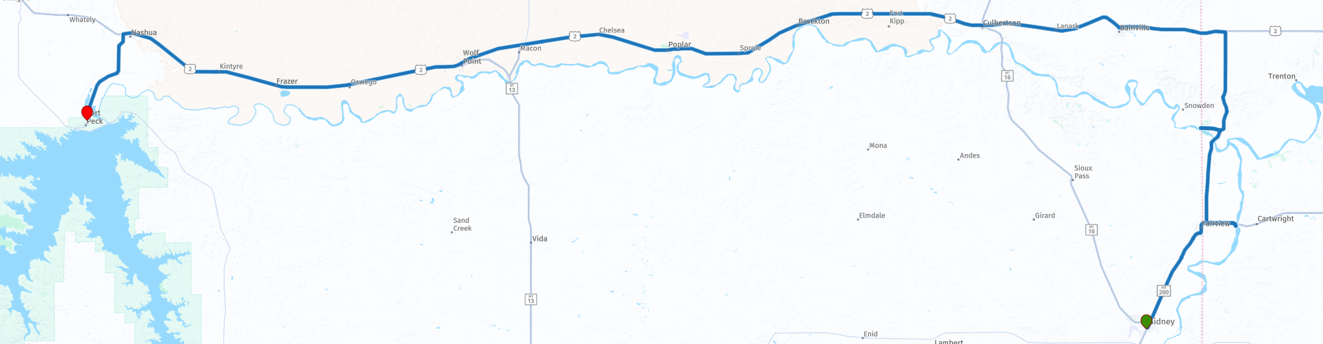
 I have further supplemented the Road Trip with even more special points that you can visit in the USA. Today we drive from Sidney to Fort Peck, Montana, with a small part of the route in North Dakota. It is a fun ride of over 270 kilometers.
Today we drive on highways, a few nice stops at museums are planned along the route. The roads take you through the beautiful landscape of Montana with wide panoramas with alternating meadows, forests and mountains. I rate this route 3 stars.
 Share this route


Animation

Verdict


Duration
9h 40m

Mode of travel
Car or motorcycle

Distance
272.55 km

Countries

 RouteXpert Review
 This bridge crosses the Yellowstone River and is one of two nearly identical bridges built by the Montana Eastern Railway within ten miles of each other. The other bridge is the Snowden Bridge which crosses the Missouri River in Montana. The body of a lynched railroad worker and criminal, JC Collins, is rumored to be in one of the concrete abutments of the Fairview Lift Bridge.
The railway has not been used since the mid-1980s. It is a beautiful construction and certainly worth seeing up close. There is a small parking lot and you can cross the bridge on foot.
After about half an hour's drive we arrive at the Fort Union Trading Post, a beautiful site to visit. Between 1828 and 1867, Fort Union was the most important fur trading post on the Upper Missouri River. Here the Assiniboine, Crow, Cree, Ojibway, Blackfeet, Hidatsa and other tribes traded buffalo robes and other furs for trade goods such as beads, guns, blankets, knives, cooking utensils and cloth.
Today, the reconstructed Fort Union represents a unique era in American history, a brief period when two different civilizations found common ground and mutual benefit through commercial exchange and cultural acceptance. A bastion of peaceful coexistence, the Trading post traded more than 25,000 buffalo robes and $100,000 in merchandise annually. It is the largest fort on the Upper Missouri River
They regularly host Indian Arts Festivals, check the website, you can find the link in this review, for the schedule Experience the history and culture of the American Indians, through music, song, dance, traditional crafts and lectures by tribal historians and elders of Upper Missouri tribes.
We drive back to Montana, along the route you will find “Historical Markers”, these are information boards about the history of this area and are interesting short stops. The signs briefly describe what happened at that, or near, location. A number are included in the route as a POI, such as;
- “Historical Marker; An Imposing and Elaborate Establishment". It commemorates Fort Union, which we just visited. It is one of the largest and best known trading posts, about 14 miles southeast of here. Built in 1828, it was the headquarters of the newly established Upper Missouri Outfit from the American Fur Company.
- “Historical Marker; In Memoriam", commemorating the victims of the smallpox epidemic that began in the summer of 1837 on an American Fur Trading Company steamboat en route from St. Louis to Fort Union. Contact with the steamboat crew during the distribution of trade goods brought to light the Wichiyabina or Little Girls' Band of Assiniboine, creating a terrible epidemic that eventually affected all the tribes of what is now northeastern Montana, killing 94% of the Assiniboine people and still mourning today.
In the small village of Bainville you can visit "Rustic N More", this is an antique shop with furniture and trinkets and coffee shop. They are only open on Wednesday, Thursday, Friday and Saturday. For this you have to leave the route briefly and you also drive a section on gravel, so be careful! It's a wonderful place to have a cup of coffee and browse the antique shop. Within walking distance of the railway are two authentic grain elevators, nice to take a look.
In the town of Culbertson we visit the Culbertson Museum, a small museum that is open daily and has many artifacts, information and photos about Culbertson and the state of Montana. You can also plan a lunch stop in Culbertson, there are a few small restaurants and an ice cream parlor on the main road.
The next stop is planned in Poplar, where we will visit the Poplar City Museum, which is housed in the old “Tribal Jail”, built around 1920, which is listed in the Historical Register. The prison's ceiling is covered with armor on the inside, to keep the prisoners locked inside. This was installed when in the past prisoners managed to escape through the roof. Frontier and Indian collections are on display in the prison cells. The emphasis is on the intricate beading and quilting of the Sioux and Assiniboine Indians. These products are also for sale. Entrance is free. They are open Monday through Friday, June 1st through Labor Day, from 11 a.m. to 5 p.m.
“Wolf Point” is the next village on the route and here too there is a museum that is worth a visit. Opened in June 1972, the Wolf Point Area Museum features exhibits featuring artifacts and belongings of the early settlers and homesteaders who arrived and settled here in the late 1800s and around 1914 and 1915.
In Fort Peck we will spend the night at the historic Hotel Fort Peck, but before checking in we will visit the nearby Northeast Montana Veterans Memorial Park which is dedicated to remembering the service and sacrifice of all military veterans, especially those from Northeast Montana. including Phillips, Valley, Roosevelt, Daniels, McCone, Garfield, Dawson, Sheridan and Richland counties.
The town of Fort Peck has a lot of history. You can visit the Powerhouse Museum and the Fort Peck Interpretive Center, which is part of the “Montana Dinosaur Trail”. You can stay at the Fort Peck Hotel, a historic, rustic hotel with lots of charm. The rooms are tastefully and authentically decorated, the hotel has a cozy bar, restaurant with home-cooked meals and a veranda where you can enjoy the evening with a drink.


 Links
Links  Usage
Usage Want to download this route?
You can download the route for free without MyRoute-app account. To do so, open the route and click 'save as'. Want to edit this route?
No problem, start by opening the route. Follow the tutorial and create your personal MyRoute-app account. After registration, your trial starts automatically.  Disclaimer
Use of this GPS route is at your own expense and risk. The route has been carefully composed and checked by a MyRoute-app accredited RouteXpert for use on TomTom, Garmin and MyRoute-app Navigation.
Changes may nevertheless have occurred due to changed circumstances, road diversions or seasonal closures. We therefore recommend checking each route before use.
Preferably use the route track in your navigation system. More information about the use of MyRoute-app can be found on the website under 'Community' or 'Academy'.

North Dakota
About this region
North Dakota is a U.S. state in the upper Midwest of the country. It is named after the indigenous Lakota and Dakota Sioux, who historically dominated the territory and remain a large community. North Dakota is bordered by the Canadian provinces of Saskatchewan and Manitoba to the north and by the U.S. states of Minnesota to the east, South Dakota to the south, and Montana to the west. It is believed to host the geographic center of North America, situated in the town of Rugby, and is home to the tallest man-made structure in the Western Hemisphere, the KVLY-TV mast.
Of the 50 states, North Dakota is the nineteenth largest in area, but with a population of less than 780,000 as of 2020, it is the fourth least populous and fourth most sparsely populated. The capital is Bismarck while the largest city is Fargo, which accounts for nearly a fifth of the state's population; both cities are among the fastest-growing in the U.S., although half of all residents live in rural areas. The state is part of the Great Plains region, with broad prairies, steppe, and temperate savanna, badlands, and farmland being defining characteristics.
What is now North Dakota was inhabited for thousands of years by various Native American tribes, including the Mandan, Hidatsa, and Arikara along the Missouri River; the Ojibwa and Cree in the northeast; and several Sioux groups (the Assiniboin, Yankton, Wahpeton, and Teton) across the rest of the state. European explorers and traders first arrived in the early 18th century, mostly in pursuit of lucrative furs. The United States acquired the region in the early 19th century, gradually settling it amid growing resistance by increasingly displaced natives.
The Dakota Territory, established in 1861, became central to American pioneers, with the Homestead Act of 1862 precipitating significant population growth and development. The traditional fur trade declined in favor of farming, particularly of wheat; the subsequent Dakota Boom from 1878 to 1886 saw giant farms stretched across the rolling prairies, with the territory becoming a key breadbasket and regional economic engine. The Northern Pacific and Great Northern railway companies competed for access to lucrative grain centers; farmers banded together in political and socioeconomic alliances that were core to the broader Populist Movement of the Midwest.
North Dakota was admitted to the Union on November 2, 1889, along with neighboring South Dakota, as the 39th and 40th states. President Benjamin Harrison shuffled the statehood papers before signing them so that no one could tell which became a state first; consequently, the two states are officially numbered in alphabetical order. Statehood marked the gradual winding down of the pioneer period, with the state fully settled by around 1920. Subsequent decades saw a rise in radical agrarian movements and economic cooperatives, of which one legacy is the Bank of North Dakota, the only state-run bank in the U.S.
Beginning in the mid 20th century, North Dakota's rich natural resources became more critical to economic development; into the 21st century, oil extraction from the Bakken formation in the northwest has played a major role in the state's prosperity. Such development has led to unprecedented population growth and reduced unemployment, with North Dakota having the second lowest unemployment rate in the U.S. (after Hawaii). It subsequently ranks highly in metrics such as healthcare, quality of life, and public safety.
Read more on Wikipedia
Of the 50 states, North Dakota is the nineteenth largest in area, but with a population of less than 780,000 as of 2020, it is the fourth least populous and fourth most sparsely populated. The capital is Bismarck while the largest city is Fargo, which accounts for nearly a fifth of the state's population; both cities are among the fastest-growing in the U.S., although half of all residents live in rural areas. The state is part of the Great Plains region, with broad prairies, steppe, and temperate savanna, badlands, and farmland being defining characteristics.
What is now North Dakota was inhabited for thousands of years by various Native American tribes, including the Mandan, Hidatsa, and Arikara along the Missouri River; the Ojibwa and Cree in the northeast; and several Sioux groups (the Assiniboin, Yankton, Wahpeton, and Teton) across the rest of the state. European explorers and traders first arrived in the early 18th century, mostly in pursuit of lucrative furs. The United States acquired the region in the early 19th century, gradually settling it amid growing resistance by increasingly displaced natives.
The Dakota Territory, established in 1861, became central to American pioneers, with the Homestead Act of 1862 precipitating significant population growth and development. The traditional fur trade declined in favor of farming, particularly of wheat; the subsequent Dakota Boom from 1878 to 1886 saw giant farms stretched across the rolling prairies, with the territory becoming a key breadbasket and regional economic engine. The Northern Pacific and Great Northern railway companies competed for access to lucrative grain centers; farmers banded together in political and socioeconomic alliances that were core to the broader Populist Movement of the Midwest.
North Dakota was admitted to the Union on November 2, 1889, along with neighboring South Dakota, as the 39th and 40th states. President Benjamin Harrison shuffled the statehood papers before signing them so that no one could tell which became a state first; consequently, the two states are officially numbered in alphabetical order. Statehood marked the gradual winding down of the pioneer period, with the state fully settled by around 1920. Subsequent decades saw a rise in radical agrarian movements and economic cooperatives, of which one legacy is the Bank of North Dakota, the only state-run bank in the U.S.
Beginning in the mid 20th century, North Dakota's rich natural resources became more critical to economic development; into the 21st century, oil extraction from the Bakken formation in the northwest has played a major role in the state's prosperity. Such development has led to unprecedented population growth and reduced unemployment, with North Dakota having the second lowest unemployment rate in the U.S. (after Hawaii). It subsequently ranks highly in metrics such as healthcare, quality of life, and public safety.
View region
 Statistics
  1
1Amount of RX reviews (North Dakota)
 447
447Amount of visitors (North Dakota)
 0
0Amount of downloads (North Dakota)
 Route Collections in this region
 Ultimate USA road trip part 11
Michel van Hagen challenged me to follow the Roadtrip of Dr. Randy Olsen as a basis to create the Ultimate USA Road Trip for the MyRoute app RouteXpert Library. I took up that challenge and started in February 2022.
The scientist Dr. Randy Olsen, who became known for using his knowledge of algorithms to find 'Waldo' in the well-known American 'Where's Waldo' book series, has been challenged by Tracy Staedter, from Discovery News, to use the same algorithm to create the perfect Road Trip by creating the US, which will visit almost every state in the US. Alaska and Hawaii are not included in this Road Trip due to their geographical location.
The following three requirements formed the basis of the route: In all 48 countries there must be at least one stop at famous points, monuments, historical sites, national parks, etc. I have added additional interesting points, beautiful tours and routes.
After more than 26 months, the job is finished and, with a lot of support from Nick Carthew, I have created 129 routes that run through the 48 states of the USA and part of Canada. This is the eleventh collection that takes you from Sheridan through Wyoming, Montana to Spokane, Washington in ten days.
View Route Collection