Day 115 The Ultimate USA road trip Portland The Dalles

This route was brought to you by:
RouteXpert René Plücken (MRA Master)
Last edit: 20-02-2024
 Route Summary
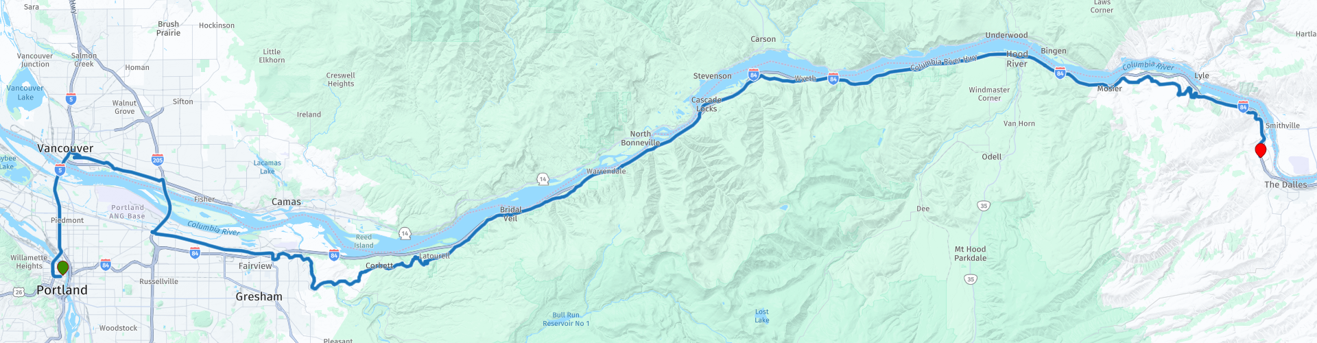
 I have further supplemented the Road Trip with even more special points that you can visit in the USA. Today we drive from Portland via Vancouver to The Dalles. It is only 165 kilometers, with many stops and we drive the first US Scenic Byway ever; “The Historic Columbia River Highway Scenic Byway”!
This Byway is a wonder with incredible scenery, rich history, spectacular waterfalls, architectural gems and stunning views of the Columbia River Gorge, it's no wonder this Byway is called the "King of Roads." And that is why I rate this route 5 stars.
 Share this route


Animation

Verdict


Duration
9h 27m

Mode of travel
Car or motorcycle

Distance
163.59 km

Countries

 RouteXpert Review
 But before we start this beautiful drive through the Colombia River Gorge, we cross the Colombia River to visit “Fort Vancouver National Historic Site” in Vancouver, Washington, a full-size replica of Fort Vancouver, a 19th century fur trading post that was the headquarters of the Hudson's Bay Company's Columbia Department, located in the Pacific Northwest.
There are many sights to see on this site, such as old army command buildings, a visitor center where you can obtain more information and the Pearson Air Museum, this museum offers a wealth of activities and sights that aircraft enthusiasts and history buffs can enjoy. The site is a reminder of aviation history with historic structures and archaeological sites associated with the U.S. military, military aviation and the Hudson's Bay Company colonial trading post.
Named after Captain George Vancouver, the Fort was located on the north bank of the Columbia River in present-day Vancouver, Washington. The fort was an important center of the regional fur trade. Every year, trade goods and supplies arrived from London via ships sailing to the Pacific or overland from Hudson Bay via the York Factory Express. Supplies and trade goods were exchanged for fur pelts with an abundance of indigenous cultures. Furs from Fort Vancouver were often shipped to the Chinese port of Guangzhou, where they were traded for Chinese goods for sale in the United Kingdom. At its height, Fort Vancouver guarded more than 34 outposts, 24 ports, six ships and 600 employees.
And then it's time to start the drive on the “Historic Columbia River Highway Scenic Byway”. This is a true wonder, due to the visionary engineering used during its construction, the incredibly beautiful landscapes and the rich history of this area. Internationally acclaimed for its spectacular waterfalls, architectural gems and stunning panoramas of the Columbia River Gorge, this Byway has been dubbed the “King of Roads” and has been declared a National Historic Landmark.
You can learn more about the road by visiting the Gateway to the Gorge Visitor Center in Troutdale. They will provide you with the information to fully enjoy your drive through the canyon and take in the beauty along the Historic Columbia River Highway.
The construction of the Columbia River Highway in 1913 was considered one of the greatest engineering feats of modern times. Not wanting to spoil what God had created, the engineer, Samuel C. Lancaster, made sure to route the road around many waterfalls and other beautiful historic sites to bring them to the attention of travelers.
The Columbia River Gorge is 130 kilometers (80 miles) long and up to 1200 meters deep. Lava flows created the substrate and the Missoula Floods much later cut through this substrate and created the towering cliffs of columnar basalt that make up the canyon. The gorge includes 16 endemic plant species, found only in the gorge, and more than 150 rare plant species, and is rich in animal life.
The Historic Columbia River Scenic Byway offers ever-changing perspectives of the canyon, including breathtaking panoramas from 1,000 feet above the Columbia River. There are many points along the route where you can stop to enjoy the breathtaking views or take a walk on the many trails, some of which lead to hidden waterfalls.
There are a number of interesting sights included as a POI in the route;
• The Stark Street Bridge, a 250-foot steel truss bridge over the Sandy River. The bridge connects Southeast Stark Street to the Historic Columbia River Highway and is one of two western entrances to the Byway.
• The Portland Women's Forum for stunning views of this historic landmark framed by the Columbia River Gorge. Portland Women's Forum is a group that has been active in the Columbia River Gorge since 1946. The founding female members were responsible for recognizing that this vantage point of the river and the canyon was special and should be protected from private development and shared with the canyon's visitors in perpetuity. The ladies sold tea and raised money to purchase this overlook and eventually donated the property to the Oregon Parks & Recreation Department, who now care for this beautiful spot for all to enjoy
• The Vista House, a museum in Crown Point in Multnomah County that also serves as a memorial to Oregon's pioneers. The site, located on a rocky promontory, is 700 feet above the Columbia River. The octagonal stone building was designed by Edgar M. Lazarus in the Art Nouveau style and was completed in 1918 after almost two years of construction. The Vista House is listed on the National Register of Historic Places. Vista House is a popular place to view the Aurora Borealis.
• The popular Latourell Falls in Guy W. Talbot State Park, there are several hiking trails: a 1-mile round trip to the Lower Falls and historic bridge, or a 2-mile loop to the 130-foot Upper Falls, the third highest in the world. the Columbia Gorge, or combined as a 3-mile loop through the South Picnic Area, Bridge and Lower Falls. It offers you fantastic views of the Latourell Falls.
• The Shepperd's Dell Bridge spans a small gorge in the Columbia River Gorge and is listed on the National Register of Historic Places. It is the second bridge built along the Historic Columbia River Highway, along with the Dry Canyon Creek bridge. You can walk to Shepperd's Dell Falls via a short path. It is an easy 0.2 mile hike that takes in the beautiful, curved 1914 Shepperd's Dell Bridge and the scenic waterfall at Shepperd's Dell on Young Creek.
• Bridal Veil Falls in Corbett, a popular waterfall destination easily accessible from I-84. The trail is a 0.6 mile out-and-back trail that takes 20 minutes. It is rocky in places, but there are steps on the steepest parts. The waterfall has two levels, in total it falls about 30 meters. It is considered one of the best value trails in the Columbia River Gorge.
• The Wahkeena Falls, a 74 meter high waterfall in the Columbia River Gorge. It has a subtle cascading flow. The name is an English transliteration of a Native American (Yakama) expression meaning 'most beautiful'. It is a 320 meter walk from the car park. The base leads to the stone bridge that crosses the main part of the falls. That trail continues east to Multnomah Falls.
• Multnomah Falls. It spans two levels on basalt cliffs and, at 600 feet (189 meters) tall, is the tallest waterfall in the state of Oregon. There is a trail, a lookout bridge and a lodge. Built in 1914, the Multnomah Creek Bridge is listed on the National Register of Historic Places. It is the most visited natural recreation site in the US Pacific Northwest and the waterfall is also visible from the Historic Columbia River Highway. Here you can also enjoy lunch.
• The Oneanta Tunnel, built in 1914 and 100 feet long, through the 200-foot cliff on the right bank of the Gorge. With the construction of Interstate 84, the tunnel fell into disuse and in 1948 the tunnel was filled with debris and vegetation covered the entrances. In the summer of 2006, the Oneonta Tunnel was excavated and work began to incorporate the tunnel as part of a walking/biking trail along the Historic Columbia River Highway. The tunnel was reopened on August 19, 2006.
• The Bridge of the Gods, a steel truss cantilever bridge that spans the Columbia River between Cascade Locks, Oregon and Washington State near North Bonneville. It is located approximately 40 miles (64 km) east of Portland, Oregon, and 4 miles (6.4 km) upstream from the Bonneville Dam. It is a toll bridge operated by the Port of Cascade Locks. The Bridge of the Gods was completed by the Wauna Toll Bridge Company and opened in 1926 with a length of 1,144 feet. Higher river levels resulting from the construction of the Bonneville Dam required the bridge to be further raised by 13 meters (44 feet) in 1938 and extended to its current length of 566 meters (1,858 feet). The bridge is named after the "Bridge of God" geological landslide that dammed the Columbia River.
• The Cascade Locks Historical Museum, located in one of the three original lock keeper's houses. The museum overlooks the original lock and canal that was built in the late 19th century. At this National Historic Site you will find fascinating artifacts, information and photographs. A must-see if you are interested in historic waterways and locks. Also on display here are the first steam locomotive, the Oregon Pony Engine, built on the Pacific coast, and the steam radar ship the Sternwheeler Columbia Gorge.
• The Dry Canyon Creek Bridge, a single-span reinforced concrete arch bridge designed by Conde B. McCullough and completed in 1921. This bridge is similar in design and detail to Sheppard's Dell Bridge.
There are certainly more beautiful points where you can stop, so study the information about this beautiful “Historic Columbia River Scenic Byway” and adjust the route to your own insight and preferences.
It may be an option to drive the route in several days if you want to spend more time walking in this beautiful Gorge.
The terminus of the “Historic Columbia River Scenic Byway” is also the end point of this day. We will spend the night in one of the many hotels in The Dalles. The Dalles was a very important trading and meeting place throughout history and prehistory. Lewis and Clark's Corps of Discovery followed the river to its terminus at Astoria in 1805, as did Oregon Trail Pioneers in the mid-19th century. The rich history of the region is preserved in several museums along the route.


 Links
Links  Usage
Usage Want to download this route?
You can download the route for free without MyRoute-app account. To do so, open the route and click 'save as'. Want to edit this route?
No problem, start by opening the route. Follow the tutorial and create your personal MyRoute-app account. After registration, your trial starts automatically.  Disclaimer
Use of this GPS route is at your own expense and risk. The route has been carefully composed and checked by a MyRoute-app accredited RouteXpert for use on TomTom, Garmin and MyRoute-app Navigation.
Changes may nevertheless have occurred due to changed circumstances, road diversions or seasonal closures. We therefore recommend checking each route before use.
Preferably use the route track in your navigation system. More information about the use of MyRoute-app can be found on the website under 'Community' or 'Academy'.

Washington
About this region
Washington officially the State of Washington, is a state in the Pacific Northwest region of the Western United States. Named for George Washington—the first U.S. president—the state was formed from the western part of the Washington Territory, which was ceded by the British Empire in 1846, in accordance with the Oregon Treaty in the settlement of the Oregon boundary dispute. The state—which is bordered on the west by the Pacific Ocean, Oregon to the south, Idaho to the east, and the Canadian province of British Columbia to the north—was admitted to the Union as the 42nd state in 1889. Olympia is the state capital; the state's largest city is Seattle. Washington is often referred to as Washington state to distinguish it from the nation's capital, Washington, D.C.Washington is the 18th-largest state, with an area of 71,362 square miles (184,830 km2), and the 13th-most populous state, with more than 7.7 million people. The majority of Washington's residents live in the Seattle metropolitan area, the center of transportation, business, and industry on Puget Sound, an inlet of the Pacific Ocean consisting of numerous islands, deep fjords, and bays carved out by glaciers. The remainder of the state consists of deep temperate rainforests in the west; mountain ranges in the west, central, northeast, and far southeast; and a semi-arid basin region in the east, central, and south, given over to intensive agriculture. Washington is the second most populous state on the West Coast and in the Western United States, after California. Mount Rainier, an active stratovolcano, is the state's highest elevation at 14,411 feet (4,392 meters), and is the most topographically prominent mountain in the contiguous U.S.
Washington is a leading lumber producer; its rugged surface is rich in stands of Douglas fir, hemlock, ponderosa pine, white pine, spruce, larch, and cedar. The state is the largest producer of apples, hops, pears, blueberries, spearmint oil, and sweet cherries in the U.S., and ranks high in the production of apricots, asparagus, dry edible peas, grapes, lentils, peppermint oil, and potatoes. Livestock, livestock products, and commercial fishing—particularly of salmon, halibut, and bottomfish—are also significant contributors to the state's economy. Washington ranks second only to California in wine production.
Manufacturing industries in Washington include aircraft, missiles, shipbuilding, and other transportation equipment, food processing, metals and metal products, chemicals, and machinery. Washington has more than a thousand dams, including the Grand Coulee Dam, built for a variety of purposes including irrigation, electricity generation, flood control, and water storage.
Washington is one of the wealthiest as well as most socially liberal states in the country. The state consistently ranks among the best for life expectancy and low unemployment. Along with Colorado, Washington was one of the first to legalize medicinal and recreational cannabis, was among the first states to legalize same-sex marriage in 2012, and was one of only four U.S. states to have been providing legal abortions on request before the 1973 Supreme Court decision in Roe v. Wade loosened abortion laws nationwide. Similarly, Washington voters approved a 2008 referendum on legalization of physician-assisted suicide, and Washington is currently one of ten states—along with Washington, D.C.—to have legalized the practice.
Read more on Wikipedia
Washington is a leading lumber producer; its rugged surface is rich in stands of Douglas fir, hemlock, ponderosa pine, white pine, spruce, larch, and cedar. The state is the largest producer of apples, hops, pears, blueberries, spearmint oil, and sweet cherries in the U.S., and ranks high in the production of apricots, asparagus, dry edible peas, grapes, lentils, peppermint oil, and potatoes. Livestock, livestock products, and commercial fishing—particularly of salmon, halibut, and bottomfish—are also significant contributors to the state's economy. Washington ranks second only to California in wine production.
Manufacturing industries in Washington include aircraft, missiles, shipbuilding, and other transportation equipment, food processing, metals and metal products, chemicals, and machinery. Washington has more than a thousand dams, including the Grand Coulee Dam, built for a variety of purposes including irrigation, electricity generation, flood control, and water storage.
Washington is one of the wealthiest as well as most socially liberal states in the country. The state consistently ranks among the best for life expectancy and low unemployment. Along with Colorado, Washington was one of the first to legalize medicinal and recreational cannabis, was among the first states to legalize same-sex marriage in 2012, and was one of only four U.S. states to have been providing legal abortions on request before the 1973 Supreme Court decision in Roe v. Wade loosened abortion laws nationwide. Similarly, Washington voters approved a 2008 referendum on legalization of physician-assisted suicide, and Washington is currently one of ten states—along with Washington, D.C.—to have legalized the practice.
View region
 Statistics
  11
11Amount of RX reviews (Washington)
 10950
10950Amount of visitors (Washington)
 150
150Amount of downloads (Washington)
 Route Collections in this region
 Top car and motorcycle tour through Canada USA and the Rockies
Traveling by car or motorcycle through Canada, USA and the Rockies is a journey that you don't just make, so don't drive for 15 days and then return home. No, book a stay of several days in Vancouver, Jasper, Banff, Seattle and Port Alberni and again Vancouver to also visit several places of interest in these cities, so that this tour becomes an unforgettable tour that you can remember with pleasure.
Do not forget to arrange and pack the following items:
*This is only a summary and completely personal and may differ per person.
Take out travel insurance, +31 for numbers in GSM, (partially) take out gas, Health insurance coverage at destination?, Switch off electrical appliances, Lighting (time clock), Check passport validity, Antenna from radio/TV due to lightning, Residence address for those left behind, Remote control house alarm, Book Smart Parking.
Hand luggage:
Liquids in packaging of max. 100 ml, Liquids in hand luggage in transparent plastic bag.
For on the road:
Candy, Book, Earplugs, Country and road map(s), Directions, Maps in your navigation system
Money & Securities:
Bank card / giro card, Credit card (think pin code), Cash, Calculator for Internet banking, Medical insurance card, Travel insurance card.
Travel documents:
Passport, (International) Driver's License, Ticket(s), Reservation Tickets, Hotel Vouchers, Arrival/Departure Time, Check-in & Check-out Times, Valid Visa (ESTA), Travel Guide.
Clothing:
Underwear, Belt, Shirts/ T-shirts, Shorts, Long pants, Shoes, Socks, Swim trunks, Towel, Slippers.
Personal stuff:
Watch, House Keys, Wallet, Sunglasses.
Toiletries:
Deodorant, Shower gel / Soap, Comb / brush, Shaving equipment, Shampoo, Toothbrush, Toothpaste, Sanitary pads
Health & Medicine:
Own medicines, Insect repellent, Cold sore ointment, Ointment for insect bites, Sunscreen, Norit, Paracetamol, Suction cup for insect bites, First aid bag.
Miscellaneous:
Travel bag / waist bag, Leatherman (= checked luggage), Pen or pencil, Headlamp, Lighter, Tools & Electronics, Mobile phone & charger, Photo/video camera & charger, Memory card(s), World plug / adapter, Ipod & charger, Adapter cable Ipod, Headphones, iPad & charger, Navigation & charger/plug, Plug socket, Fuelpack battery.
Engine (accessories):
Helmet, Motorcycle clothing, Motorcycle boots, Chain lock / disc brake lock, Gloves, Bandana, Inner bags (plastic shopping bag), Insulation bag, Tension straps, Tie wraps, Rain suit, Rainaway.
Addresses:
Address list, Embassy telephone number, Telephone number to block (bank) card(s), Telephone number (airline tickets).
View Route Collection
The 10 most downloaded routes in the USA from RouteXpert Hans van de Ven
Hello and welcome to this collection of the Top 10 MyRoute app downloaded routes in USA.
There will be a great new event to be announced soon, where all these routes can be driven.
Download them all now and place them in a new "Top 10" folder, so that you always have them at hand.
If you are going to drive one of these routes in the meantime, track them with the MRA Mobile App or with MRA Navigation. Take some photos (moments) along the way as these will come in handy.
Create a travelogue of your Top 10 driven routes and add the recorded track to it.
There will also be some great prizes on offer, so keep an eye on the MRA-RouteXperts page and your mail.
The 10 routes are:
1. D13 Estes Park Denver
2. D03 Chadron Custer
3. D01 Pigeon Forge round trip through the Smokey Mountains
4. D08 Kalispell Sandpoint
5. D10 Colville Wenatchee
6. D09 Sandpoint Colville
7. D04 Custer Wall
8. D11 Wenatchee Seattle
9. D08 Cody Yellowstone NP
10.R13 San Francisco Monterey
View Route Collection